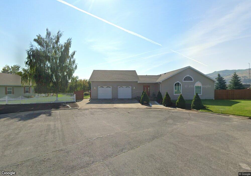
507 Caroline Ct Anaconda, MT 59711
Estimated Value: $208,000 - $496,000
4
Beds
3
Baths
2,048
Sq Ft
$200/Sq Ft
Est. Value
About This Home
This home is located at 507 Caroline Ct, Anaconda, MT 59711 and is currently estimated at $410,594, approximately $200 per square foot. 507 Caroline Ct is a home with nearby schools including Lincoln Elementary School, Fred Moodry Intermediate School, and Anaconda Junior High School.
Ownership History
Date
Name
Owned For
Owner Type
Purchase Details
Closed on
Jan 30, 2025
Sold by
Elias David M and Elias Wendy L
Bought by
Elias David M and Elias Wendy L
Current Estimated Value
Purchase Details
Closed on
Sep 23, 2010
Sold by
Elias Wendy
Bought by
Elias David M and Elias Wendy L
Home Financials for this Owner
Home Financials are based on the most recent Mortgage that was taken out on this home.
Original Mortgage
$129,500
Interest Rate
4.35%
Mortgage Type
New Conventional
Purchase Details
Closed on
Sep 2, 2009
Sold by
Langford Ray and Jorgenson Gary
Bought by
Elias Wendy
Create a Home Valuation Report for This Property
The Home Valuation Report is an in-depth analysis detailing your home's value as well as a comparison with similar homes in the area
Home Values in the Area
Average Home Value in this Area
Purchase History
| Date | Buyer | Sale Price | Title Company |
|---|---|---|---|
| Elias David M | -- | None Listed On Document | |
| Elias David M | -- | None Listed On Document | |
| Elias David M | -- | First American Title Company | |
| Elias Wendy | -- | None Available |
Source: Public Records
Mortgage History
| Date | Status | Borrower | Loan Amount |
|---|---|---|---|
| Previous Owner | Elias David M | $129,500 |
Source: Public Records
Tax History Compared to Growth
Tax History
| Year | Tax Paid | Tax Assessment Tax Assessment Total Assessment is a certain percentage of the fair market value that is determined by local assessors to be the total taxable value of land and additions on the property. | Land | Improvement |
|---|---|---|---|---|
| 2025 | $3,195 | $574,700 | $0 | $0 |
| 2024 | $3,970 | $422,000 | $0 | $0 |
| 2023 | $3,557 | $422,000 | $0 | $0 |
| 2022 | $3,118 | $264,341 | $0 | $0 |
| 2021 | $2,897 | $264,341 | $0 | $0 |
| 2020 | $3,219 | $267,610 | $0 | $0 |
| 2019 | $3,601 | $267,610 | $0 | $0 |
| 2018 | $3,213 | $235,500 | $0 | $0 |
| 2017 | $3,287 | $235,500 | $0 | $0 |
| 2016 | $3,360 | $252,353 | $0 | $0 |
| 2015 | $2,924 | $252,353 | $0 | $0 |
| 2014 | $2,378 | $116,242 | $0 | $0 |
Source: Public Records
Map
Nearby Homes
- 414 E Commercial Ave
- NHN Condor St
- 25 Condor St
- 917 E 3rd St
- 505 E Pennsylvania St
- 1110 E 4th St
- 520 E Pennsylvania St Unit 10
- 520 E Pennsylvania St Unit 11
- 520 E Pennsylvania St Unit 4
- 8 Chestnut St
- 803 E 4th St
- 1008 E 5th St
- 1009 E 5th St
- 1201 E 5th St
- 310 Chestnut St
- 512 Monroe St
- NHN Tbd
- 312 E 4th St
- 406 Cedar St
- 812 E 8th St
- 505 Caroline Ct
- 504 Caroline Ct
- 927 Pauline Loop
- 402 Christine Ct
- 925 Pauline Loop
- 501 Caroline Ct
- 909 Pauline Loop
- 909 Pauline Dr
- 911 Pauline Loop
- 919 Pauline Loop
- 917 Pauline Dr
- 903 Pauline Loop
- 809 Pauline Loop
- NHN Pauline Dr
- 906 Pauline Loop
- 934 Pauline Loop
- 928 Pauline Dr
- 912 Pauline Loop
- 912 Pauline Loop
- Lot 8 Pauline Dr