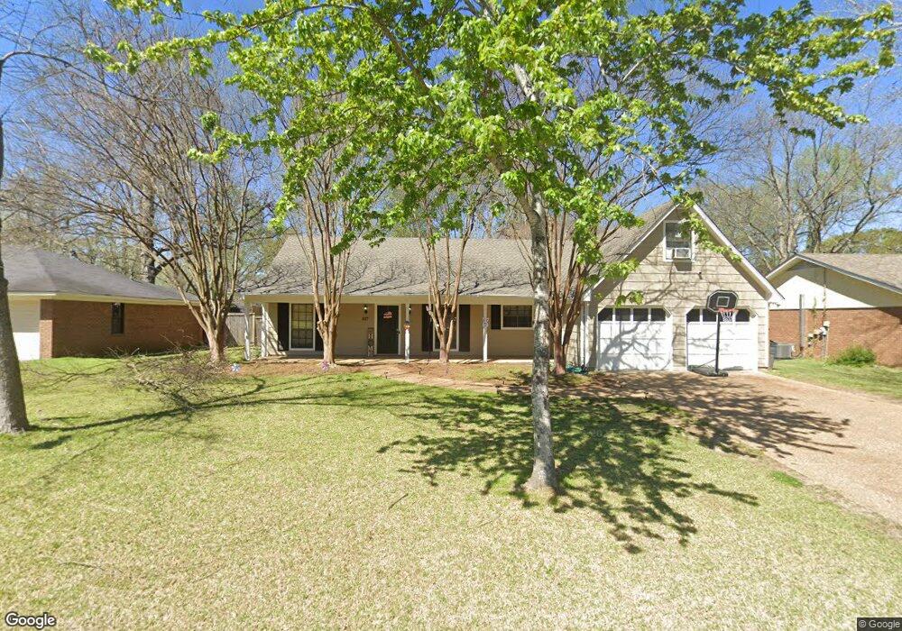
507 Harvest Dr Ridgeland, MS 39157
Estimated Value: $203,000 - $231,000
3
Beds
2
Baths
2,083
Sq Ft
$105/Sq Ft
Est. Value
About This Home
This home is located at 507 Harvest Dr, Ridgeland, MS 39157 and is currently estimated at $218,720, approximately $105 per square foot. 507 Harvest Dr is a home located in Madison County with nearby schools including Ann Smith Elementary School, Highland Elementary School, and Olde Towne Middle School.
Ownership History
Date
Name
Owned For
Owner Type
Purchase Details
Closed on
Dec 1, 2021
Sold by
Crook Kenneth Michael and Crook Patricia M
Bought by
Wilks Zerrica B
Current Estimated Value
Home Financials for this Owner
Home Financials are based on the most recent Mortgage that was taken out on this home.
Original Mortgage
$177,721
Outstanding Balance
$163,413
Interest Rate
3.09%
Mortgage Type
FHA
Estimated Equity
$55,307
Purchase Details
Closed on
Mar 15, 2006
Sold by
Neece Norma
Bought by
Crook Kenneth M and Crook Patricia M
Purchase Details
Closed on
Mar 29, 2005
Sold by
Cro Bar Corp
Bought by
Crook Kenneth M
Create a Home Valuation Report for This Property
The Home Valuation Report is an in-depth analysis detailing your home's value as well as a comparison with similar homes in the area
Home Values in the Area
Average Home Value in this Area
Purchase History
| Date | Buyer | Sale Price | Title Company |
|---|---|---|---|
| Wilks Zerrica B | -- | None Available | |
| Crook Kenneth M | -- | None Available | |
| Crook Kenneth M | -- | None Available |
Source: Public Records
Mortgage History
| Date | Status | Borrower | Loan Amount |
|---|---|---|---|
| Open | Wilks Zerrica B | $177,721 |
Source: Public Records
Tax History Compared to Growth
Tax History
| Year | Tax Paid | Tax Assessment Tax Assessment Total Assessment is a certain percentage of the fair market value that is determined by local assessors to be the total taxable value of land and additions on the property. | Land | Improvement |
|---|---|---|---|---|
| 2024 | $1,010 | $12,152 | $0 | $0 |
| 2023 | $1,010 | $12,152 | $0 | $0 |
| 2022 | $1,010 | $12,152 | $0 | $0 |
| 2021 | $1,894 | $17,576 | $0 | $0 |
| 2020 | $1,894 | $17,576 | $0 | $0 |
| 2019 | $1,894 | $17,576 | $0 | $0 |
| 2018 | $1,894 | $17,576 | $0 | $0 |
| 2017 | $1,866 | $17,312 | $0 | $0 |
| 2016 | $1,866 | $17,312 | $0 | $0 |
| 2015 | $1,866 | $17,312 | $0 | $0 |
| 2014 | $1,866 | $17,312 | $0 | $0 |
Source: Public Records
Map
Nearby Homes
- 0 Greenfield Dr Unit 11168740
- 0 Lake Harbour Dr Unit 4121534
- 409 Friday Harbour
- 570 Boardwalk Blvd
- 327 Peach Orchard Dr
- 0 S Pear Orchard Rd
- 46 Enclave Cir
- 1401 Jamestown Way Unit 2
- 1101 Jamestown Way Unit 1,2
- 314 Trunnell Rd
- 308 Redbud Place
- 1283 Woodfield Dr
- 222 Cherry Cir
- 86 N Crownpointe Dr
- 11 S Crownpointe Dr
- 213 Waverly Place
- 1163 Ferncrest Dr
- 1001 Charmant Place
- 1137 Ridgewood Blvd
- 1431 Tracewood Dr
- 505 Harvest Dr
- 601 Harvest Dr
- 671 Ralde Cir
- 503 Harvest Dr
- 603 Harvest Dr
- 667 Ralde Cir
- 140 Wheatley Place
- 673 Ralde Cir
- 139 Wheatley Place
- 665 Ralde Cir
- 675 Ralde Cir
- 501 Harvest Dr
- 605 Harvest Dr
- 143 Mill Cove
- 142 Wheatley Place
- 141 Wheatley Place
- 677 Ralde Cir
- 668 Ralde Cir
- 145 Mill Cove
- 604 Harvest Dr