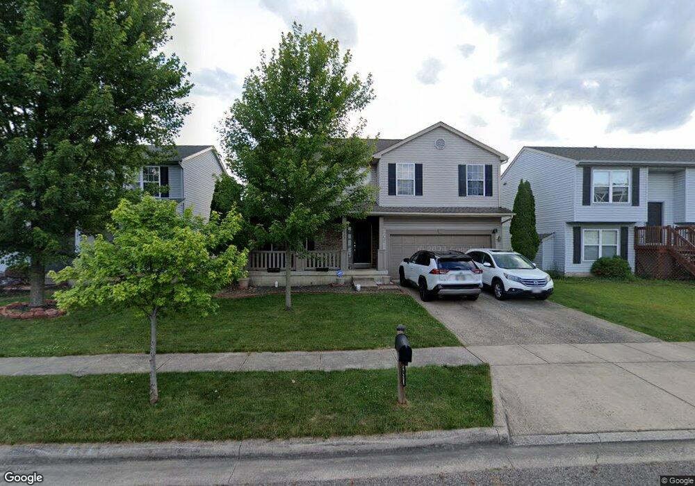
507 Mcpherson Dr Unit 352 Blacklick, OH 43004
East Broad NeighborhoodEstimated Value: $370,000 - $381,000
4
Beds
3
Baths
2,337
Sq Ft
$161/Sq Ft
Est. Value
About This Home
This home is located at 507 Mcpherson Dr Unit 352, Blacklick, OH 43004 and is currently estimated at $375,367, approximately $160 per square foot. 507 Mcpherson Dr Unit 352 is a home located in Franklin County with nearby schools including North Elementary School, Licking Heights Central, and Licking Heights High School.
Ownership History
Date
Name
Owned For
Owner Type
Purchase Details
Closed on
May 24, 2019
Sold by
Wyckoff Timothy A
Bought by
Glan Pasang D
Current Estimated Value
Home Financials for this Owner
Home Financials are based on the most recent Mortgage that was taken out on this home.
Original Mortgage
$180,000
Outstanding Balance
$158,256
Interest Rate
4.2%
Mortgage Type
New Conventional
Estimated Equity
$217,111
Purchase Details
Closed on
Apr 24, 2003
Sold by
Crossman Communities Of Ohio Inc
Bought by
Wycoff Timothy A
Home Financials for this Owner
Home Financials are based on the most recent Mortgage that was taken out on this home.
Original Mortgage
$176,604
Interest Rate
5.71%
Mortgage Type
FHA
Create a Home Valuation Report for This Property
The Home Valuation Report is an in-depth analysis detailing your home's value as well as a comparison with similar homes in the area
Home Values in the Area
Average Home Value in this Area
Purchase History
| Date | Buyer | Sale Price | Title Company |
|---|---|---|---|
| Glan Pasang D | $225,000 | Northwest Ttl Fam Of Compani | |
| Wycoff Timothy A | $178,000 | Stewart Title Agency Of Colu |
Source: Public Records
Mortgage History
| Date | Status | Borrower | Loan Amount |
|---|---|---|---|
| Open | Glan Pasang D | $180,000 | |
| Previous Owner | Wycoff Timothy A | $176,604 |
Source: Public Records
Tax History Compared to Growth
Tax History
| Year | Tax Paid | Tax Assessment Tax Assessment Total Assessment is a certain percentage of the fair market value that is determined by local assessors to be the total taxable value of land and additions on the property. | Land | Improvement |
|---|---|---|---|---|
| 2024 | $5,958 | $115,120 | $31,500 | $83,620 |
| 2023 | $6,117 | $115,115 | $31,500 | $83,615 |
| 2022 | $4,734 | $77,350 | $14,210 | $63,140 |
| 2021 | $4,761 | $77,350 | $14,210 | $63,140 |
| 2020 | $4,732 | $77,350 | $14,210 | $63,140 |
| 2019 | $4,067 | $61,540 | $11,380 | $50,160 |
| 2018 | $3,974 | $61,540 | $11,380 | $50,160 |
| 2017 | $4,220 | $61,500 | $11,380 | $50,120 |
| 2016 | $3,925 | $56,460 | $8,260 | $48,200 |
| 2015 | $3,862 | $56,460 | $8,260 | $48,200 |
| 2014 | $3,908 | $56,460 | $8,260 | $48,200 |
| 2013 | $2,046 | $59,395 | $8,680 | $50,715 |
Source: Public Records
Map
Nearby Homes
- 7781 Hazelton St
- 466 Hannifin Dr
- 7883 Grandlin Park Ct
- 7831 Fairfax Loop Dr
- 596 Altona Dr
- 417 Hannifin Dr
- 625 Streamwater Dr
- 7873 Beamish Way Unit 12-C
- 7963 Brianna Dr
- 665 Bideford Ave Unit 13C
- 7950 Chapel Stone Rd Unit 3A
- 7645 Swindon St
- 7991 Windsome Ct
- 267 Brueghel Rd
- 545 River Pebble Dr
- 192 Strathsprey Dr
- 593 River Pebble Dr
- 399 Dysar Run Dr Unit 28
- 8002 Overmont Ridge Rd
- 160 Strathsprey Dr
- 507 Mcpherson Dr
- 501 Mcpherson Dr
- 513 Mcpherson Dr
- 519 Mcpherson Dr
- 489 Mcpherson Dr
- 506 Farm Hill Ct
- 525 Mcpherson Dr
- 426 Dover Pond Dr
- 492 Mcpherson Dr
- 508 Mcpherson Dr
- 434 Dover Pond Dr
- 531 Mcpherson Dr
- 484 Mcpherson Dr
- 522 Farm Hill Ct
- 516 Mcpherson Dr
- 442 Dover Pond Dr
- 476 Mcpherson Dr
- 524 Mcpherson Dr
- 528 Farm Hill Ct
- 505 Farm Hill Ct