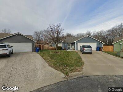
507 River Bend Cir Lawrence, KS 66044
Estimated Value: $271,033 - $301,000
3
Beds
2
Baths
1,278
Sq Ft
$219/Sq Ft
Est. Value
About This Home
This home is located at 507 River Bend Cir, Lawrence, KS 66044 and is currently estimated at $280,258, approximately $219 per square foot. 507 River Bend Cir is a home located in Douglas County with nearby schools including Deerfield Elementary School, West Middle School, and Lawrence Free State High School.
Ownership History
Date
Name
Owned For
Owner Type
Purchase Details
Closed on
Apr 20, 2004
Sold by
Moore Christina S and Moore Eric M
Bought by
Rice Ronald A
Current Estimated Value
Home Financials for this Owner
Home Financials are based on the most recent Mortgage that was taken out on this home.
Original Mortgage
$107,920
Interest Rate
5.5%
Mortgage Type
Purchase Money Mortgage
Purchase Details
Closed on
Sep 5, 2003
Sold by
Moore Christina S and Moore Eric M
Bought by
Moore Eric M and Moore Christina S
Home Financials for this Owner
Home Financials are based on the most recent Mortgage that was taken out on this home.
Original Mortgage
$101,000
Interest Rate
4.94%
Mortgage Type
Purchase Money Mortgage
Create a Home Valuation Report for This Property
The Home Valuation Report is an in-depth analysis detailing your home's value as well as a comparison with similar homes in the area
Home Values in the Area
Average Home Value in this Area
Purchase History
| Date | Buyer | Sale Price | Title Company |
|---|---|---|---|
| Rice Ronald A | -- | Kansas Secured Title | |
| Moore Eric M | -- | Nations Title Agency |
Source: Public Records
Mortgage History
| Date | Status | Borrower | Loan Amount |
|---|---|---|---|
| Open | Rice Ronald A | $40,000 | |
| Closed | Rice Ronald A | $109,200 | |
| Closed | Rice Ronald A | $125,600 | |
| Closed | Rice Ronald A | $137,700 | |
| Closed | Rice Ronald A | $107,920 | |
| Previous Owner | Moore Eric M | $101,000 | |
| Closed | Rice Ronald A | $26,980 |
Source: Public Records
Tax History Compared to Growth
Tax History
| Year | Tax Paid | Tax Assessment Tax Assessment Total Assessment is a certain percentage of the fair market value that is determined by local assessors to be the total taxable value of land and additions on the property. | Land | Improvement |
|---|---|---|---|---|
| 2024 | $3,445 | $28,198 | $7,475 | $20,723 |
| 2023 | $3,186 | $25,036 | $6,900 | $18,136 |
| 2022 | $2,871 | $22,448 | $4,600 | $17,848 |
| 2021 | $2,624 | $19,769 | $4,368 | $15,401 |
| 2020 | $2,454 | $18,608 | $4,368 | $14,240 |
| 2019 | $2,333 | $17,721 | $3,798 | $13,923 |
| 2018 | $2,214 | $16,710 | $3,571 | $13,139 |
| 2017 | $2,214 | $16,528 | $3,571 | $12,957 |
| 2016 | $2,064 | $16,111 | $4,028 | $12,083 |
| 2015 | $1,028 | $16,042 | $4,028 | $12,014 |
| 2014 | $2,128 | $16,755 | $4,028 | $12,727 |
Source: Public Records
Map
Nearby Homes
- 255 N Michigan St Unit 82
- 255 N Michigan St Unit 78
- 504 Lone Tree Dr
- 1506 Pin Oak Dr
- 121 Florida St
- 1612 Northwood Dr
- 1612 Kenwood Dr
- 2412 Brett Dr
- 515 McDonald Dr
- 620 Durham Ct
- 1420 W 4th St
- 322 Indiana St
- 312 Birch Ln
- 223 Lyon St
- 521 Durham Ct
- 413 Michigan St
- 321 Maiden Ln
- 417 Alabama St
- 420 Michigan St
- 442 Michigan St
- 507 River Bend Cir
- 510 River Bend Cir
- 504 River Bend Ct
- 503 River Bend Cir
- 508 River Bend Ct
- 506 River Bend Cir
- 500 River Bend Ct
- 502 River Bend Cir
- 1300 Sunchase Dr
- 1201 Sunchase Dr
- 1321 Sunchase Dr
- 1325 Sunchase Dr
- 509 River Bend Ct
- 1327 Sunchase Dr
- 1319 Sunchase Dr
- 1317 Sunchase Dr
- 1329 Sunchase Dr
- 1315 Sunchase Dr
- 505 River Bend Ct
- 1333 Sunchase Dr