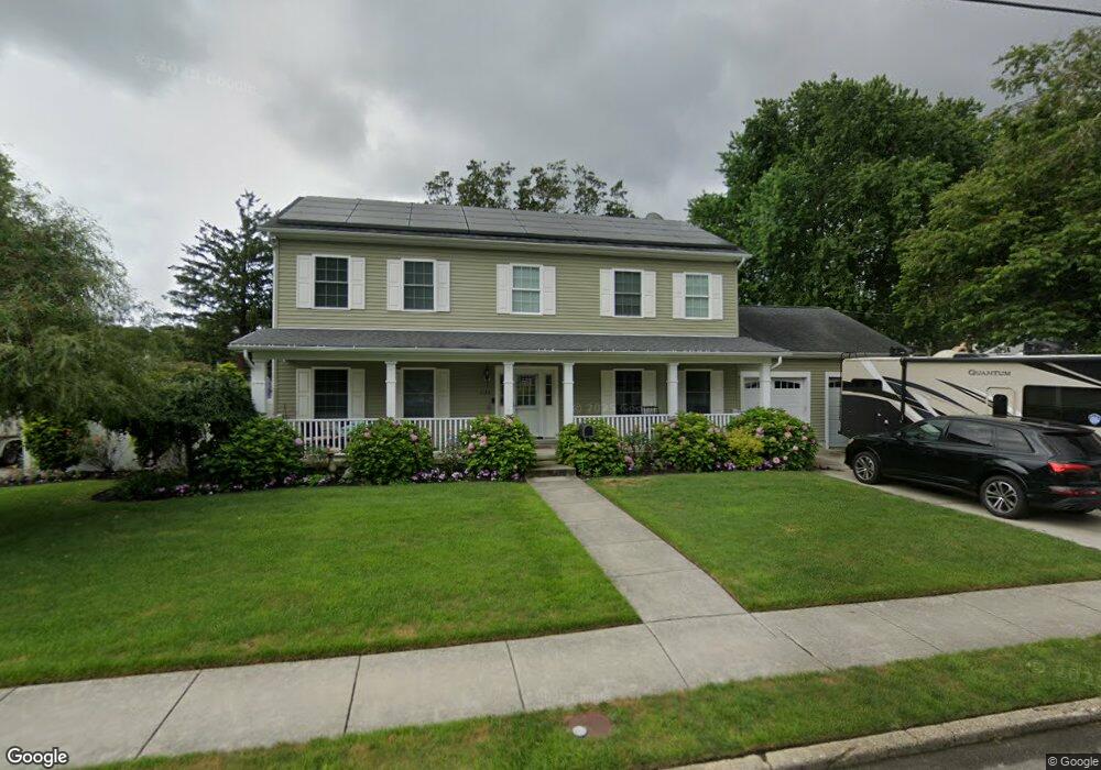
509 Pierce Ave Linwood, NJ 08221
Estimated Value: $618,721 - $706,000
--
Bed
--
Bath
2,464
Sq Ft
$272/Sq Ft
Est. Value
About This Home
This home is located at 509 Pierce Ave, Linwood, NJ 08221 and is currently estimated at $670,680, approximately $272 per square foot. 509 Pierce Ave is a home located in Atlantic County with nearby schools including Seaview Elementary School, Belhaven Middle School, and Mainland Regional High School.
Ownership History
Date
Name
Owned For
Owner Type
Purchase Details
Closed on
Jun 27, 2005
Sold by
Bunting Peter and Bunting Marie
Bought by
Bunting Josiah P
Current Estimated Value
Purchase Details
Closed on
Aug 25, 1995
Sold by
Ridgway Esq Theodore S and Tousley Pauline M
Bought by
Bunting Peter and Bunting Marie
Purchase Details
Closed on
Sep 18, 1989
Sold by
Tousley Pauline M and Tousley Downey,Lorna F
Bought by
Tousley Pauline M
Create a Home Valuation Report for This Property
The Home Valuation Report is an in-depth analysis detailing your home's value as well as a comparison with similar homes in the area
Home Values in the Area
Average Home Value in this Area
Purchase History
| Date | Buyer | Sale Price | Title Company |
|---|---|---|---|
| Bunting Josiah P | -- | -- | |
| Bunting Peter | $113,000 | The Title Company | |
| Tousley Pauline M | -- | -- |
Source: Public Records
Tax History Compared to Growth
Tax History
| Year | Tax Paid | Tax Assessment Tax Assessment Total Assessment is a certain percentage of the fair market value that is determined by local assessors to be the total taxable value of land and additions on the property. | Land | Improvement |
|---|---|---|---|---|
| 2025 | $13,539 | $354,900 | $110,000 | $244,900 |
| 2024 | $13,539 | $354,900 | $110,000 | $244,900 |
| 2023 | $12,911 | $354,900 | $110,000 | $244,900 |
| 2022 | $12,911 | $354,900 | $110,000 | $244,900 |
| 2021 | $12,798 | $354,900 | $110,000 | $244,900 |
| 2020 | $12,620 | $354,900 | $110,000 | $244,900 |
| 2019 | $12,351 | $354,900 | $110,000 | $244,900 |
| 2018 | $12,074 | $354,900 | $110,000 | $244,900 |
| 2017 | $11,832 | $354,900 | $110,000 | $244,900 |
| 2016 | $10,410 | $323,100 | $110,000 | $213,100 |
| 2015 | $10,420 | $323,100 | $110,000 | $213,100 |
| 2014 | $10,016 | $110,000 | $110,000 | $0 |
Source: Public Records
Map
Nearby Homes
- 1005 Bartlett Ave
- 901 Oak Ave
- 1026 Bartlett Dr
- 1026 Bartlett Ave
- 500 Davis Ave
- 921 Oak Grove Ave
- 2 Sandy Ct
- 309 Haines Ave
- 109 Blackman Rd
- 104 W Poplar Ave
- 15 Elm Ave
- 404 Cedarbrook Ln
- 210 Haines Ave
- 130 Wilson Ave
- 34 Crossing Dr
- 120 W Devonshire Ave
- 28 Crossing Dr
- 622 Central Ave
- 1050 Shore Rd
- 4 Princeton Ln
- 507 Pierce Ave
- 511 Pierce Ave
- 508 Van Sant Ave
- 510 Van Sant Ave
- 506 Van Sant Ave
- 508 Pierce Ave
- 506 Pierce Ave
- 510 Pierce Ave
- 505 Pierce Ave
- 513 Pierce Ave
- 504 Van Sant Ave
- 512 Van Sant Ave
- 504 Pierce Ave
- 509 Marie Ave
- 512 Pierce Ave
- 1000 Bartlett Ave
- 507 Marie Ave
- 511 Marie Ave
- 509 Van Sant Ave
- 1001 Richards Dr