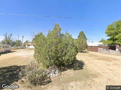
509 State Highway 59 Kit Carson, CO 80825
Estimated Value: $85,286 - $134,000
3
Beds
1
Bath
1,056
Sq Ft
$102/Sq Ft
Est. Value
About This Home
This home is located at 509 State Highway 59, Kit Carson, CO 80825 and is currently estimated at $108,072, approximately $102 per square foot. 509 State Highway 59 is a home with nearby schools including Kit Carson Elementary School and Kit Carson Junior/Senior High School.
Ownership History
Date
Name
Owned For
Owner Type
Purchase Details
Closed on
Mar 6, 2024
Sold by
Rother Betty Jo
Bought by
Rother Gerald C
Current Estimated Value
Purchase Details
Closed on
Oct 25, 1989
Sold by
Carrigan K D
Bought by
Rother B J
Purchase Details
Closed on
Jan 4, 1985
Sold by
Alma Aliice Morgan
Purchase Details
Closed on
Dec 12, 1984
Sold by
Burns E
Bought by
Carrigan K
Purchase Details
Closed on
Mar 28, 1979
Sold by
Morgan J B
Bought by
Burns Ea and Morgan Fr
Purchase Details
Closed on
Feb 19, 1978
Sold by
Alma Alice Morgan Inheritance Tax Releas
Purchase Details
Closed on
Apr 11, 1966
Sold by
Holter Henry and Holter Lorna
Bought by
Morgan J Bissel J and Morgan Alma A
Create a Home Valuation Report for This Property
The Home Valuation Report is an in-depth analysis detailing your home's value as well as a comparison with similar homes in the area
Home Values in the Area
Average Home Value in this Area
Purchase History
| Date | Buyer | Sale Price | Title Company |
|---|---|---|---|
| Rother Gerald C | -- | None Listed On Document | |
| Rother B J | -- | -- | |
| -- | -- | -- | |
| Carrigan K | $20,000 | -- | |
| Burns Ea | -- | -- | |
| -- | -- | -- | |
| Morgan J Bissel J | -- | -- |
Source: Public Records
Tax History Compared to Growth
Tax History
| Year | Tax Paid | Tax Assessment Tax Assessment Total Assessment is a certain percentage of the fair market value that is determined by local assessors to be the total taxable value of land and additions on the property. | Land | Improvement |
|---|---|---|---|---|
| 2024 | $117 | $2,933 | $575 | $2,358 |
| 2023 | $58 | $2,933 | $575 | $2,358 |
| 2022 | $53 | $1,527 | $575 | $952 |
| 2021 | $55 | $1,527 | $575 | $952 |
| 2020 | $52 | $1,498 | $575 | $923 |
| 2019 | $52 | $1,498 | $575 | $923 |
| 2018 | $55 | $678 | $0 | $0 |
| 2017 | $43 | $678 | $0 | $0 |
| 2016 | $42 | $749 | $0 | $0 |
| 2015 | $41 | $665 | $0 | $0 |
| 2014 | -- | $665 | $0 | $0 |
| 2013 | -- | $665 | $0 | $0 |
Source: Public Records
Map
Nearby Homes
- 202 W 5th Ave
- TBD Highway 287
- 8715 County Road R
- 0000 Rd 9
- TBD County Rd W
- 1010 Wansted St
- 1006 Maine St
- 1000 Rittgers St
- Tract 3 Rittgers St
- 7449 County Road 37
- 104 W 12th St
- 1300 Luther St
- 1306 Rittgers St
- 512 E 14th St
- 0 Tbd County Rd W
- 0 County Rd N
- N County Rd
- 0 Tbd County Road 30 Unit REC4442906
- 215 W 4th St N
- 130 W 4th St S
- 509 State Highway 59
- 507 State Highway 59
- 505 State Highway 59
- 510 Park St
- 201 W 6th Ave
- 506 State Highway 59
- 601 State Highway 59
- 508 Park St
- 504 Colorado 59
- 512 Park St
- 506 Park St
- 603 State Highway 59
- 202 W 6th Ave
- 502 State Highway 59
- 207 W 5th St
- 203 W 5th Ave
- 607 State Highway 59
- 406 Park St
- 402 State Highway 59
- 208 W 4th Ave