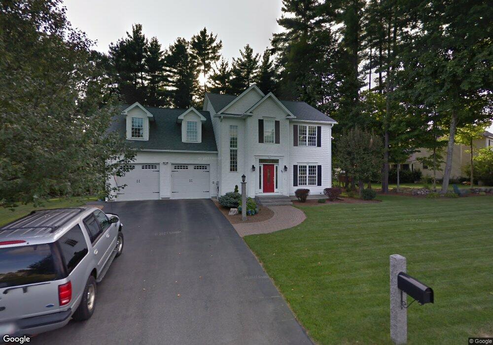
51 Barnside Dr Bedford, NH 03110
Bedford NeighborhoodEstimated Value: $877,896 - $926,000
4
Beds
4
Baths
2,460
Sq Ft
$368/Sq Ft
Est. Value
About This Home
This home is located at 51 Barnside Dr, Bedford, NH 03110 and is currently estimated at $906,474, approximately $368 per square foot. 51 Barnside Dr is a home located in Hillsborough County with nearby schools including Mckelvie Intermediate School, Ross A. Lurgio Middle School, and Bedford High School.
Ownership History
Date
Name
Owned For
Owner Type
Purchase Details
Closed on
Jan 14, 2000
Sold by
Dac Invst Corp
Bought by
Reed Scott M and Reed Kimberly S
Current Estimated Value
Home Financials for this Owner
Home Financials are based on the most recent Mortgage that was taken out on this home.
Original Mortgage
$223,686
Outstanding Balance
$64,983
Interest Rate
7.79%
Mortgage Type
Purchase Money Mortgage
Estimated Equity
$841,491
Create a Home Valuation Report for This Property
The Home Valuation Report is an in-depth analysis detailing your home's value as well as a comparison with similar homes in the area
Home Values in the Area
Average Home Value in this Area
Purchase History
| Date | Buyer | Sale Price | Title Company |
|---|---|---|---|
| Reed Scott M | $248,600 | -- |
Source: Public Records
Mortgage History
| Date | Status | Borrower | Loan Amount |
|---|---|---|---|
| Open | Reed Scott M | $223,686 |
Source: Public Records
Tax History
| Year | Tax Paid | Tax Assessment Tax Assessment Total Assessment is a certain percentage of the fair market value that is determined by local assessors to be the total taxable value of land and additions on the property. | Land | Improvement |
|---|---|---|---|---|
| 2024 | $12,022 | $760,400 | $331,800 | $428,600 |
| 2023 | $11,254 | $760,400 | $331,800 | $428,600 |
| 2022 | $10,189 | $578,900 | $245,600 | $333,300 |
| 2021 | $9,922 | $578,900 | $245,600 | $333,300 |
| 2020 | $9,890 | $494,000 | $195,500 | $298,500 |
| 2019 | $9,361 | $494,000 | $195,500 | $298,500 |
| 2018 | $9,570 | $469,100 | $195,500 | $273,600 |
| 2017 | $8,871 | $469,100 | $195,500 | $273,600 |
| 2016 | $8,015 | $358,300 | $109,200 | $249,100 |
| 2015 | $8,155 | $358,300 | $109,200 | $249,100 |
| 2014 | $8,062 | $358,300 | $109,200 | $249,100 |
| 2013 | $7,944 | $358,300 | $109,200 | $249,100 |
Source: Public Records
Map
Nearby Homes
- 283 Liberty Hill Rd
- 16 Summit Rd
- 29 Hancock Dr
- 53 Seton Dr
- 17 Walnut Cir
- 28 Pearson Rd
- 4 McQuade Brook Rd
- 179 Back River Rd
- 65 Jenkins Rd Unit Lot 4 - The Hannah
- 7 Hamilton Way
- 29 Bedford Rd
- 10 Owls Ct
- 65 Sebbins Pond Dr
- 2 Tanager Ct
- 22 Back River Rd
- 51 Donovan Ct
- 9 Donovan Ct
- 12 Davis Rd
- 76 Shelburne Rd
- 9 Kimberly Dr
Your Personal Tour Guide
Ask me questions while you tour the home.