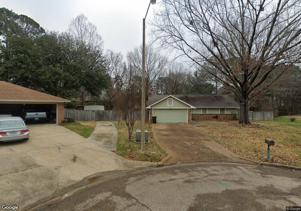
51 Old Orchard Ln Brandon, MS 39042
Estimated Value: $205,000 - $220,496
3
Beds
2
Baths
1,415
Sq Ft
$152/Sq Ft
Est. Value
About This Home
This home is located at 51 Old Orchard Ln, Brandon, MS 39042 and is currently estimated at $214,874, approximately $151 per square foot. 51 Old Orchard Ln is a home located in Rankin County with nearby schools including Rouse Elementary School, Brandon Elementary School, and Stonebridge Elementary School.
Ownership History
Date
Name
Owned For
Owner Type
Purchase Details
Closed on
Dec 11, 2020
Sold by
Hudson John Paul and Hudson Kristine Elizabeth
Bought by
Watts Phillip A and Ziesmer Khalsea M
Current Estimated Value
Home Financials for this Owner
Home Financials are based on the most recent Mortgage that was taken out on this home.
Original Mortgage
$186,459
Outstanding Balance
$166,300
Interest Rate
2.8%
Mortgage Type
New Conventional
Estimated Equity
$48,574
Purchase Details
Closed on
Jul 27, 2007
Sold by
Nix Katherine P and Nix Kathrine P
Bought by
Hudson John Paul and Hudson Kristine Elizabeth
Home Financials for this Owner
Home Financials are based on the most recent Mortgage that was taken out on this home.
Original Mortgage
$129,492
Interest Rate
6.63%
Mortgage Type
FHA
Create a Home Valuation Report for This Property
The Home Valuation Report is an in-depth analysis detailing your home's value as well as a comparison with similar homes in the area
Home Values in the Area
Average Home Value in this Area
Purchase History
| Date | Buyer | Sale Price | Title Company |
|---|---|---|---|
| Watts Phillip A | -- | None Listed On Document | |
| Hudson John Paul | -- | Title & Escrow Services, Inc |
Source: Public Records
Mortgage History
| Date | Status | Borrower | Loan Amount |
|---|---|---|---|
| Open | Watts Phillip A | $186,459 | |
| Previous Owner | Hudson John Paul | $129,492 | |
| Closed | Watts Phillip A | $6,646 |
Source: Public Records
Tax History Compared to Growth
Tax History
| Year | Tax Paid | Tax Assessment Tax Assessment Total Assessment is a certain percentage of the fair market value that is determined by local assessors to be the total taxable value of land and additions on the property. | Land | Improvement |
|---|---|---|---|---|
| 2024 | $1,260 | $11,952 | $0 | $0 |
| 2023 | $1,042 | $10,282 | $0 | $0 |
| 2022 | $1,027 | $10,282 | $0 | $0 |
| 2021 | $1,027 | $10,282 | $0 | $0 |
| 2020 | $1,027 | $10,282 | $0 | $0 |
| 2019 | $947 | $9,459 | $0 | $0 |
| 2018 | $928 | $9,459 | $0 | $0 |
| 2017 | $928 | $9,459 | $0 | $0 |
| 2016 | $1,150 | $9,518 | $0 | $0 |
| 2015 | $1,150 | $9,518 | $0 | $0 |
| 2014 | $829 | $9,518 | $0 | $0 |
| 2013 | -- | $9,518 | $0 | $0 |
Source: Public Records
Map
Nearby Homes
- 36 Pebble Hill Dr
- 61 Sunline Dr
- 11 Sandway Dr
- 54 Willowbrook Ln
- 106 Fern Valley Rd
- 135 Fawnwood Dr
- 92 Fern Valley Rd
- 107 Woodgate Dr
- 220 Cherry Dr
- 116 Long Meadow Ct
- 0 Thorngate Dr
- 48 Sandlewood Dr
- 22 Fox Glen Cove
- 111 Hickory Hill Place
- 60 Summit Ridge Dr
- 705 Heartwood Ln
- 104 Shelby Mae Cir
- 37 Woodgate Dr
- 112 Fairdale Place
- 108 Fairdale Place
- 42 Sunline Ct
- 49 Old Orchard Ln
- 50 Old Orchard Ln
- 44 Sunline Ct
- 40 Sunline Ct
- 48 Old Orchard Ln
- 47 Old Orchard Ln
- 38 Sunline Ct
- 45 Sunline Ct
- 27 Carriage Ct
- 25 Carriage Ct
- 24 Old Mill Place
- 22 Old Mill Place
- 29 Carriage Ct
- 23 Carriage Ct
- 43 Sunline Ct
- 41 Sunline Ct
- 34 Pebble Hill Dr
- 39 Sunline Ct
- 21 Carriage Ct