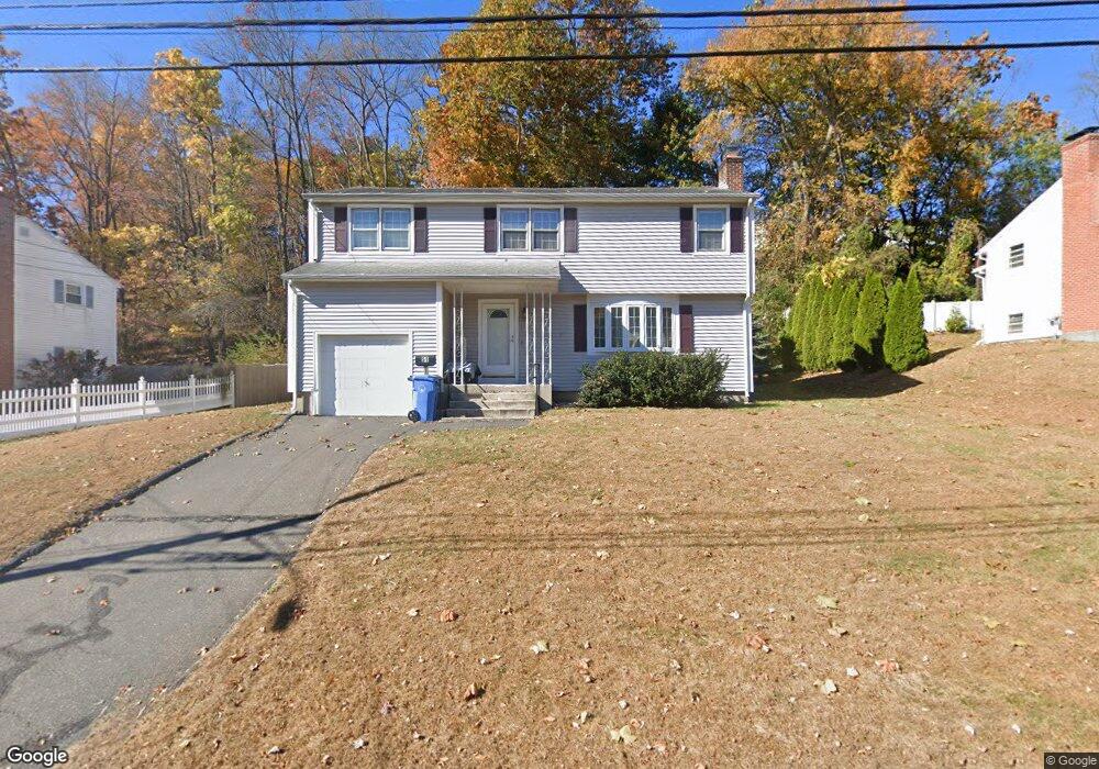
51 Varmor Dr New Britain, CT 06053
Estimated Value: $327,000 - $376,000
4
Beds
2
Baths
1,612
Sq Ft
$219/Sq Ft
Est. Value
About This Home
This home is located at 51 Varmor Dr, New Britain, CT 06053 and is currently estimated at $353,690, approximately $219 per square foot. 51 Varmor Dr is a home located in Hartford County with nearby schools including Holmes School, Pulaski Middle School, and St. Francis of Assisi Middle School.
Ownership History
Date
Name
Owned For
Owner Type
Purchase Details
Closed on
Oct 2, 2025
Sold by
Dabkowski Joseph C and Dabkowski Todd D
Bought by
Dorothy M Dabkowski Irt and Allaire
Current Estimated Value
Purchase Details
Closed on
Oct 20, 2023
Sold by
Dabkowski Dorothy M
Bought by
Dabkowski Todd D
Purchase Details
Closed on
Apr 15, 2016
Sold by
Dabkowski Dorothy M
Bought by
Dabkowski 3Rd Joseph C and Dabkowski Dorothy M
Create a Home Valuation Report for This Property
The Home Valuation Report is an in-depth analysis detailing your home's value as well as a comparison with similar homes in the area
Home Values in the Area
Average Home Value in this Area
Purchase History
| Date | Buyer | Sale Price | Title Company |
|---|---|---|---|
| Dorothy M Dabkowski Irt | -- | -- | |
| Dabkowski Todd D | -- | None Available | |
| Dabkowski 3Rd Joseph C | -- | -- |
Source: Public Records
Tax History Compared to Growth
Tax History
| Year | Tax Paid | Tax Assessment Tax Assessment Total Assessment is a certain percentage of the fair market value that is determined by local assessors to be the total taxable value of land and additions on the property. | Land | Improvement |
|---|---|---|---|---|
| 2025 | $6,744 | $172,130 | $59,430 | $112,700 |
| 2024 | $6,815 | $172,130 | $59,430 | $112,700 |
| 2023 | $6,589 | $172,130 | $59,430 | $112,700 |
| 2022 | $6,299 | $127,260 | $41,510 | $85,750 |
| 2021 | $6,299 | $127,260 | $41,510 | $85,750 |
| 2020 | $6,427 | $127,260 | $41,510 | $85,750 |
| 2019 | $6,427 | $127,260 | $41,510 | $85,750 |
| 2018 | $6,427 | $127,260 | $41,510 | $85,750 |
| 2017 | $5,829 | $115,430 | $27,720 | $87,710 |
| 2016 | $5,829 | $115,430 | $27,720 | $87,710 |
| 2015 | $5,656 | $115,430 | $27,720 | $87,710 |
| 2014 | $5,656 | $115,430 | $27,720 | $87,710 |
Source: Public Records
Map
Nearby Homes
- 40 Varmor Dr
- 90 Country Club Rd
- 55 Alexander Rd
- 192 Blodgett Roy Dr
- 164 Brittany Farms Rd Unit A
- 198 Brittany Farms Rd Unit D
- 57 Merigold Dr
- 29 Bradford Walk Unit 29
- 180 Batterson Park Rd
- 182 Batterson Park Rd
- 135 Village Square Dr Unit 1
- 187 Miriam Rd
- 84 Barbour Rd
- 910 Farmington Ave
- 83 Kim Dr
- 34 Hutchinson St
- 281 South Rd
- 5 Yorkshire Ct Unit 5
- 93 South Rd
- 3 Farmington Meadow Dr Unit 3