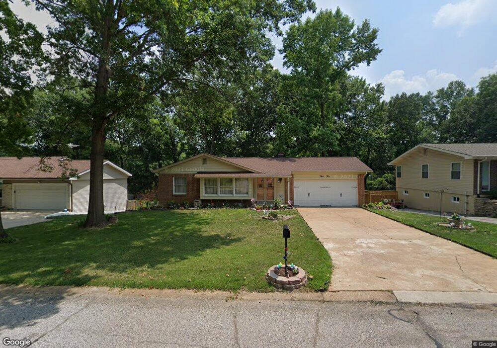
510 Forest Run Dr Eureka, MO 63025
Estimated Value: $312,606 - $390,000
3
Beds
2
Baths
1,741
Sq Ft
$199/Sq Ft
Est. Value
About This Home
This home is located at 510 Forest Run Dr, Eureka, MO 63025 and is currently estimated at $346,402, approximately $198 per square foot. 510 Forest Run Dr is a home located in St. Louis County with nearby schools including Blevins Elementary School, Lasalle Springs Middle School, and Eureka Senior High School.
Ownership History
Date
Name
Owned For
Owner Type
Purchase Details
Closed on
Apr 30, 1998
Sold by
Wesley Hibbert H and Wesley Marie
Bought by
Murphy Daniel E and Murphy Nina F
Current Estimated Value
Home Financials for this Owner
Home Financials are based on the most recent Mortgage that was taken out on this home.
Original Mortgage
$102,500
Outstanding Balance
$19,441
Interest Rate
7.09%
Estimated Equity
$326,961
Create a Home Valuation Report for This Property
The Home Valuation Report is an in-depth analysis detailing your home's value as well as a comparison with similar homes in the area
Home Values in the Area
Average Home Value in this Area
Purchase History
| Date | Buyer | Sale Price | Title Company |
|---|---|---|---|
| Murphy Daniel E | -- | -- |
Source: Public Records
Mortgage History
| Date | Status | Borrower | Loan Amount |
|---|---|---|---|
| Open | Murphy Daniel E | $102,500 |
Source: Public Records
Tax History
| Year | Tax Paid | Tax Assessment Tax Assessment Total Assessment is a certain percentage of the fair market value that is determined by local assessors to be the total taxable value of land and additions on the property. | Land | Improvement |
|---|---|---|---|---|
| 2025 | $3,767 | $55,040 | $19,170 | $35,870 |
| 2024 | $3,767 | $50,460 | $13,410 | $37,050 |
| 2023 | $3,770 | $50,460 | $13,410 | $37,050 |
| 2022 | $3,543 | $44,120 | $14,380 | $29,740 |
| 2021 | $3,517 | $44,120 | $14,380 | $29,740 |
| 2020 | $3,356 | $40,250 | $11,480 | $28,770 |
| 2019 | $3,366 | $40,250 | $11,480 | $28,770 |
| 2018 | $2,956 | $33,350 | $8,610 | $24,740 |
| 2016 | $2,816 | $31,710 | $6,710 | $25,000 |
Source: Public Records
Map
Nearby Homes
- 369 Cerny Ave
- 402 Wallach Dr
- 814 Eureka Rd
- 75 Old Farmhouse Way
- 826 Lower Field Ln
- 808 Lower Field Ln
- 83 Old Farmhouse Way
- 830 Lower Field Ln
- 1075 Eureka Rd
- 814 Bald Hill Rd
- 9 N Trail Dr
- 1045 Bloomfield Dr
- 22 Fall Flower Ct
- 1049 Bloomfield Dr
- 16805 Enderbush Ln
- 412 Parkview Ln
- 2449 Flowerdale Ct
- 571 Bluffs View Ct
- 2052 Windswept Farms Dr
- 2043 Windswept Farms Dr
- 512 Forest Run Dr
- 508 Forest Run Dr
- 511 Williams Dr
- 514 Forest Run Dr
- 506 Forest Run Dr
- 509 Williams Dr
- 513 Williams Dr
- 511 Forest Run Dr
- 513 Forest Run Dr
- 509 Forest Run Dr
- 507 Williams Dr
- 515 Williams Dr
- 516 Forest Run Dr
- 504 Forest Run Dr
- 515 Forest Run Dr
- 507 Forest Run Dr
- 505 Williams Dr
- 517 Williams Dr
- 1TBB @ Hawthorn at Rockwood Villas Way
- 1TBB Hawthorn-Arbors of Rockwood Way