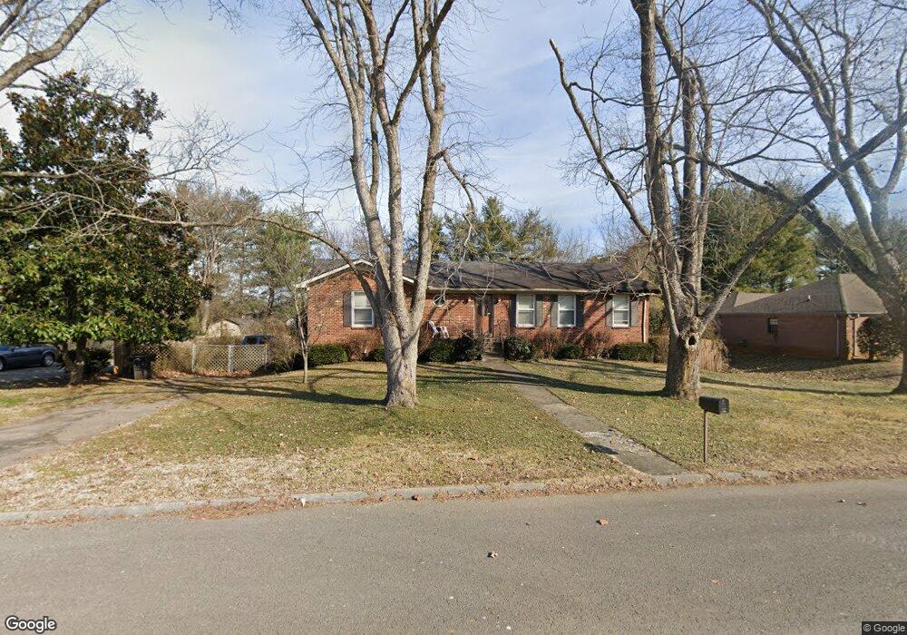
510 Iris Ave Murfreesboro, TN 37128
Estimated Value: $146,000 - $440,000
--
Bed
3
Baths
1,576
Sq Ft
$214/Sq Ft
Est. Value
About This Home
This home is located at 510 Iris Ave, Murfreesboro, TN 37128 and is currently estimated at $336,647, approximately $213 per square foot. 510 Iris Ave is a home located in Rutherford County with nearby schools including Barfield Elementary School, Cason Lane Academy, and Rockvale Middle School.
Ownership History
Date
Name
Owned For
Owner Type
Purchase Details
Closed on
Jul 24, 2025
Sold by
Stewart Carol
Bought by
Legacy Property Investors Llc
Current Estimated Value
Home Financials for this Owner
Home Financials are based on the most recent Mortgage that was taken out on this home.
Original Mortgage
$274,700
Outstanding Balance
$230,208
Interest Rate
6.84%
Mortgage Type
Construction
Estimated Equity
$106,439
Create a Home Valuation Report for This Property
The Home Valuation Report is an in-depth analysis detailing your home's value as well as a comparison with similar homes in the area
Home Values in the Area
Average Home Value in this Area
Purchase History
| Date | Buyer | Sale Price | Title Company |
|---|---|---|---|
| Legacy Property Investors Llc | $145,000 | Lawyers Land & Title | |
| Legacy Property Investors Llc | $145,000 | Lawyers Land & Title |
Source: Public Records
Mortgage History
| Date | Status | Borrower | Loan Amount |
|---|---|---|---|
| Open | Legacy Property Investors Llc | $274,700 | |
| Closed | Legacy Property Investors Llc | $274,700 |
Source: Public Records
Tax History Compared to Growth
Tax History
| Year | Tax Paid | Tax Assessment Tax Assessment Total Assessment is a certain percentage of the fair market value that is determined by local assessors to be the total taxable value of land and additions on the property. | Land | Improvement |
|---|---|---|---|---|
| 2025 | $2,466 | $87,175 | $13,750 | $73,425 |
| 2024 | $2,466 | $87,175 | $13,750 | $73,425 |
| 2023 | $1,636 | $87,175 | $13,750 | $73,425 |
| 2022 | $1,409 | $87,175 | $13,750 | $73,425 |
| 2021 | $1,350 | $60,825 | $10,625 | $50,200 |
| 2020 | $1,350 | $60,825 | $10,625 | $50,200 |
| 2019 | $1,350 | $60,825 | $10,625 | $50,200 |
| 2018 | $1,854 | $60,825 | $0 | $0 |
| 2017 | $1,742 | $44,825 | $0 | $0 |
| 2016 | $1,742 | $44,825 | $0 | $0 |
| 2015 | $1,742 | $44,825 | $0 | $0 |
| 2014 | $1,115 | $44,825 | $0 | $0 |
| 2013 | -- | $36,025 | $0 | $0 |
Source: Public Records
Map
Nearby Homes
- 515 Crocus Ct
- 509 Lilly Ln
- 542 Warrior Dr
- 953 Warrior Dr
- 326 Warrior Dr
- 2453 New Holland Cir
- 2449 New Holland Cir
- 2306 New Holland Cir
- 413 John Deere Dr
- 292 Indian Park Dr
- 262 Indian Park Dr
- 346 Indian Park Dr
- 1549 Shalom St
- 322 Arapaho Dr
- 304 Arapaho Dr
- 232 Arapaho Dr
- 354 Arapaho Dr
- 304 Shoshone Place
- 252 Shoshone Place
- 443 Forest Glen Cir
- 512 Iris Ave
- 703 Magnolia Ct
- 702 Magnolia Ct
- 514 Iris Ave
- 707 Magnolia Ct
- 1601 Redbud Dr
- 706 Magnolia Ct
- 513 Iris Ave
- 711 Magnolia Ct
- 516 Iris Ave
- 1603 Redbud Dr
- 1515 Magnolia Dr
- 710 Magnolia Ct
- 1604 Redbud Dr
- 1511 Magnolia Dr
- 1601 Magnolia Dr
- 805 Magnolia Ct
- 714 Magnolia Ct
- 1606 Redbud Dr
- 1605 Redbud Dr