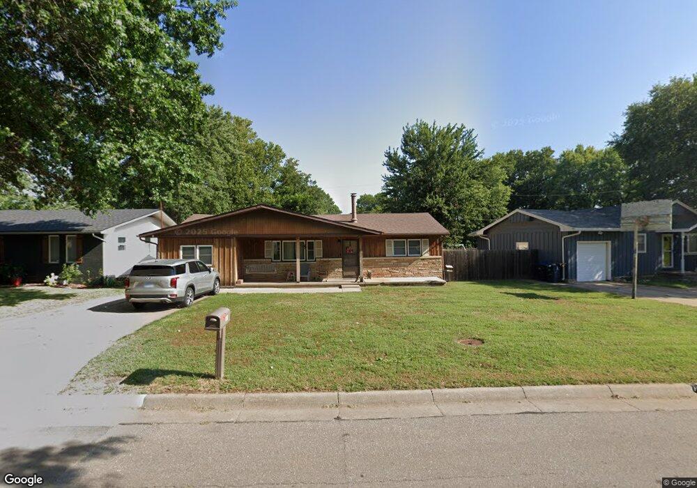
510 W 13th Ave El Dorado, KS 67042
Estimated Value: $127,000 - $184,000
4
Beds
2
Baths
1,896
Sq Ft
$83/Sq Ft
Est. Value
About This Home
This home is located at 510 W 13th Ave, El Dorado, KS 67042 and is currently estimated at $157,473, approximately $83 per square foot. 510 W 13th Ave is a home located in Butler County with nearby schools including El Dorado High School.
Ownership History
Date
Name
Owned For
Owner Type
Purchase Details
Closed on
Jan 27, 2020
Sold by
Underwood Rebekah L and Prichard Rebekah
Bought by
Prichard Rebekah and Prichard Matthew
Current Estimated Value
Home Financials for this Owner
Home Financials are based on the most recent Mortgage that was taken out on this home.
Original Mortgage
$96,000
Outstanding Balance
$75,956
Interest Rate
3.74%
Mortgage Type
New Conventional
Estimated Equity
$81,517
Purchase Details
Closed on
Jul 22, 2009
Sold by
Storm Shari Gayle
Bought by
Underwood Rebekah L
Purchase Details
Closed on
Jul 20, 2009
Sold by
Storm Shari Gayle
Bought by
Underwood Rebekah L
Create a Home Valuation Report for This Property
The Home Valuation Report is an in-depth analysis detailing your home's value as well as a comparison with similar homes in the area
Home Values in the Area
Average Home Value in this Area
Purchase History
| Date | Buyer | Sale Price | Title Company |
|---|---|---|---|
| Prichard Rebekah | -- | Servicelink | |
| Underwood Rebekah L | -- | -- | |
| Underwood Rebekah L | -- | -- |
Source: Public Records
Mortgage History
| Date | Status | Borrower | Loan Amount |
|---|---|---|---|
| Open | Prichard Rebekah | $96,000 |
Source: Public Records
Tax History Compared to Growth
Tax History
| Year | Tax Paid | Tax Assessment Tax Assessment Total Assessment is a certain percentage of the fair market value that is determined by local assessors to be the total taxable value of land and additions on the property. | Land | Improvement |
|---|---|---|---|---|
| 2025 | $24 | $15,950 | $1,122 | $14,828 |
| 2024 | $24 | $14,985 | $708 | $14,277 |
| 2023 | $2,462 | $15,237 | $708 | $14,529 |
| 2022 | $2,450 | $13,443 | $1,398 | $12,045 |
| 2021 | $2,094 | $12,707 | $1,398 | $11,309 |
| 2020 | $2,159 | $12,431 | $1,398 | $11,033 |
| 2019 | $2,130 | $12,305 | $1,398 | $10,907 |
| 2018 | $1,904 | $10,982 | $1,398 | $9,584 |
| 2017 | $1,835 | $10,557 | $1,398 | $9,159 |
| 2014 | -- | $92,270 | $12,300 | $79,970 |
Source: Public Records
Map
Nearby Homes
- TBD W 14th Ave
- 523 Linda Ln
- 512 W 8th Ave
- 918 N Gordy St
- 110 E 10th Ave
- 821 N Taylor St
- 219 Warren Rd
- 1425 Lawndale Ave
- 229 Warren Rd
- 318 E 11th Ave
- 713 N Washington St
- 711 N Washington St
- 1620 N Montana Ave
- 1890 Kendrick Ln
- 820 W 6th Ave
- 504 Warren Rd
- 2100 Pico Ct
- 537 N Topeka St
- 629 N Summit St
- 521 W 4th Ave
- 516 W 13th Ave
- 502 W 13th Ave
- 522 W 13th Ave
- 501 W 14th Ave
- 515 W 14th Ave
- 525 W 14th Ave
- 509 W 13th Ave
- 515 W 13th Ave
- 530 W 13th Ave
- 501 W 13th Ave
- 1410 N Taylor St
- 1420 N Taylor St
- 535 W 14th Ave
- 1336 Joyce St
- 1402 N Taylor St
- 1430 N Taylor St
- 602 W 13th Ave
- 520 Linda Ln
- 512 Linda Ln
- 611 W 14th Ave