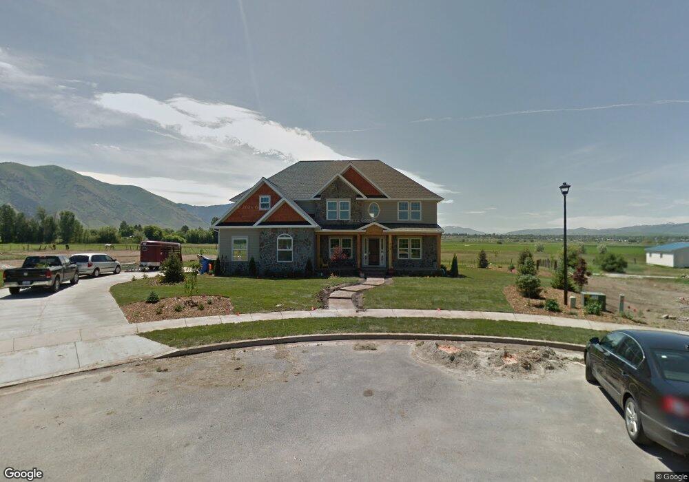
510 W 3800 S Unit 47 Nibley, UT 84321
Estimated Value: $717,000 - $938,000
--
Bed
--
Bath
3,207
Sq Ft
$266/Sq Ft
Est. Value
About This Home
This home is located at 510 W 3800 S Unit 47, Nibley, UT 84321 and is currently estimated at $853,618, approximately $266 per square foot. 510 W 3800 S Unit 47 is a home located in Cache County with nearby schools including Heritage School, Spring Creek Middle School, and South Cache Middle School.
Ownership History
Date
Name
Owned For
Owner Type
Purchase Details
Closed on
Dec 16, 2021
Sold by
Johnson James E and Johnson Margaret E
Bought by
Johnson James E and Johnson Margaret E
Current Estimated Value
Purchase Details
Closed on
Sep 28, 2012
Sold by
Anderson Neil and Anderson Cathy
Bought by
Johnson James E and Johnson Margaret E
Purchase Details
Closed on
Apr 25, 2006
Sold by
Murray Dennis R and Murray Patricia
Bought by
Anderson Neil and Anderson Cathy
Create a Home Valuation Report for This Property
The Home Valuation Report is an in-depth analysis detailing your home's value as well as a comparison with similar homes in the area
Home Values in the Area
Average Home Value in this Area
Purchase History
| Date | Buyer | Sale Price | Title Company |
|---|---|---|---|
| Johnson James E | -- | Northern Title Company | |
| Johnson James E | -- | Pinnacle Title Ins Agency | |
| Anderson Neil | -- | Northern Title Company |
Source: Public Records
Tax History Compared to Growth
Tax History
| Year | Tax Paid | Tax Assessment Tax Assessment Total Assessment is a certain percentage of the fair market value that is determined by local assessors to be the total taxable value of land and additions on the property. | Land | Improvement |
|---|---|---|---|---|
| 2025 | $3,398 | $450,460 | $0 | $0 |
| 2024 | $3,601 | $448,165 | $0 | $0 |
| 2023 | $379 | $442,035 | $0 | $0 |
| 2022 | $3,948 | $442,035 | $0 | $0 |
| 2021 | $3,633 | $619,400 | $115,800 | $503,600 |
| 2020 | $3,304 | $534,691 | $115,800 | $418,891 |
| 2019 | $3,466 | $534,691 | $115,800 | $418,891 |
| 2018 | $3,155 | $471,510 | $97,500 | $374,010 |
| 2017 | $3,156 | $257,410 | $0 | $0 |
| 2016 | $3,191 | $235,740 | $0 | $0 |
| 2015 | $2,553 | $207,240 | $0 | $0 |
| 2014 | $2,495 | $207,240 | $0 | $0 |
| 2013 | $754 | $111,360 | $0 | $0 |
Source: Public Records
Map
Nearby Homes
- 396 W 3650 S
- 187 W 3175 S
- 268 W 3400 S Unit 5
- 189 W 3175 S
- 173 W 3175 S
- 3400 S 250 W Unit 2
- 262 W 3400 S Unit 11
- 324 W 3400 S Unit 7
- 278 W 3400 S Unit 10
- 294 W 3400 S Unit 9
- 308 W 3400 S Unit 8
- 338 W 3400 S Unit 6
- 3262 S 470 W
- 191 W 3175 S Unit U629
- 191 W 3175 S
- 185 W 3175 S
- 186 W 3175 S
- 182 W 3175 S
- 1004 3410 S
- 4009 S Cottonwoods Ct
- 490 W 3800 S
- 3896 S 640 W
- 470 W 3800 S
- 505 W 3800 S
- 485 W 3800 S
- 465 W 3800 S Unit 44
- 3786 S 450 W
- 490 Sheridan Ridge Ln
- 3765 S 450 W
- 516 Sheridan Ridge Ln
- 3766 S 450 W
- 536 Sheridan Ridge Ln
- 408 Sheridan Ridge Ln
- 489 Sheridan Ln
- 515 Sheridan Ridge Ln
- 467 Sheridan Ridge Ln
- 535 Sheridan Ridge Ln
- 386 Sheridan Ridge Ln
- 435 Sheridan Ridge Ln
- 413 Sheridan Ridge Ln