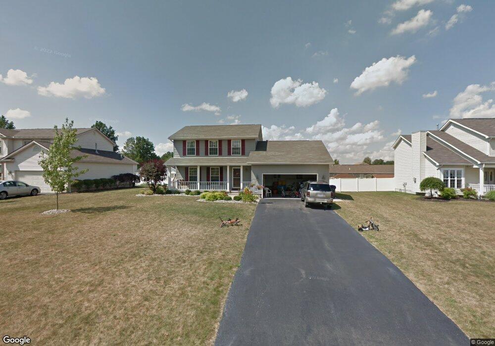
5106 Winslow Dr Mineral Ridge, OH 44440
Austintown NeighborhoodEstimated Value: $251,000 - $292,000
3
Beds
3
Baths
1,784
Sq Ft
$156/Sq Ft
Est. Value
About This Home
This home is located at 5106 Winslow Dr, Mineral Ridge, OH 44440 and is currently estimated at $278,022, approximately $155 per square foot. 5106 Winslow Dr is a home located in Mahoning County with nearby schools including Seaborn Elementary School, Mineral Ridge High School, and Stambaugh Charter Academy.
Ownership History
Date
Name
Owned For
Owner Type
Purchase Details
Closed on
Dec 14, 2004
Sold by
Bertelli Homes Inc
Bought by
Pappagallo Timothy M and Pappagallo Natalie M
Current Estimated Value
Home Financials for this Owner
Home Financials are based on the most recent Mortgage that was taken out on this home.
Original Mortgage
$143,436
Interest Rate
5.82%
Mortgage Type
FHA
Create a Home Valuation Report for This Property
The Home Valuation Report is an in-depth analysis detailing your home's value as well as a comparison with similar homes in the area
Home Values in the Area
Average Home Value in this Area
Purchase History
| Date | Buyer | Sale Price | Title Company |
|---|---|---|---|
| Pappagallo Timothy M | $145,700 | -- |
Source: Public Records
Mortgage History
| Date | Status | Borrower | Loan Amount |
|---|---|---|---|
| Closed | Pappagallo Timothy M | $143,436 |
Source: Public Records
Tax History Compared to Growth
Tax History
| Year | Tax Paid | Tax Assessment Tax Assessment Total Assessment is a certain percentage of the fair market value that is determined by local assessors to be the total taxable value of land and additions on the property. | Land | Improvement |
|---|---|---|---|---|
| 2024 | $3,611 | $78,910 | $6,650 | $72,260 |
| 2023 | $3,554 | $78,910 | $6,650 | $72,260 |
| 2022 | $3,131 | $55,740 | $6,650 | $49,090 |
| 2021 | $3,133 | $55,740 | $6,650 | $49,090 |
| 2020 | $3,146 | $55,740 | $6,650 | $49,090 |
| 2019 | $3,079 | $49,710 | $6,650 | $43,060 |
| 2018 | $2,963 | $49,710 | $6,650 | $43,060 |
| 2017 | $2,927 | $49,710 | $6,650 | $43,060 |
| 2016 | $2,895 | $48,140 | $6,650 | $41,490 |
| 2015 | $2,806 | $48,140 | $6,650 | $41,490 |
| 2014 | $2,819 | $48,140 | $6,650 | $41,490 |
| 2013 | $2,789 | $48,140 | $6,650 | $41,490 |
Source: Public Records
Map
Nearby Homes
- 5085 Winslow Dr
- 1239 Woodledge Dr
- 0 W Webb Rd
- 1467 E County Line Rd
- 21 E Liberty St
- 1684 Morris St
- 1445 E County Line Rd
- 3872 Main St
- 645 Carlin Dr
- 3907 Edwards St
- 3579 Bee St
- 6360 Meander Glen Dr
- 3474 S Main St
- 6393 Meander Glen Dr
- 0 W Liberty Unit 5153649
- 5231 W Rockwell Rd
- 4028 Lanterman Rd
- 4020 Lanterman Rd
- 176 N Canfield Niles Rd
- 3440 Lakeside Dr
- 5102 Winslow Dr
- 5110 Winslow Dr
- 5123 Clearfield Dr
- 5098 Winslow Dr
- 5114 Winslow Dr
- 5119 Clearfield Dr
- 5127 Clearfield Dr
- 5105 Winslow Dr
- 5101 Winslow Dr
- 5109 Winslow Dr
- 5115 Clearfield Dr
- 5131 Clearfield Dr
- 5094 Winslow Dr
- 5118 Winslow Dr
- 5097 Winslow Dr
- 5113 Winslow Dr
- 5111 Clearfield Dr
- 5135 Clearfield Dr
- 5117 Winslow Dr
- 5093 Winslow Dr