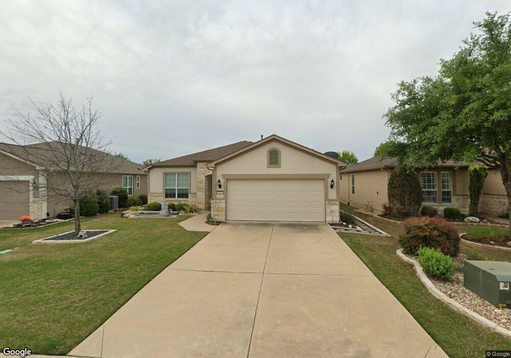
511 Apache Mountain Ln Georgetown, TX 78633
Sun City NeighborhoodEstimated Value: $321,696 - $374,000
Studio
2
Baths
1,624
Sq Ft
$217/Sq Ft
Est. Value
About This Home
This home is located at 511 Apache Mountain Ln, Georgetown, TX 78633 and is currently estimated at $351,674, approximately $216 per square foot. 511 Apache Mountain Ln is a home located in Williamson County.
Ownership History
Date
Name
Owned For
Owner Type
Purchase Details
Closed on
May 5, 2020
Sold by
Copland Ronnie L and Estate Of Hugh Bernard Copland
Bought by
Copland Ronnie L
Current Estimated Value
Purchase Details
Closed on
Jul 26, 2010
Sold by
Del Webb Texas Limited Partnership
Bought by
Copland Ronnie L and Copland Hugh B
Home Financials for this Owner
Home Financials are based on the most recent Mortgage that was taken out on this home.
Original Mortgage
$131,465
Outstanding Balance
$86,911
Interest Rate
4.54%
Mortgage Type
New Conventional
Estimated Equity
$264,763
Create a Home Valuation Report for This Property
The Home Valuation Report is an in-depth analysis detailing your home's value as well as a comparison with similar homes in the area
Home Values in the Area
Average Home Value in this Area
Purchase History
| Date | Buyer | Sale Price | Title Company |
|---|---|---|---|
| Copland Ronnie L | -- | None Available | |
| Copland Ronnie L | -- | None Available |
Source: Public Records
Mortgage History
| Date | Status | Borrower | Loan Amount |
|---|---|---|---|
| Open | Copland Ronnie L | $131,465 |
Source: Public Records
Tax History
| Year | Tax Paid | Tax Assessment Tax Assessment Total Assessment is a certain percentage of the fair market value that is determined by local assessors to be the total taxable value of land and additions on the property. | Land | Improvement |
|---|---|---|---|---|
| 2025 | $1,620 | $343,169 | $80,000 | $263,169 |
| 2024 | $1,620 | $381,712 | $80,000 | $301,712 |
| 2023 | $1,626 | $375,383 | $0 | $0 |
| 2022 | $3,401 | $341,257 | $0 | $0 |
| 2021 | $6,775 | $310,234 | $65,000 | $245,234 |
| 2020 | $6,444 | $290,547 | $57,150 | $233,397 |
| 2019 | $6,784 | $296,515 | $55,640 | $240,875 |
| 2018 | $3,474 | $297,035 | $55,640 | $241,395 |
| 2017 | $6,648 | $287,853 | $52,000 | $235,853 |
| 2016 | $6,375 | $276,016 | $38,900 | $245,216 |
| 2015 | $3,613 | $250,924 | $38,900 | $231,302 |
| 2014 | $3,613 | $228,113 | $0 | $0 |
Source: Public Records
Map
Nearby Homes
- 110 Emory Peak Trail
- 214 Apache Mountain Ln
- 122 Lost Peak Path
- 302 Pipe Creek Ln
- 304 Pipe Creek Ln
- 124 Huntsville Cove
- 310 Pipe Creek Ln
- 136 Prairie Creek Trail
- 915 Apache Mountain Ln
- 114 Bee Creek Ct
- 106 Kickapoo Creek Ln
- 208 Bear Creek Ln
- 834 Salado Creek Ln
- 203 Independence Creek Ln
- 205 Standing Oak Dr
- 308 Hanging Star Ln
- 103 Mud Creek Cove
- 606 Salado Creek Ln
- 232 Standing Oak Dr
- 111 McKittrick Ridge Rd
- 509 Apache Mountain Ln
- 513 Apache Mountain Ln
- 507 Apache Mountain Ln
- 111 Cleburne Pass
- 113 Cleburne Pass
- 109 Cleburne Pass
- 505 Apache Mountain Ln
- 510 Sheldon Lake Dr
- 107 Cleburne Pass
- 506 Sheldon Lake Dr
- 115 Cleburne Pass
- 119 Cleburne Pass
- 602 Sheldon Lake Dr
- 504 Sheldon Lake Dr
- 506 Apache Mountain Ln
- 503 Apache Mountain Ln
- 121 Cleburne Pass
- 502 Sheldon Lake Dr
- 504 Apache Mountain Ln
- 604 Sheldon Lake Dr
Your Personal Tour Guide
Ask me questions while you tour the home.