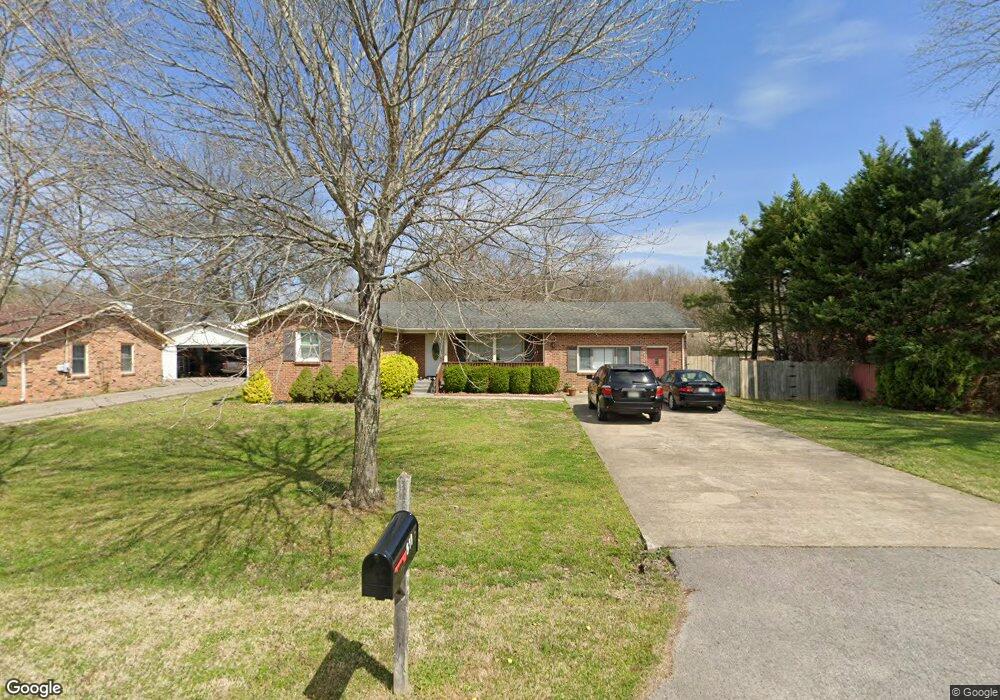
511 E Gresham Dr Smyrna, TN 37167
Estimated Value: $363,000 - $422,000
3
Beds
3
Baths
2,039
Sq Ft
$191/Sq Ft
Est. Value
About This Home
This home is located at 511 E Gresham Dr, Smyrna, TN 37167 and is currently estimated at $390,393, approximately $191 per square foot. 511 E Gresham Dr is a home located in Rutherford County with nearby schools including Smyrna Elementary School, Smyrna Middle School, and Smyrna High School.
Ownership History
Date
Name
Owned For
Owner Type
Purchase Details
Closed on
Jun 10, 2005
Sold by
Badr Brenda C
Bought by
Abdulrahman Shereen J
Current Estimated Value
Home Financials for this Owner
Home Financials are based on the most recent Mortgage that was taken out on this home.
Original Mortgage
$80,000
Outstanding Balance
$40,739
Interest Rate
5.38%
Estimated Equity
$349,654
Purchase Details
Closed on
Dec 16, 2003
Sold by
Badr Brenda C
Bought by
Badr Ahmed I and Badr Brenda C
Purchase Details
Closed on
Sep 15, 2003
Sold by
Rupnik Patricia M
Bought by
Badr Brenda C
Create a Home Valuation Report for This Property
The Home Valuation Report is an in-depth analysis detailing your home's value as well as a comparison with similar homes in the area
Home Values in the Area
Average Home Value in this Area
Purchase History
| Date | Buyer | Sale Price | Title Company |
|---|---|---|---|
| Abdulrahman Shereen J | $128,000 | -- | |
| Badr Ahmed I | -- | -- | |
| Badr Brenda C | $124,900 | -- |
Source: Public Records
Mortgage History
| Date | Status | Borrower | Loan Amount |
|---|---|---|---|
| Open | Badr Brenda C | $80,000 |
Source: Public Records
Tax History
| Year | Tax Paid | Tax Assessment Tax Assessment Total Assessment is a certain percentage of the fair market value that is determined by local assessors to be the total taxable value of land and additions on the property. | Land | Improvement |
|---|---|---|---|---|
| 2025 | $1,799 | $74,900 | $13,750 | $61,150 |
| 2024 | $1,799 | $74,900 | $13,750 | $61,150 |
| 2023 | $1,799 | $74,900 | $13,750 | $61,150 |
| 2022 | $1,605 | $74,900 | $13,750 | $61,150 |
| 2021 | $1,559 | $53,375 | $8,750 | $44,625 |
| 2020 | $1,559 | $53,375 | $8,750 | $44,625 |
| 2019 | $1,559 | $53,375 | $8,750 | $44,625 |
| 2018 | $1,495 | $53,375 | $0 | $0 |
| 2017 | $1,262 | $35,400 | $0 | $0 |
| 2016 | $1,262 | $35,400 | $0 | $0 |
| 2015 | $1,262 | $35,400 | $0 | $0 |
| 2014 | $880 | $35,400 | $0 | $0 |
| 2013 | -- | $35,025 | $0 | $0 |
Source: Public Records
Map
Nearby Homes
- 515 Mary St
- 0 E Gresham Dr
- 160 Twain Aly Unit 109 C
- 412 Gooding Blvd
- 108 Fairview Ave
- 106 Kings Rd
- 380 Sam Davis Rd
- 508 Restoration Dr
- 504 Restoration Dr
- 0 Enon Springs Rd W
- 170 Twain Aly Unit 109 B
- 3025 Stratton Valley Unit 95 A
- 130 Twain Aly Unit 105 E
- 113 Joella Dr
- 206 Richland Ave
- 106 Creek Ct
- 642 Rock Springs Rd
- 129 Stokes Dr
- 101 Annleeken Dr
- 401 Ravencliff Ct
Your Personal Tour Guide
Ask me questions while you tour the home.