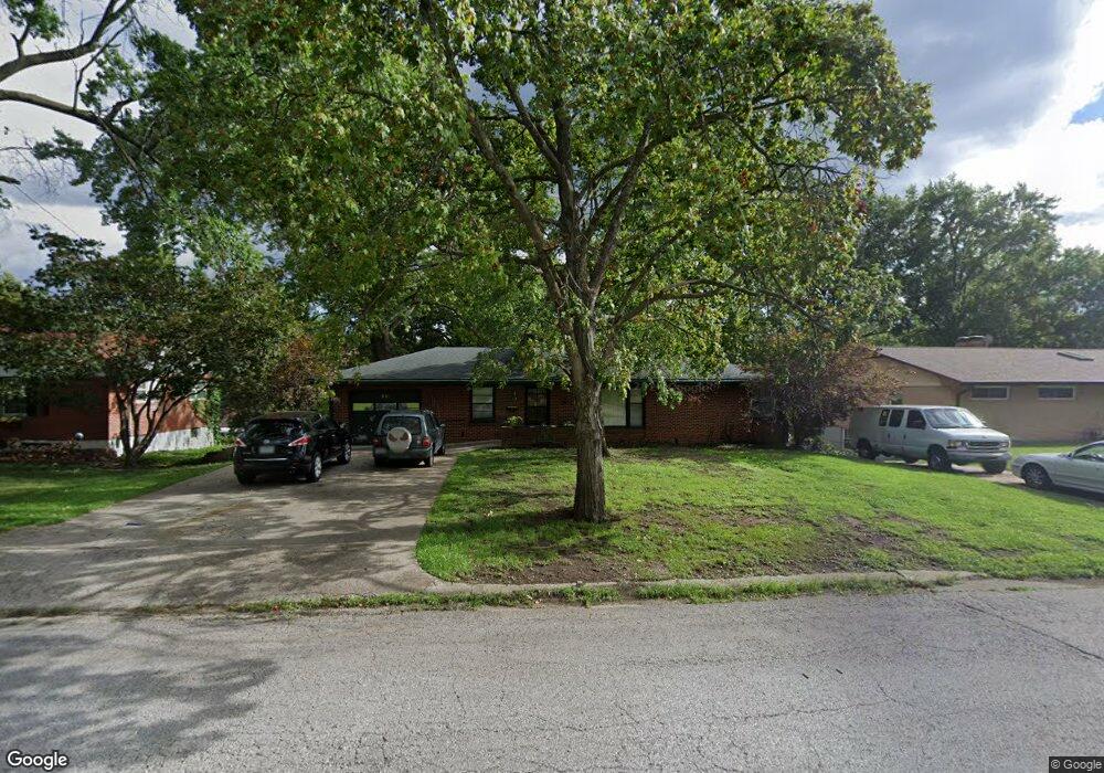
511 E Partridge Ave Independence, MO 64055
Hanthorn NeighborhoodEstimated Value: $213,837 - $256,000
2
Beds
2
Baths
1,225
Sq Ft
$192/Sq Ft
Est. Value
About This Home
This home is located at 511 E Partridge Ave, Independence, MO 64055 and is currently estimated at $235,209, approximately $192 per square foot. 511 E Partridge Ave is a home located in Jackson County with nearby schools including Sycamore Hills Elementary School, Bridger Middle School, and Pioneer Ridge Middle School.
Ownership History
Date
Name
Owned For
Owner Type
Purchase Details
Closed on
Nov 17, 2009
Sold by
Jeffries Melba J
Bought by
Jeffries Sarah
Current Estimated Value
Home Financials for this Owner
Home Financials are based on the most recent Mortgage that was taken out on this home.
Original Mortgage
$90,000
Outstanding Balance
$55,692
Interest Rate
4%
Mortgage Type
Seller Take Back
Estimated Equity
$179,517
Purchase Details
Closed on
Nov 5, 1997
Sold by
Beebe Lenora E
Bought by
Jeffries Nile J and Jeffries Melba J
Create a Home Valuation Report for This Property
The Home Valuation Report is an in-depth analysis detailing your home's value as well as a comparison with similar homes in the area
Home Values in the Area
Average Home Value in this Area
Purchase History
| Date | Buyer | Sale Price | Title Company |
|---|---|---|---|
| Jeffries Sarah | -- | First American Title Ins Co | |
| Jeffries Nile J | -- | -- |
Source: Public Records
Mortgage History
| Date | Status | Borrower | Loan Amount |
|---|---|---|---|
| Open | Jeffries Sarah | $90,000 |
Source: Public Records
Tax History
| Year | Tax Paid | Tax Assessment Tax Assessment Total Assessment is a certain percentage of the fair market value that is determined by local assessors to be the total taxable value of land and additions on the property. | Land | Improvement |
|---|---|---|---|---|
| 2025 | $1,759 | $29,197 | $6,192 | $23,005 |
| 2024 | $1,719 | $25,390 | $4,549 | $20,841 |
| 2023 | $1,719 | $25,390 | $4,102 | $21,288 |
| 2022 | $1,839 | $24,890 | $5,168 | $19,722 |
| 2021 | $1,838 | $24,890 | $5,168 | $19,722 |
| 2020 | $1,772 | $23,318 | $5,168 | $18,150 |
| 2019 | $1,744 | $23,318 | $5,168 | $18,150 |
| 2018 | $1,797 | $22,944 | $3,803 | $19,141 |
| 2017 | $1,797 | $22,944 | $3,803 | $19,141 |
| 2016 | $1,769 | $22,368 | $4,305 | $18,063 |
Source: Public Records
Map
Nearby Homes
- 303 E Partridge Ave Unit 39
- 301 E Partridge Ave Unit K
- 212 E Hansen Ct Unit 1
- 660 E Red Rd
- 1954 S Lake Terrace
- 14600 E 33rd St S
- 921 E Manor Rd
- 14816 E 33rd St S
- 3412 S Emery St
- 718 E Gudgell Ave
- 14810 E 34th St S
- 735 E Devon St
- 1815 & 1719 S Osage St
- 421 E Angus St
- 1402 S Dodgion Ave
- 1339 S Hocker Ave
- 1340 S Emery Ave
- 603 E Myrtle St
- 14405 E 36th Terrace S
- 1312 S Pearl St
- 507 E Partridge Ave
- 517 E Partridge Ave
- 421 E Partridge Ave
- 521 E Partridge Ave
- 512 E Partridge Ave
- 500 E Linwood Ave
- 424 E Linwood Ave
- 520 E Partridge Ave
- 506 E Linwood Ave
- 420 E Linwood Ave
- 420 E Partridge Ave
- 2031 S Pearl St
- 611 E Partridge Ave
- 512 E Linwood Ave
- 419 E Partridge Ave
- 604 E Partridge Ave
- 414 E Linwood Ave
- 418 E Partridge Ave
- 501 E Linwood Ave
- 518 E Linwood Ave
Your Personal Tour Guide
Ask me questions while you tour the home.