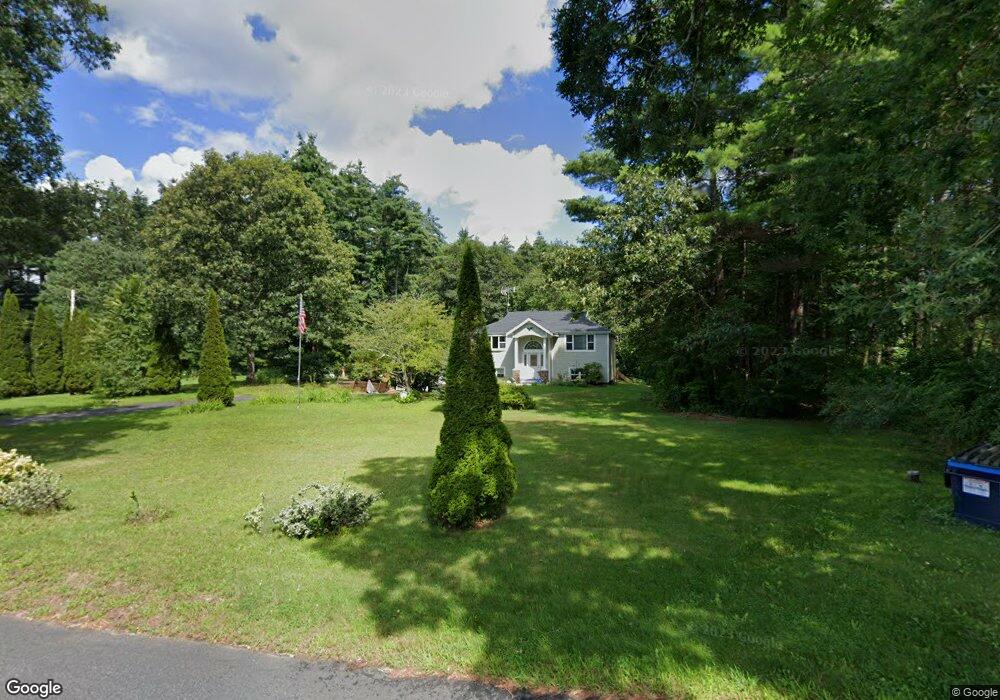
511 Michael Sears Rd Belchertown, MA 01007
Estimated Value: $376,000 - $501,000
3
Beds
2
Baths
2,048
Sq Ft
$215/Sq Ft
Est. Value
About This Home
This home is located at 511 Michael Sears Rd, Belchertown, MA 01007 and is currently estimated at $439,297, approximately $214 per square foot. 511 Michael Sears Rd is a home located in Hampshire County with nearby schools including Swift River Elementary School, Chestnut Hill Community School, and Jabish Middle School.
Ownership History
Date
Name
Owned For
Owner Type
Purchase Details
Closed on
Mar 29, 2001
Sold by
Fnma
Bought by
Pecia William F
Current Estimated Value
Purchase Details
Closed on
Jul 17, 2000
Sold by
Chaverri Oscar L
Bought by
Federal National Mortgage Association
Purchase Details
Closed on
Sep 9, 1988
Sold by
Puerto Julio E
Bought by
Chaverri Oscar L
Create a Home Valuation Report for This Property
The Home Valuation Report is an in-depth analysis detailing your home's value as well as a comparison with similar homes in the area
Home Values in the Area
Average Home Value in this Area
Purchase History
| Date | Buyer | Sale Price | Title Company |
|---|---|---|---|
| Pecia William F | $118,500 | -- | |
| Federal National Mortgage Association | $100,000 | -- | |
| Chaverri Oscar L | $136,000 | -- |
Source: Public Records
Mortgage History
| Date | Status | Borrower | Loan Amount |
|---|---|---|---|
| Open | Chaverri Oscar L | $241,000 | |
| Closed | Chaverri Oscar L | $46,000 |
Source: Public Records
Tax History
| Year | Tax Paid | Tax Assessment Tax Assessment Total Assessment is a certain percentage of the fair market value that is determined by local assessors to be the total taxable value of land and additions on the property. | Land | Improvement |
|---|---|---|---|---|
| 2025 | $4,986 | $343,600 | $82,100 | $261,500 |
| 2024 | $4,964 | $324,000 | $74,500 | $249,500 |
| 2023 | $4,521 | $277,000 | $68,700 | $208,300 |
| 2022 | $4,373 | $247,600 | $68,700 | $178,900 |
| 2021 | $4,226 | $233,100 | $68,700 | $164,400 |
| 2020 | $4,119 | $226,700 | $68,700 | $158,000 |
| 2019 | $3,963 | $216,300 | $68,700 | $147,600 |
| 2018 | $3,945 | $216,900 | $70,000 | $146,900 |
| 2017 | $3,891 | $213,800 | $70,000 | $143,800 |
| 2016 | $3,829 | $213,100 | $70,000 | $143,100 |
| 2015 | $3,678 | $205,600 | $70,000 | $135,600 |
Source: Public Records
Map
Nearby Homes
- 6 High Bluff Rd
- 7 High Bluff Rd
- 15 High Bluff Rd
- 23 High Bluff Rd
- 31 High Bluff Rd
- 4 Sunny Crest Ln
- 0 South St
- 521 N Liberty St
- 0 N Liberty St
- 0 Michael Sears Rd
- 3072 Main St Unit 3072
- 308 N Liberty St
- 87-12 State St
- 3078 Main St Unit B
- 22 Crawford St
- 29 Griffin St
- 8 Summit Dr
- Lot 87-12 State St
- Lot T Woodland Ln
- 17 Woodland Ln
- 515 Michael Sears Rd
- 497 Michael Sears Rd
- 514 Michael Sears Rd
- 506 Michael Sears Rd
- 491 Michael Sears Rd
- 521 Michael Sears Rd
- 483 Michael Sears Rd
- 522 Michael Sears Rd
- 482 Michael Sears Rd
- 1 Eugene Dr
- 17 Eugene Dr
- 84-GH Eugene Dr
- 538 Michael Sears Rd
- 23 Eugene Dr
- 527 Michael Sears Rd
- 62 Pine St
- 476 Michael Sears Rd
- 29 Eugene Dr
- 35 Eugene Dr
- 471 Michael Sears Rd
Your Personal Tour Guide
Ask me questions while you tour the home.