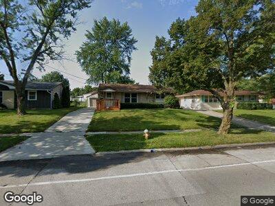
5112 Lower Beaver Rd Des Moines, IA 50310
Lower Beaver NeighborhoodEstimated Value: $219,000 - $238,000
4
Beds
2
Baths
964
Sq Ft
$236/Sq Ft
Est. Value
About This Home
This home is located at 5112 Lower Beaver Rd, Des Moines, IA 50310 and is currently estimated at $227,250, approximately $235 per square foot. 5112 Lower Beaver Rd is a home located in Polk County with nearby schools including Samuelson Elementary School, Meredith Middle School, and Hoover High School.
Ownership History
Date
Name
Owned For
Owner Type
Purchase Details
Closed on
Apr 18, 2005
Sold by
Wells George Adam and Wells Tracy S
Bought by
Elliott Robert W and Elliott Michelle
Current Estimated Value
Home Financials for this Owner
Home Financials are based on the most recent Mortgage that was taken out on this home.
Original Mortgage
$85,900
Outstanding Balance
$47,680
Interest Rate
6.06%
Mortgage Type
Fannie Mae Freddie Mac
Estimated Equity
$182,828
Purchase Details
Closed on
Oct 28, 2001
Sold by
Baker Cameron J and Baker Andrea G
Bought by
Wells George Adam and Wells Tracy S
Home Financials for this Owner
Home Financials are based on the most recent Mortgage that was taken out on this home.
Original Mortgage
$69,200
Interest Rate
7.62%
Create a Home Valuation Report for This Property
The Home Valuation Report is an in-depth analysis detailing your home's value as well as a comparison with similar homes in the area
Home Values in the Area
Average Home Value in this Area
Purchase History
| Date | Buyer | Sale Price | Title Company |
|---|---|---|---|
| Elliott Robert W | $125,500 | -- | |
| Wells George Adam | $106,000 | -- |
Source: Public Records
Mortgage History
| Date | Status | Borrower | Loan Amount |
|---|---|---|---|
| Open | Elliott Robert W | $52,867 | |
| Open | Elliott Robert W | $85,900 | |
| Previous Owner | Wells George Adam | $69,200 |
Source: Public Records
Tax History Compared to Growth
Tax History
| Year | Tax Paid | Tax Assessment Tax Assessment Total Assessment is a certain percentage of the fair market value that is determined by local assessors to be the total taxable value of land and additions on the property. | Land | Improvement |
|---|---|---|---|---|
| 2024 | $3,526 | $196,700 | $46,000 | $150,700 |
| 2023 | $3,664 | $196,700 | $46,000 | $150,700 |
| 2022 | $3,634 | $164,300 | $39,600 | $124,700 |
| 2021 | $3,562 | $164,300 | $39,600 | $124,700 |
| 2020 | $3,694 | $151,300 | $36,400 | $114,900 |
| 2019 | $3,434 | $151,300 | $36,400 | $114,900 |
| 2018 | $3,394 | $136,300 | $32,200 | $104,100 |
| 2017 | $3,112 | $136,300 | $32,200 | $104,100 |
| 2016 | $3,028 | $123,600 | $28,800 | $94,800 |
| 2015 | $3,028 | $123,600 | $28,800 | $94,800 |
| 2014 | $2,684 | $113,700 | $26,100 | $87,600 |
Source: Public Records
Map
Nearby Homes
- 3801 Brinkwood Rd
- 3714 Skyline Dr
- 3916 Bel Aire Rd
- 3122 Lindlavista Way
- 4461 Lower Beaver Rd
- 4419 Lower Beaver Rd
- 4311 38th St
- 4021 Crestmoor Place
- 4606 40th St
- 4813 Sawyers Dr
- 4308 40th St
- 4616 Sawyers Dr
- 3900 Shawnee Ave
- 2975 Twana Dr
- 4111 Aurora Ave
- 4118 Aurora Ave
- 4027 39th Place
- 3703 Madison Ave
- 4000 36th Place
- 4421 Brinkwood Rd
- 5112 Lower Beaver Rd
- 5108 Lower Beaver Rd
- 5118 Lower Beaver Rd
- 5009 Oaklyn Dr
- 5019 Oaklyn Dr
- 3521 Brinkwood Rd
- 5100 Lower Beaver Rd
- 3603 Brinkwood Rd
- 3515 Brinkwood Rd
- 3609 Brinkwood Rd
- 3509 Brinkwood Rd
- 5109 Lower Beaver Rd
- 5117 Lower Beaver Rd
- 5103 Lower Beaver Rd
- 5123 Lower Beaver Rd
- 3501 Brinkwood Rd
- 5006 Oaklyn Dr
- 5012 Oaklyn Dr
- 5132 Lower Beaver Rd
- 3433 Hillcrest Dr