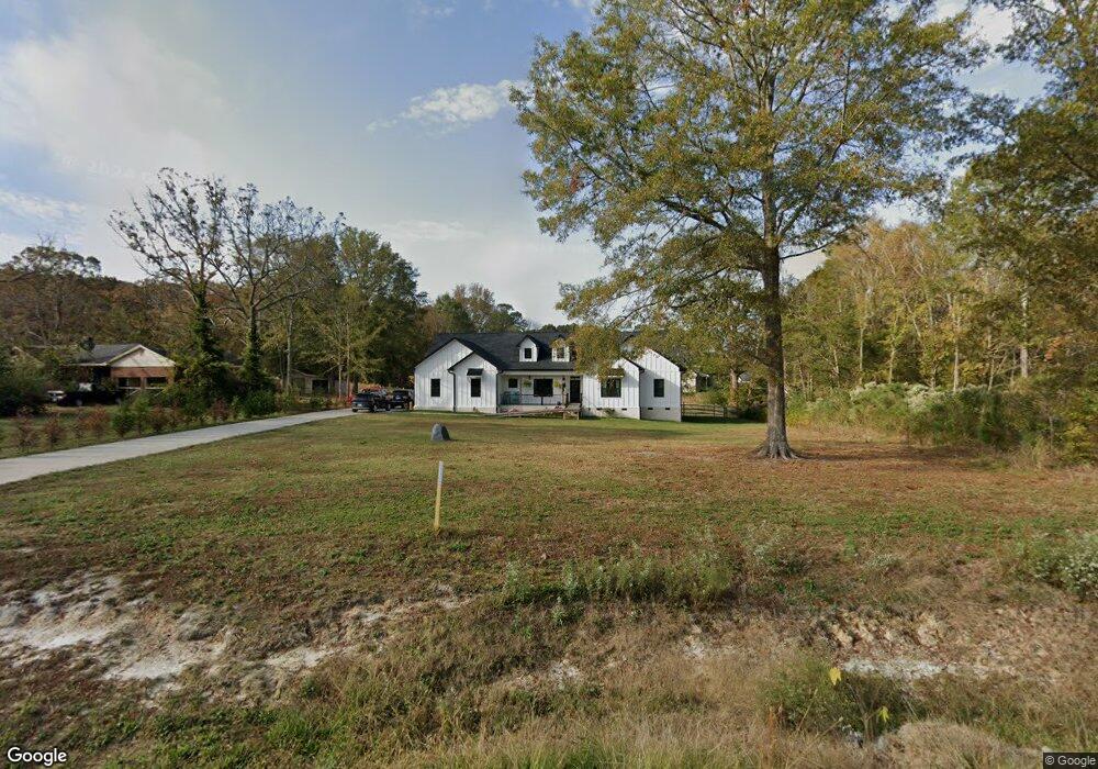
5117 Tom Starnes Rd Waxhaw, NC 28173
Estimated Value: $533,000 - $632,000
4
Beds
3
Baths
2,300
Sq Ft
$248/Sq Ft
Est. Value
About This Home
This home is located at 5117 Tom Starnes Rd, Waxhaw, NC 28173 and is currently estimated at $570,918, approximately $248 per square foot. 5117 Tom Starnes Rd is a home located in Union County with nearby schools including Prospect Elementary School, Parkwood Middle School, and Parkwood High School.
Ownership History
Date
Name
Owned For
Owner Type
Purchase Details
Closed on
Jan 25, 2023
Sold by
Rg Real Estate Holdings Llc
Bought by
Ritter Samuel R and Ritter Debra Sue
Current Estimated Value
Home Financials for this Owner
Home Financials are based on the most recent Mortgage that was taken out on this home.
Original Mortgage
$390,000
Outstanding Balance
$377,719
Interest Rate
6.31%
Mortgage Type
New Conventional
Estimated Equity
$193,199
Purchase Details
Closed on
Jul 7, 2021
Sold by
Cochran & Tanner Properties Llc
Bought by
Tanner Design & Build Llc
Purchase Details
Closed on
Jan 21, 2021
Sold by
Cochran & Tanner Properties Llc
Bought by
Rg Real Estate Holdings Llc
Create a Home Valuation Report for This Property
The Home Valuation Report is an in-depth analysis detailing your home's value as well as a comparison with similar homes in the area
Home Values in the Area
Average Home Value in this Area
Purchase History
| Date | Buyer | Sale Price | Title Company |
|---|---|---|---|
| Ritter Samuel R | $490,000 | -- | |
| Tanner Design & Build Llc | -- | None Available | |
| Rg Real Estate Holdings Llc | $50,000 | None Available |
Source: Public Records
Mortgage History
| Date | Status | Borrower | Loan Amount |
|---|---|---|---|
| Open | Ritter Samuel R | $390,000 |
Source: Public Records
Tax History Compared to Growth
Tax History
| Year | Tax Paid | Tax Assessment Tax Assessment Total Assessment is a certain percentage of the fair market value that is determined by local assessors to be the total taxable value of land and additions on the property. | Land | Improvement |
|---|---|---|---|---|
| 2024 | $2,371 | $371,500 | $25,200 | $346,300 |
| 2023 | $1,963 | $312,600 | $25,200 | $287,400 |
| 2022 | $158 | $25,200 | $25,200 | $0 |
| 2021 | $155 | $25,200 | $25,200 | $0 |
Source: Public Records
Map
Nearby Homes
- 7517 Lancaster Hwy Unit 5
- 7517 Lancaster Hwy
- 5105 Tom Starnes Rd
- Roanoke Plan at Lancaster Hwy
- Charleston Plan at Lancaster Hwy
- 7513 Lancaster Hwy Unit 6
- 7513 Lancaster Hwy
- 0 Potter Rd S Unit 1 CAR4189512
- 0 Potter Rd S Unit 3 CAR4189516
- 0 Potter Rd S Unit 2 CAR4189515
- 0 Potter Rd S Unit CAR4189519
- 0 Potter Rd S Unit CAR4189518
- 110 Serenity Creek Dr
- 106 Serenity Creek Dr
- 6419 Lancaster Hwy Unit 9, 19
- 5904 Nesbit Rd
- 5904 Mcwhorter Rd
- 0 Nesbit Rd Unit CAR4290917
- 5313 Old Highway Rd
- 00 Shaw Ave
- 5117 Tom Starnes Rd Unit 31
- 000 Raymond Helms Rd
- 0000 Raymond Helms Rd
- 0001 Raymond Helms Rd
- 0002 Raymond Helms Rd
- 5113 Tom Starnes Rd
- 5203 Lancaster Hwy
- 7407 Lancaster Hwy
- 5109 Tom Starnes Rd
- 7411 Lancaster Hwy
- 7411 Lancaster Hwy Unit 29
- 5116 Tom Starnes Rd
- 5114 Tom Starnes Rd
- 7501 Lancaster Hwy Unit 28
- 5112 Tom Starnes Rd Unit 4
- 5112 Tom Starnes Rd
- 7309 Lancaster Hwy
- 7505 Lancaster Hwy
- 5111 Tom Starnes Rd
- 5107 Tom Starnes Rd