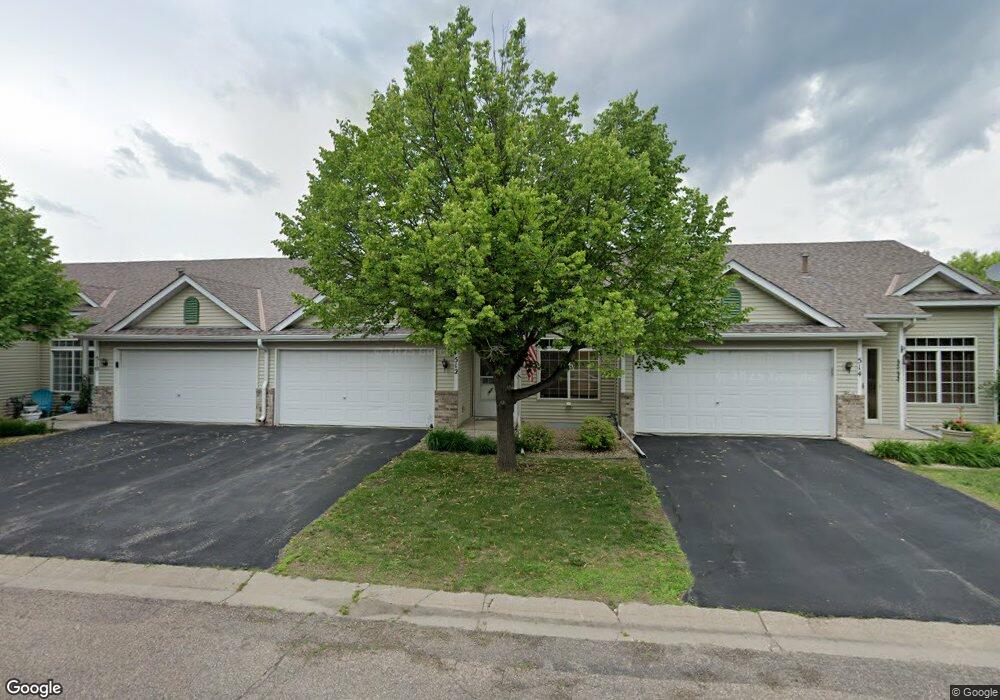
512 Creekside Dr Buffalo, MN 55313
Estimated Value: $242,948 - $304,000
3
Beds
2
Baths
928
Sq Ft
$280/Sq Ft
Est. Value
About This Home
This home is located at 512 Creekside Dr, Buffalo, MN 55313 and is currently estimated at $259,487, approximately $279 per square foot. 512 Creekside Dr is a home located in Wright County with nearby schools including Parkside Elementary School, Buffalo Community Middle School, and Buffalo Senior High School.
Ownership History
Date
Name
Owned For
Owner Type
Purchase Details
Closed on
Sep 26, 2003
Sold by
Rassat Jay T and Rassat Esa M
Bought by
Joy Jesse and Joy Angela
Current Estimated Value
Purchase Details
Closed on
Feb 28, 2001
Sold by
Pilot Land Development Company
Bought by
Rassat Jay and Julkowski Esa
Create a Home Valuation Report for This Property
The Home Valuation Report is an in-depth analysis detailing your home's value as well as a comparison with similar homes in the area
Home Values in the Area
Average Home Value in this Area
Purchase History
| Date | Buyer | Sale Price | Title Company |
|---|---|---|---|
| Joy Jesse | $157,900 | -- | |
| Rassat Jay | $122,995 | -- |
Source: Public Records
Tax History
| Year | Tax Paid | Tax Assessment Tax Assessment Total Assessment is a certain percentage of the fair market value that is determined by local assessors to be the total taxable value of land and additions on the property. | Land | Improvement |
|---|---|---|---|---|
| 2025 | $2,818 | $227,000 | $40,000 | $187,000 |
| 2024 | $2,466 | $220,700 | $40,000 | $180,700 |
| 2023 | $2,514 | $203,700 | $35,000 | $168,700 |
| 2022 | $2,412 | $191,900 | $30,000 | $161,900 |
| 2021 | $2,480 | $163,700 | $20,000 | $143,700 |
| 2020 | $2,278 | $165,200 | $20,000 | $145,200 |
| 2019 | $2,170 | $146,500 | $0 | $0 |
| 2018 | $1,968 | $147,700 | $0 | $0 |
| 2017 | $1,798 | $133,700 | $0 | $0 |
| 2016 | $1,350 | $0 | $0 | $0 |
| 2015 | $1,036 | $0 | $0 | $0 |
| 2014 | -- | $0 | $0 | $0 |
Source: Public Records
Map
Nearby Homes
- 416 Creekside Dr
- 316 Creekside Dr
- 308 Creekside Dr
- 705 4th St S
- 905 Harvest Trail
- 911 Harvest Trail
- 913 Harvest Trail
- 915 Harvest Trail
- 703 Erickson Ln
- 415 7th Ave S
- 912 Harvest Trail
- 914 Harvest Trail
- 1611 10th St NE
- 200 6th Ave S
- 609 Lake Blvd S
- 305 14th Ave NE
- 1400 4th St NE
- 402 13th Ave NE
- 107 2nd Ave NE
- 110 1st Ave NE Unit 402
- 510 Creekside Dr
- 514 Creekside Dr
- 508 Creekside Dr
- 520 Creekside Dr
- 502 Creekside Dr
- 500 Creekside Dr
- 504 Creekside Dr
- 522 Creekside Dr
- 516 Creekside Dr
- 506 Creekside Dr
- 524 Creekside Dr
- 526 Creekside Dr
- 501 Creekside Dr
- 523 Creekside Dr
- 414 Creekside Dr
- 412 Creekside Dr
- 418 Creekside Dr
- 503 Creekside Dr
- 521 Creekside Dr
- 505 Creekside Dr
Your Personal Tour Guide
Ask me questions while you tour the home.