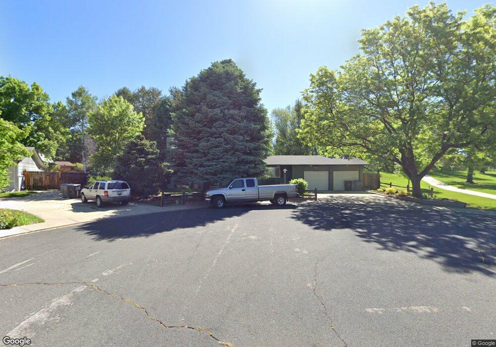
512 E Saint Clair Ave Longmont, CO 80504
Kensington NeighborhoodEstimated Value: $485,000 - $550,000
5
Beds
3
Baths
2,776
Sq Ft
$189/Sq Ft
Est. Value
About This Home
This home is located at 512 E Saint Clair Ave, Longmont, CO 80504 and is currently estimated at $524,553, approximately $188 per square foot. 512 E Saint Clair Ave is a home located in Boulder County with nearby schools including Rocky Mountain Elementary School, Trail Ridge Middle School, and Skyline High School.
Ownership History
Date
Name
Owned For
Owner Type
Purchase Details
Closed on
Apr 20, 2021
Sold by
Hartman David
Bought by
Harman David
Current Estimated Value
Home Financials for this Owner
Home Financials are based on the most recent Mortgage that was taken out on this home.
Original Mortgage
$286,000
Interest Rate
2.96%
Mortgage Type
New Conventional
Purchase Details
Closed on
Mar 14, 2017
Sold by
Mowrey Gwen K
Bought by
Hartman David
Home Financials for this Owner
Home Financials are based on the most recent Mortgage that was taken out on this home.
Original Mortgage
$315,250
Interest Rate
4.17%
Mortgage Type
New Conventional
Purchase Details
Closed on
Sep 27, 2002
Sold by
Daniels Mary L and Daniels Allen Scott
Bought by
Mowrey Brian
Home Financials for this Owner
Home Financials are based on the most recent Mortgage that was taken out on this home.
Original Mortgage
$219,123
Interest Rate
6.26%
Purchase Details
Closed on
Dec 1, 1995
Sold by
Daniels George A and Daniels Mary L
Bought by
Daniels George A
Home Financials for this Owner
Home Financials are based on the most recent Mortgage that was taken out on this home.
Original Mortgage
$162,637
Interest Rate
7.6%
Mortgage Type
Assumption
Purchase Details
Closed on
Oct 25, 1995
Sold by
Enfinger Harrie E and Enfinger Karyl D
Bought by
Daniels George A
Home Financials for this Owner
Home Financials are based on the most recent Mortgage that was taken out on this home.
Original Mortgage
$162,637
Interest Rate
7.6%
Mortgage Type
Assumption
Purchase Details
Closed on
Oct 9, 1984
Bought by
Mowrey Brian and Mowrey Gwen K
Purchase Details
Closed on
Sep 23, 1977
Bought by
Mowrey Brian and Mowrey Gwen K
Create a Home Valuation Report for This Property
The Home Valuation Report is an in-depth analysis detailing your home's value as well as a comparison with similar homes in the area
Home Values in the Area
Average Home Value in this Area
Purchase History
| Date | Buyer | Sale Price | Title Company |
|---|---|---|---|
| Harman David | -- | Elevated Title Co | |
| Hartman David | $325,000 | First American Title | |
| Mowrey Brian | $225,900 | -- | |
| Daniels George A | -- | Commonwealth Land Title | |
| Daniels George A | $157,900 | Commonwealth Land Title | |
| Mowrey Brian | $105,600 | -- | |
| Mowrey Brian | $51,600 | -- |
Source: Public Records
Mortgage History
| Date | Status | Borrower | Loan Amount |
|---|---|---|---|
| Previous Owner | Harman David | $286,000 | |
| Previous Owner | Hartman David | $315,250 | |
| Previous Owner | Mowrey Brian | $219,123 | |
| Previous Owner | Daniels George A | $162,637 |
Source: Public Records
Tax History
| Year | Tax Paid | Tax Assessment Tax Assessment Total Assessment is a certain percentage of the fair market value that is determined by local assessors to be the total taxable value of land and additions on the property. | Land | Improvement |
|---|---|---|---|---|
| 2025 | $3,486 | $37,981 | $13,156 | $24,825 |
| 2024 | $3,486 | $37,981 | $13,156 | $24,825 |
| 2023 | $3,438 | $36,441 | $14,378 | $25,748 |
| 2022 | $2,962 | $29,934 | $10,078 | $19,856 |
| 2021 | $3,001 | $30,796 | $10,368 | $20,428 |
| 2020 | $2,625 | $27,028 | $8,795 | $18,233 |
| 2019 | $2,584 | $27,028 | $8,795 | $18,233 |
| 2018 | $2,289 | $24,098 | $7,488 | $16,610 |
| 2017 | $2,258 | $26,642 | $8,278 | $18,364 |
| 2016 | $2,016 | $21,094 | $6,766 | $14,328 |
| 2015 | $1,921 | $18,109 | $6,129 | $11,980 |
| 2014 | $1,691 | $18,109 | $6,129 | $11,980 |
Source: Public Records
Map
Nearby Homes
- 631 Rider Ridge Rd
- 727 Hubbard Dr
- 524 Rider Ridge Dr
- 262 E 5th Ave
- 244 Sorento Place
- 613 Rider Ridge Dr
- 820 Brookside Dr
- 737 Goss Dr
- 815 Hilltop St
- 902 Sugar Mill Ave
- 500 Lashley St Unit 48
- 240 Wadsworth Cir
- 225 E 8th Ave Unit E20
- 225 E 8th Ave Unit F2
- 225 E 8th Ave Unit C14
- 140 E 5th Ave
- 136 E 5th Ave
- 1267 E 9th Ave
- 128 E 5th Ave
- 29 Marshall Place
- 506 E Saint Clair Ave
- 507 Copeland Way
- 513 Copeland Way
- 626 Elliott St
- 632 Elliott St
- 600 Elliott St
- 610 Elliott St
- 544 Elliott St
- 538 Elliott St
- 512 Copeland Way
- 532 Elliott St
- 625 Elliott St
- 500 Copeland Way
- 631 Elliott St
- 506 Copeland Way
- 526 Elliott St
- 617 Elliott St
- 637 Elliott St
- 432 E Saint Clair Ave
- 545 Elliott St
Your Personal Tour Guide
Ask me questions while you tour the home.