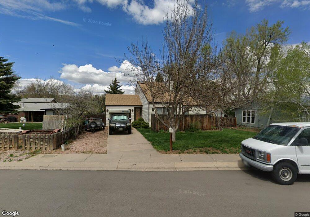
512 Locust Grove Dr Fort Collins, CO 80521
Rogers Park NeighborhoodEstimated Value: $418,000 - $478,000
3
Beds
2
Baths
1,155
Sq Ft
$380/Sq Ft
Est. Value
About This Home
This home is located at 512 Locust Grove Dr, Fort Collins, CO 80521 and is currently estimated at $438,550, approximately $379 per square foot. 512 Locust Grove Dr is a home located in Larimer County with nearby schools including Lincoln Middle School and Poudre High School.
Ownership History
Date
Name
Owned For
Owner Type
Purchase Details
Closed on
Jan 26, 2000
Sold by
Schroyer Steve and Schroyer Kelly
Bought by
Newton Brett
Current Estimated Value
Home Financials for this Owner
Home Financials are based on the most recent Mortgage that was taken out on this home.
Original Mortgage
$140,298
Interest Rate
7.43%
Mortgage Type
FHA
Purchase Details
Closed on
May 23, 1997
Sold by
Haberkorn William C Hope T
Bought by
Schroyer Steve and Schroyer Kelly
Home Financials for this Owner
Home Financials are based on the most recent Mortgage that was taken out on this home.
Original Mortgage
$108,129
Interest Rate
8.12%
Mortgage Type
FHA
Create a Home Valuation Report for This Property
The Home Valuation Report is an in-depth analysis detailing your home's value as well as a comparison with similar homes in the area
Home Values in the Area
Average Home Value in this Area
Purchase History
| Date | Buyer | Sale Price | Title Company |
|---|---|---|---|
| Newton Brett | $142,500 | -- | |
| Schroyer Steve | $109,000 | Land Title |
Source: Public Records
Mortgage History
| Date | Status | Borrower | Loan Amount |
|---|---|---|---|
| Previous Owner | Newton Brett | $140,298 | |
| Previous Owner | Schroyer Steve | $108,129 |
Source: Public Records
Tax History Compared to Growth
Tax History
| Year | Tax Paid | Tax Assessment Tax Assessment Total Assessment is a certain percentage of the fair market value that is determined by local assessors to be the total taxable value of land and additions on the property. | Land | Improvement |
|---|---|---|---|---|
| 2025 | $2,316 | $27,818 | $2,412 | $25,406 |
| 2024 | $2,203 | $27,818 | $2,412 | $25,406 |
| 2022 | $2,055 | $21,760 | $2,502 | $19,258 |
| 2021 | $2,077 | $22,387 | $2,574 | $19,813 |
| 2020 | $1,895 | $20,256 | $2,574 | $17,682 |
| 2019 | $1,903 | $20,256 | $2,574 | $17,682 |
| 2018 | $1,620 | $17,770 | $2,592 | $15,178 |
| 2017 | $1,614 | $17,770 | $2,592 | $15,178 |
| 2016 | $1,379 | $15,108 | $2,866 | $12,242 |
| 2015 | $1,369 | $15,110 | $2,870 | $12,240 |
| 2014 | $1,138 | $12,480 | $2,870 | $9,610 |
Source: Public Records
Map
Nearby Homes
- 501 Locust Grove Dr
- 400 S Overland Trail Unit 6
- 2908 W Olive St Unit 2908
- 720 S Overland Trail
- 1564 S Overland Trail
- 850 S Overland Trail Unit 20
- 812 Rocky Rd
- 816 Rocky Rd
- 920 S Overland Trail
- 915 Pear St
- 3002 W Elizabeth St Unit 8E
- 3002 W Elizabeth St
- 3002 W Elizabeth St Unit G
- 1002 Andrews Peak Dr Unit 103
- 736 Gallup Rd
- 2609 Bartlett Dr
- 1007 Tierra Ln Unit A2
- 2704 Laporte Ave
- 2708 Laporte Ave
- 2211 W Mulberry St Unit 81
- 524 Locust Grove Dr
- 2719 W Mulberry St
- 2721 W Mulberry St
- 2717 W Mulberry St
- 2715 W Mulberry St
- 2906 Berkeley Cir
- 2912 Berkeley Cir
- 2900 Berkeley Cir
- 507 Locust Grove Dr
- 2707 W Mulberry St
- 509 Louise Ln
- 505 Louise Ln
- 2918 Berkeley Cir
- 600 Locust Grove Dr
- 2714 W Mulberry St
- 2724 W Mulberry St
- 501 Louise Ln
- 2720 W Mulberry St
- 515 Louise Ln
- 2722 W Mulberry St