Estimated Value: $366,306 - $416,000
4
Beds
4
Baths
2,546
Sq Ft
$154/Sq Ft
Est. Value
About This Home
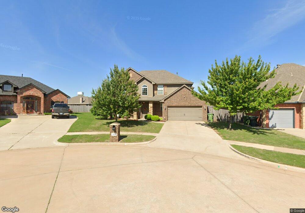
This home is located at 512 Swingman Rd, Yukon, OK 73099 and is currently estimated at $393,327, approximately $154 per square foot. 512 Swingman Rd is a home located in Canadian County with nearby schools including Banner School and St. John Nepomuk Catholic School.
Ownership History
Date
Name
Owned For
Owner Type
Purchase Details
Closed on
Mar 28, 2014
Sold by
D R Horton Texas Ltd Lp
Bought by
Stancliffe Daniel M
Current Estimated Value
Home Financials for this Owner
Home Financials are based on the most recent Mortgage that was taken out on this home.
Original Mortgage
$254,269
Outstanding Balance
$191,538
Interest Rate
4.41%
Mortgage Type
VA
Estimated Equity
$201,789
Purchase Details
Closed on
Sep 23, 2011
Sold by
Okc Properties Llc
Bought by
D R Horton Texas Ltd
Create a Home Valuation Report for This Property
The Home Valuation Report is an in-depth analysis detailing your home's value as well as a comparison with similar homes in the area
Home Values in the Area
Average Home Value in this Area
Purchase History
| Date | Buyer | Sale Price | Title Company |
|---|---|---|---|
| Stancliffe Daniel M | $249,000 | American Eagle Title Group | |
| D R Horton Texas Ltd | $97,500 | American Eagle Title Group | |
| Okc Properties Llc | -- | American Eagle Title Group |
Source: Public Records
Mortgage History
| Date | Status | Borrower | Loan Amount |
|---|---|---|---|
| Open | Stancliffe Daniel M | $254,269 |
Source: Public Records
Tax History
| Year | Tax Paid | Tax Assessment Tax Assessment Total Assessment is a certain percentage of the fair market value that is determined by local assessors to be the total taxable value of land and additions on the property. | Land | Improvement |
|---|---|---|---|---|
| 2025 | $2,985 | $40,142 | $5,280 | $34,862 |
| 2024 | $2,877 | $38,231 | $5,280 | $32,951 |
| 2023 | $2,877 | $36,410 | $5,280 | $31,130 |
| 2022 | $2,778 | $34,677 | $5,280 | $29,397 |
| 2021 | $2,700 | $33,431 | $5,280 | $28,151 |
| 2020 | $2,703 | $33,742 | $5,280 | $28,462 |
| 2019 | $2,670 | $33,025 | $5,280 | $27,745 |
| 2018 | $2,588 | $31,453 | $5,280 | $26,173 |
| 2017 | $2,640 | $31,739 | $5,280 | $26,459 |
| 2016 | $2,559 | $32,156 | $5,280 | $26,876 |
| 2015 | -- | $29,895 | $3,900 | $25,995 |
| 2014 | -- | $425 | $425 | $0 |
Source: Public Records
Map
Nearby Homes
- 1804 Flagman St
- 1901 Tinder St
- 1805 Hobo St
- 0 U S Route 66
- 1309 Sandstone Dr
- 905 Stone Creek Blvd
- 1016 Maple Ave
- 930 Maple St
- 1005 Cedar Ave
- 428 S 8th St
- 601 S 8th St
- 11625 NW 104th St
- 744 Kingston Dr
- 12816 Torretta Way
- 12828 Torretta Way
- 12916 Florence Ln
- 12857 Torretta Way
- 12925 Florence Ln
- 12832 Torretta Way
- 12920 Florence Ln
- 508 Swingman Rd
- 516 Swingman Rd
- 513 Frisco Ridge Rd
- 509 Frisco Ridge Rd
- 517 Frisco Ridge Rd
- 504 Swingman Rd
- 1824 Derail St
- 505 Frisco Ridge Rd
- 521 Frisco Ridge Rd
- 500 Swingman Rd
- 1820 Derail St
- 501 Frisco Ridge Rd
- 608 Signalman
- 1825 Flagman St
- 525 Frisco Ridge Rd
- 1817 Derail St
- 1816 Caboose St
- 1816 Derail St
- 416 Swingman Rd
- 1821 Flagman St
Your Personal Tour Guide
Ask me questions while you tour the home.