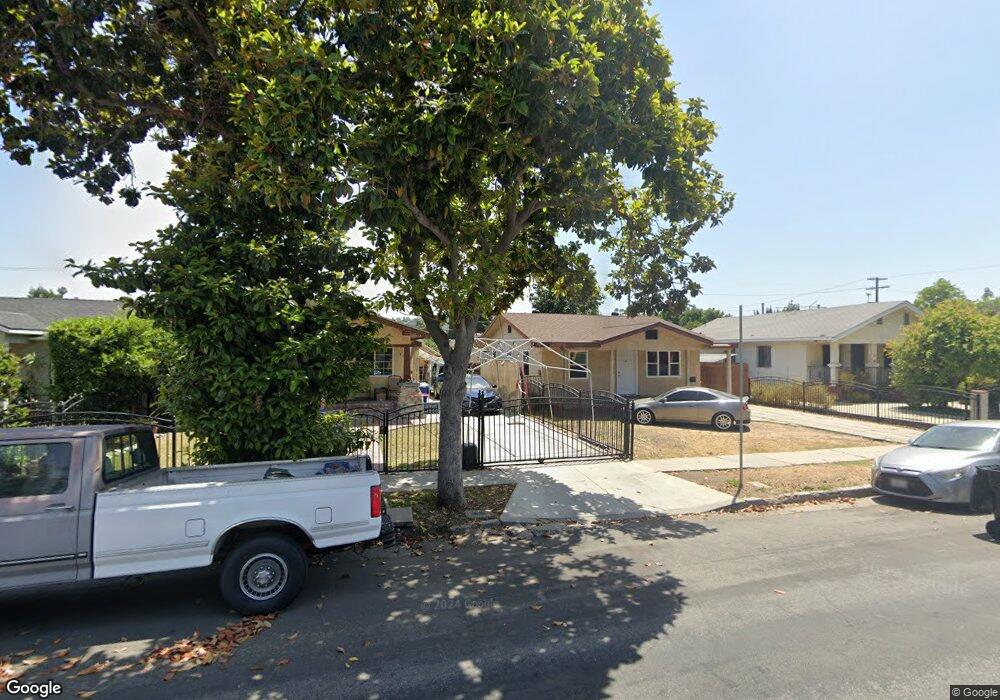
5120 Lincoln Ave Los Angeles, CA 90042
Estimated Value: $1,233,982 - $1,328,000
4
Beds
2
Baths
1,714
Sq Ft
$751/Sq Ft
Est. Value
About This Home
This home is located at 5120 Lincoln Ave, Los Angeles, CA 90042 and is currently estimated at $1,287,246, approximately $751 per square foot. 5120 Lincoln Ave is a home located in Los Angeles County with nearby schools including Buchanan Street Elementary, Benjamin Franklin High School, and Luther Burbank Middle School.
Ownership History
Date
Name
Owned For
Owner Type
Purchase Details
Closed on
May 18, 2006
Sold by
Guerra Manuel and Guerra Dolores V
Bought by
Guerra Manuel
Current Estimated Value
Home Financials for this Owner
Home Financials are based on the most recent Mortgage that was taken out on this home.
Original Mortgage
$108,000
Interest Rate
1%
Mortgage Type
Fannie Mae Freddie Mac
Purchase Details
Closed on
Nov 16, 2005
Sold by
Guerra Manuel and Guerra Dolores V
Bought by
Guerra Manuel
Create a Home Valuation Report for This Property
The Home Valuation Report is an in-depth analysis detailing your home's value as well as a comparison with similar homes in the area
Home Values in the Area
Average Home Value in this Area
Purchase History
| Date | Buyer | Sale Price | Title Company |
|---|---|---|---|
| Guerra Manuel | -- | Investors Title Company | |
| Guerra Manuel | -- | -- |
Source: Public Records
Mortgage History
| Date | Status | Borrower | Loan Amount |
|---|---|---|---|
| Closed | Guerra Manuel | $108,000 |
Source: Public Records
Tax History Compared to Growth
Tax History
| Year | Tax Paid | Tax Assessment Tax Assessment Total Assessment is a certain percentage of the fair market value that is determined by local assessors to be the total taxable value of land and additions on the property. | Land | Improvement |
|---|---|---|---|---|
| 2025 | $3,253 | $258,787 | $59,119 | $199,668 |
| 2024 | $3,253 | $253,713 | $57,960 | $195,753 |
| 2023 | $3,193 | $248,739 | $56,824 | $191,915 |
| 2022 | $3,048 | $243,862 | $55,710 | $188,152 |
| 2021 | $3,002 | $239,081 | $54,618 | $184,463 |
| 2019 | $2,913 | $231,992 | $52,999 | $178,993 |
| 2018 | $2,814 | $227,444 | $51,960 | $175,484 |
| 2016 | $2,670 | $218,615 | $49,944 | $168,671 |
| 2015 | $2,631 | $215,332 | $49,194 | $166,138 |
| 2014 | $2,646 | $211,115 | $48,231 | $162,884 |
Source: Public Records
Map
Nearby Homes
- 5125 Buchanan St
- 5055 Hub St
- 1113 N Avenue 50
- 1037 N Avenue 50
- 5117 Stratford Rd
- 1048 Dexter St
- 829 N Avenue 53
- 4925 Buchanan St
- 917 N Avenue 51
- 5252 Range View Ave
- 4854 Buchanan St
- 5318 Irvington Place
- 865 N Avenue 50
- 1813 N Avenue 53
- 4780 Hub St
- 1336 Armadale Ave
- 459 Holland Ave
- 1813 N Avenue 55
- 925 927 El Paso Dr
- 5240 Barker Dr
- 5124 Lincoln Ave
- 5116 Lincoln Ave
- 5112 Lincoln Ave
- 5132 Lincoln Ave
- 5106 Lincoln Ave
- 5121 Buchanan St
- 5117 Buchanan St
- 5113 Buchanan St
- 5129 Buchanan St
- 5138 Lincoln Ave
- 5104 Lincoln Ave
- 5117 Lincoln Ave
- 5109 Buchanan St
- 5133 Buchanan St
- 5121 Lincoln Ave
- 5125 Lincoln Ave
- 5140 Lincoln Ave
- 1210 North Avenue 51
- 5100 Lincoln Ave
- 1210 N Avenue 51