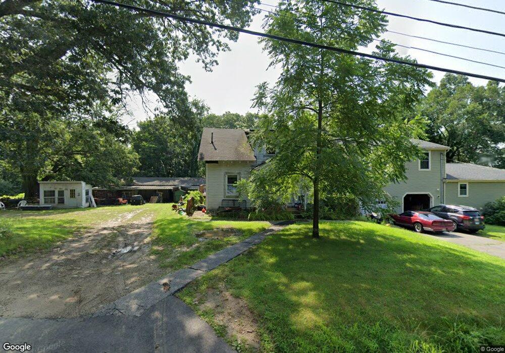
513 Boston Rd Sutton, MA 01590
Estimated Value: $712,571 - $783,000
3
Beds
4
Baths
2,642
Sq Ft
$279/Sq Ft
Est. Value
About This Home
This home is located at 513 Boston Rd, Sutton, MA 01590 and is currently estimated at $737,643, approximately $279 per square foot. 513 Boston Rd is a home located in Worcester County with nearby schools including Sutton Elementary School, Sutton Middle School, and Sutton High School.
Ownership History
Date
Name
Owned For
Owner Type
Purchase Details
Closed on
Jul 30, 2013
Sold by
Decoteau Donna L
Bought by
Trottier David T and Trottier Michael W
Current Estimated Value
Purchase Details
Closed on
May 15, 2007
Sold by
Merrill Donald A and Decoteau Donna L
Bought by
Trottier David T and Decoteau Donna L
Home Financials for this Owner
Home Financials are based on the most recent Mortgage that was taken out on this home.
Original Mortgage
$137,500
Interest Rate
6.21%
Mortgage Type
Purchase Money Mortgage
Create a Home Valuation Report for This Property
The Home Valuation Report is an in-depth analysis detailing your home's value as well as a comparison with similar homes in the area
Home Values in the Area
Average Home Value in this Area
Purchase History
| Date | Buyer | Sale Price | Title Company |
|---|---|---|---|
| Trottier David T | -- | -- | |
| Trottier David T | -- | -- |
Source: Public Records
Mortgage History
| Date | Status | Borrower | Loan Amount |
|---|---|---|---|
| Previous Owner | Trottier David T | $137,500 |
Source: Public Records
Tax History Compared to Growth
Tax History
| Year | Tax Paid | Tax Assessment Tax Assessment Total Assessment is a certain percentage of the fair market value that is determined by local assessors to be the total taxable value of land and additions on the property. | Land | Improvement |
|---|---|---|---|---|
| 2025 | $7,246 | $602,800 | $174,800 | $428,000 |
| 2024 | $7,197 | $567,600 | $166,500 | $401,100 |
| 2023 | $7,847 | $566,600 | $151,400 | $415,200 |
| 2022 | $7,462 | $491,600 | $116,300 | $375,300 |
| 2021 | $7,026 | $439,100 | $116,300 | $322,800 |
| 2020 | $5,535 | $349,000 | $116,300 | $232,700 |
| 2019 | $5,361 | $324,500 | $116,300 | $208,200 |
| 2018 | $5,185 | $313,300 | $116,300 | $197,000 |
| 2017 | $5,018 | $304,100 | $102,600 | $201,500 |
| 2016 | $5,072 | $304,100 | $102,600 | $201,500 |
| 2015 | $4,867 | $291,800 | $102,600 | $189,200 |
| 2014 | $4,794 | $284,000 | $108,000 | $176,000 |
Source: Public Records
Map
Nearby Homes
- 354 W Sutton Rd
- 21 Hutchinson Rd
- 24 Manchaug Rd
- 186 8 Lots Rd
- 31 Douglas Rd
- 31 Central Turnpike
- 51 Central Turnpike
- 63 Uxbridge Rd
- 265 Mendon Rd
- 8 Turk Hollow Rd
- 29 Winwood Rd
- 242 Boston Rd
- 43A Southwick Rd
- 1 Burbank Rd
- 190 Federal Hill Rd
- 7 Tower Hill Rd
- 34R Tucker Ln
- 99 Burbank Rd
- 99 Burbank Road Lot 182
- 0 Dana Rd
- 503 Boston Rd
- 1 Century Farm Rd
- 3 Century Farm Rd
- 504 Boston Rd
- 527 Boston Rd
- 17 Town Farm Rd
- 2 Century Farm Rd
- 21 Town Farm Rd
- 497 Boston Rd
- 501 Boston Rd
- 22 Town Farm Rd
- 493 Boston Rd
- 27 Town Farm Rd
- 14 Century Farm Rd
- 2 Overlook Dr
- 537 Boston Rd
- 488 Boston Rd
- 6 Overlook Dr
- 31 Town Farm Rd
- 28 Town Farm Rd