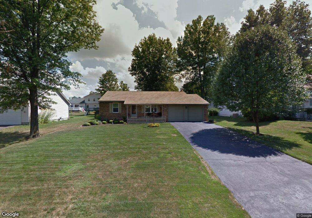
5135 Clearfield Dr Mineral Ridge, OH 44440
Austintown NeighborhoodEstimated Value: $152,000 - $239,000
3
Beds
1
Bath
1,064
Sq Ft
$180/Sq Ft
Est. Value
About This Home
This home is located at 5135 Clearfield Dr, Mineral Ridge, OH 44440 and is currently estimated at $191,222, approximately $179 per square foot. 5135 Clearfield Dr is a home located in Mahoning County with nearby schools including Seaborn Elementary School, Mineral Ridge High School, and Stambaugh Charter Academy.
Ownership History
Date
Name
Owned For
Owner Type
Purchase Details
Closed on
Jan 25, 2023
Sold by
Delgreco Dorothy A
Bought by
Shoemaker Karen
Current Estimated Value
Purchase Details
Closed on
Jun 9, 2022
Sold by
Delgreco Dorothy A
Bought by
Shoemaker Karen
Purchase Details
Closed on
May 9, 2022
Sold by
Delgreco Samuel
Bought by
Kannensohn Fredric A
Purchase Details
Closed on
Sep 26, 2002
Sold by
Delgreco Samuel and Delgreco Dorothy A
Bought by
Delgreco Samuel and Delgreco Dorothy A
Purchase Details
Closed on
Apr 9, 1979
Bought by
Delgreco Samuel and D A
Create a Home Valuation Report for This Property
The Home Valuation Report is an in-depth analysis detailing your home's value as well as a comparison with similar homes in the area
Home Values in the Area
Average Home Value in this Area
Purchase History
| Date | Buyer | Sale Price | Title Company |
|---|---|---|---|
| Shoemaker Karen | -- | -- | |
| Shoemaker Karen | -- | -- | |
| Delgreco Dorothy A | -- | -- | |
| Kannensohn Fredric A | -- | -- | |
| Delgreco Samuel | -- | -- | |
| Delgreco Samuel | -- | -- |
Source: Public Records
Tax History Compared to Growth
Tax History
| Year | Tax Paid | Tax Assessment Tax Assessment Total Assessment is a certain percentage of the fair market value that is determined by local assessors to be the total taxable value of land and additions on the property. | Land | Improvement |
|---|---|---|---|---|
| 2024 | $2,476 | $47,370 | $6,240 | $41,130 |
| 2023 | $1,939 | $47,370 | $6,240 | $41,130 |
| 2022 | $1,593 | $36,440 | $6,240 | $30,200 |
| 2021 | $1,592 | $36,440 | $6,240 | $30,200 |
| 2020 | $1,598 | $36,440 | $6,240 | $30,200 |
| 2019 | $1,512 | $32,730 | $6,240 | $26,490 |
| 2018 | $1,457 | $32,730 | $6,240 | $26,490 |
| 2017 | $1,454 | $32,730 | $6,240 | $26,490 |
| 2016 | $1,360 | $30,340 | $6,240 | $24,100 |
| 2015 | $1,321 | $30,340 | $6,240 | $24,100 |
| 2014 | $1,330 | $30,340 | $6,240 | $24,100 |
| 2013 | $1,320 | $30,340 | $6,240 | $24,100 |
Source: Public Records
Map
Nearby Homes
- 5085 Winslow Dr
- 1239 Woodledge Dr
- 1760 Dumont Dr
- 0 W Webb Rd
- 1467 E County Line Rd
- 1684 Morris St
- 1445 E County Line Rd
- 21 E Liberty St
- 3872 Main St
- 1452 Furnace St
- 3907 Edwards St
- 645 Carlin Dr
- 3579 Bee St
- 6360 Meander Glen Dr
- 3474 S Main St
- 6393 Meander Glen Dr
- 0 W Liberty Unit 5153649
- 5231 W Rockwell Rd
- 3440 Lakeside Dr
- 4028 Lanterman Rd
- 5139 Clearfield Dr
- 5131 Clearfield Dr
- 5118 Winslow Dr
- 5143 Clearfield Dr
- 5127 Clearfield Dr
- 5114 Winslow Dr
- 5122 Winslow Dr
- 5110 Winslow Dr
- 5126 Winslow Dr
- 5147 Clearfield Dr
- 5123 Clearfield Dr
- 5136 Clearfield Dr
- 5140 Clearfield Dr
- 5106 Winslow Dr
- 5130 Winslow Dr
- 5128 Clearfield Dr
- 5119 Clearfield Dr
- 5117 Winslow Dr
- 1293 Cedarwood Dr
- 5121 Winslow Dr