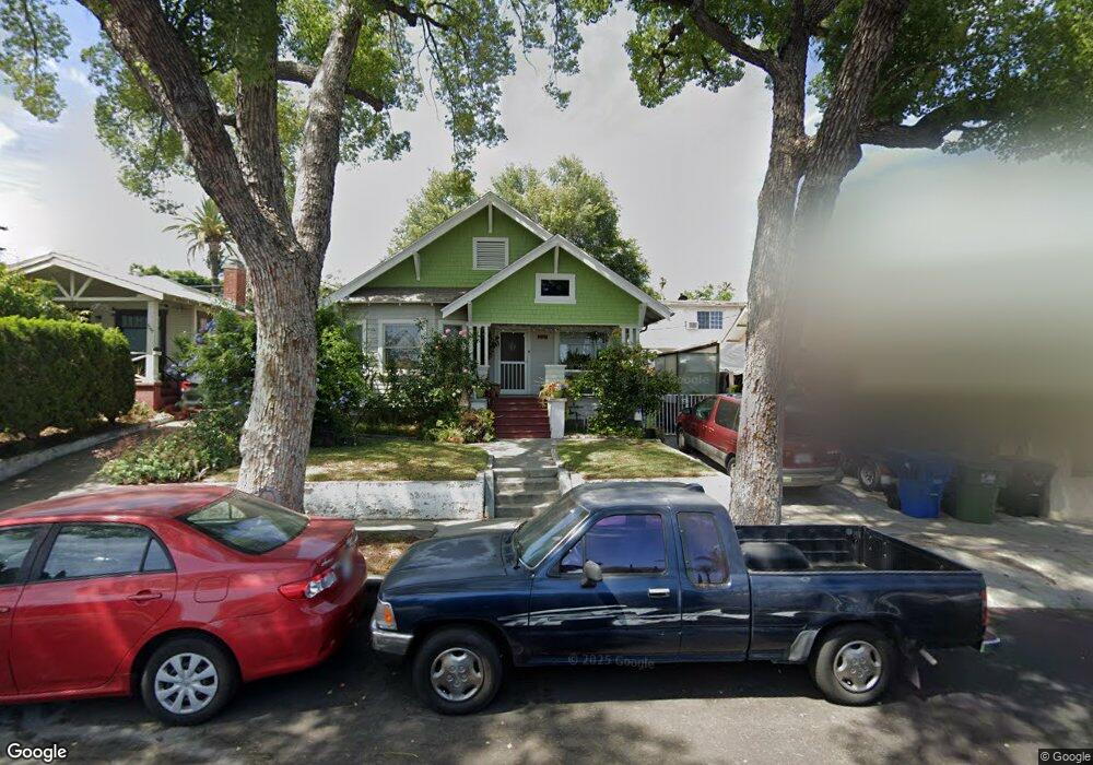
5161 Range View Ave Los Angeles, CA 90042
Highland Park NeighborhoodEstimated Value: $1,028,880 - $1,259,000
3
Beds
1
Bath
1,313
Sq Ft
$887/Sq Ft
Est. Value
About This Home
This home is located at 5161 Range View Ave, Los Angeles, CA 90042 and is currently estimated at $1,164,720, approximately $887 per square foot. 5161 Range View Ave is a home located in Los Angeles County with nearby schools including Buchanan Street Elementary and Franklin Middle School & High School.
Ownership History
Date
Name
Owned For
Owner Type
Purchase Details
Closed on
Jun 25, 2005
Sold by
Grundy Lisa B
Bought by
Grundy Lisa B
Current Estimated Value
Home Financials for this Owner
Home Financials are based on the most recent Mortgage that was taken out on this home.
Original Mortgage
$50,000
Interest Rate
5.58%
Mortgage Type
Credit Line Revolving
Purchase Details
Closed on
Feb 11, 1999
Sold by
Wildanger John J
Bought by
Grundy Lisa B
Purchase Details
Closed on
Feb 9, 1999
Sold by
Cumming John R
Bought by
Grundy Lisa B
Create a Home Valuation Report for This Property
The Home Valuation Report is an in-depth analysis detailing your home's value as well as a comparison with similar homes in the area
Home Values in the Area
Average Home Value in this Area
Purchase History
| Date | Buyer | Sale Price | Title Company |
|---|---|---|---|
| Grundy Lisa B | -- | -- | |
| Grundy Lisa B | -- | -- | |
| Grundy Lisa B | -- | -- |
Source: Public Records
Mortgage History
| Date | Status | Borrower | Loan Amount |
|---|---|---|---|
| Closed | Grundy Lisa B | $50,000 |
Source: Public Records
Tax History
| Year | Tax Paid | Tax Assessment Tax Assessment Total Assessment is a certain percentage of the fair market value that is determined by local assessors to be the total taxable value of land and additions on the property. | Land | Improvement |
|---|---|---|---|---|
| 2025 | $2,573 | $207,884 | $126,884 | $81,000 |
| 2024 | $2,573 | $203,809 | $124,397 | $79,412 |
| 2023 | $2,525 | $199,813 | $121,958 | $77,855 |
| 2022 | $2,408 | $195,896 | $119,567 | $76,329 |
| 2021 | $2,371 | $192,056 | $117,223 | $74,833 |
| 2019 | $2,300 | $186,362 | $113,748 | $72,614 |
| 2018 | $2,254 | $182,709 | $111,518 | $71,191 |
| 2016 | $2,139 | $175,617 | $107,189 | $68,428 |
| 2015 | $2,108 | $172,980 | $105,579 | $67,401 |
| 2014 | $2,121 | $169,592 | $103,511 | $66,081 |
Source: Public Records
Map
Nearby Homes
- 5132 Range View Ave
- 5240 Barker Dr
- 5007 Almaden Dr
- 1817 N Avenue 55
- 1932 Phillips Way
- 5330 Lincoln Ave
- 5144 Buchanan St
- 1942 Phillips Way
- 1938 Phillips Way
- 4920 Stratford Rd
- 5001 Buchanan St
- 1393 N Avenue 57
- 5349 Baltimore St
- 5055 Hub St
- 5118 Hub St
- 829 N Avenue 53
- 4816 Stratford Rd
- 1048 Dexter St
- 1333 Wildwood Dr
- 917 N Avenue 51
- 5201 Range View Ave
- 5157 Range View Ave
- 5205 Range View Ave
- 5153 Range View Ave
- 5209 Range View Ave
- 5149 Range View Ave
- 5162 Almaden Dr
- 5202 Almaden Dr
- 5158 Almaden Dr
- 5206 Almaden Dr
- 5154 Almaden Dr
- 1688 N Avenue 52
- 5217 Range View Ave
- 5145 Range View Ave
- 1688 North Avenue 52
- 5210 Almaden Dr
- 5150 Almaden Dr
- 5156 Range View Ave
- 5152 Range View Ave
- 5141 Range View Ave
Your Personal Tour Guide
Ask me questions while you tour the home.