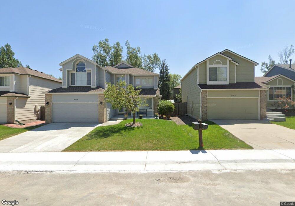
5162 Devon Ave Castle Rock, CO 80104
Founders Village NeighborhoodEstimated Value: $544,017 - $573,000
4
Beds
4
Baths
2,257
Sq Ft
$247/Sq Ft
Est. Value
About This Home
This home is located at 5162 Devon Ave, Castle Rock, CO 80104 and is currently estimated at $558,504, approximately $247 per square foot. 5162 Devon Ave is a home located in Douglas County with nearby schools including Rock Ridge Elementary School, Mesa Middle School, and Douglas County High School.
Ownership History
Date
Name
Owned For
Owner Type
Purchase Details
Closed on
Mar 11, 1994
Sold by
Richmond Homes Inc Ii
Bought by
Miller Thomas E and Miller Debra Lynn
Current Estimated Value
Home Financials for this Owner
Home Financials are based on the most recent Mortgage that was taken out on this home.
Original Mortgage
$141,800
Interest Rate
6.96%
Purchase Details
Closed on
Dec 28, 1989
Sold by
Mdc Land Corp
Bought by
Richmond American Homes Colorado Inc Ii
Create a Home Valuation Report for This Property
The Home Valuation Report is an in-depth analysis detailing your home's value as well as a comparison with similar homes in the area
Home Values in the Area
Average Home Value in this Area
Purchase History
| Date | Buyer | Sale Price | Title Company |
|---|---|---|---|
| Miller Thomas E | $149,315 | Land Title | |
| Richmond American Homes Colorado Inc Ii | -- | -- |
Source: Public Records
Mortgage History
| Date | Status | Borrower | Loan Amount |
|---|---|---|---|
| Closed | Miller Thomas E | $141,800 |
Source: Public Records
Tax History
| Year | Tax Paid | Tax Assessment Tax Assessment Total Assessment is a certain percentage of the fair market value that is determined by local assessors to be the total taxable value of land and additions on the property. | Land | Improvement |
|---|---|---|---|---|
| 2025 | $5,643 | $33,860 | $8,570 | $25,290 |
| 2024 | $5,643 | $38,030 | $7,970 | $30,060 |
| 2023 | $5,676 | $38,030 | $7,970 | $30,060 |
| 2022 | $4,204 | $26,550 | $5,920 | $20,630 |
| 2021 | $4,283 | $26,550 | $5,920 | $20,630 |
| 2020 | $4,124 | $26,320 | $5,010 | $21,310 |
| 2019 | $4,126 | $26,320 | $5,010 | $21,310 |
| 2018 | $3,603 | $22,810 | $3,890 | $18,920 |
| 2017 | $3,468 | $22,810 | $3,890 | $18,920 |
| 2016 | $2,953 | $20,280 | $3,810 | $16,470 |
| 2015 | $2,991 | $20,280 | $3,810 | $16,470 |
| 2014 | $2,542 | $16,550 | $3,420 | $13,130 |
Source: Public Records
Map
Nearby Homes
- 653 Fairhaven St
- 475 Hampstead Ave
- 321 Lockwood St
- 5431 Suffolk Cir
- 5323 E Sandpiper Ave
- 4613 E Bennington Ave
- 207 S Quicksilver Ave
- 5965 Raleigh Cir
- 1065 S Lindsey St
- 5326 E Howe St
- 162 S Tilbury St
- 5786 Raleigh Cir
- 5839 Raleigh Cir
- 535 Howe St
- 6110 Raleigh Cir
- 512 Blue Teal Dr
- 4384 Las Lunas Ct
- 152 Las Lunas St
- 4885 Eckert St
- 650 Howe Cir
- 5142 Devon Ave
- 5182 Devon Ave
- 5173 Essex Ave
- 5122 E Devon Ave
- 5173 E Essex Ave
- 5122 Devon Ave
- 5202 E Devon Ave
- 5203 Essex Ave
- 5202 Devon Ave
- 5153 Essex Ave
- 5153 E Essex Ave
- 5223 Essex Ave
- 5133 Essex Ave
- 5161 Devon Ave
- 5181 E Devon Ave
- 5222 Devon Ave
- 5102 Devon Ave
- 5141 Devon Ave
- 5201 Devon Ave
- 5113 E Essex Ave
Your Personal Tour Guide
Ask me questions while you tour the home.