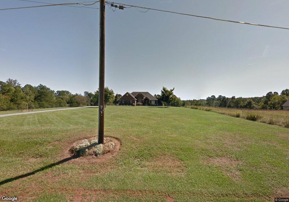
5165 Rifle Range Rd Conover, NC 28613
Estimated Value: $421,000 - $528,875
3
Beds
2
Baths
2,270
Sq Ft
$205/Sq Ft
Est. Value
About This Home
This home is located at 5165 Rifle Range Rd, Conover, NC 28613 and is currently estimated at $465,219, approximately $204 per square foot. 5165 Rifle Range Rd is a home located in Catawba County with nearby schools including Lyle Creek Elementary School, River Bend Middle School, and Bunker Hill High School.
Ownership History
Date
Name
Owned For
Owner Type
Purchase Details
Closed on
Apr 5, 2012
Sold by
Loyer Amy E and Loyer Daniel C
Bought by
Travis Andrew Franklin
Current Estimated Value
Purchase Details
Closed on
Mar 31, 2008
Sold by
Tomlinson Charles W and Tomlinson Brenda T
Bought by
Loyer Amy E and Tomlinson Charles W
Purchase Details
Closed on
Feb 28, 2005
Sold by
Tomlinson Charles W and Tomlinson Brenda T
Bought by
Loyer Amy T
Purchase Details
Closed on
Dec 1, 1997
Bought by
Drum Charles H and Drum Susanne W
Create a Home Valuation Report for This Property
The Home Valuation Report is an in-depth analysis detailing your home's value as well as a comparison with similar homes in the area
Home Values in the Area
Average Home Value in this Area
Purchase History
| Date | Buyer | Sale Price | Title Company |
|---|---|---|---|
| Travis Andrew Franklin | -- | None Available | |
| Loyer Amy E | -- | None Available | |
| Loyer Amy T | -- | None Available | |
| Drum Charles H | $52,000 | -- |
Source: Public Records
Tax History Compared to Growth
Tax History
| Year | Tax Paid | Tax Assessment Tax Assessment Total Assessment is a certain percentage of the fair market value that is determined by local assessors to be the total taxable value of land and additions on the property. | Land | Improvement |
|---|---|---|---|---|
| 2025 | $2,317 | $443,400 | $34,700 | $408,700 |
| 2024 | $2,317 | $443,400 | $34,700 | $408,700 |
| 2023 | $2,228 | $290,700 | $34,700 | $256,000 |
| 2022 | $2,020 | $290,700 | $34,700 | $256,000 |
| 2021 | $2,020 | $290,700 | $34,700 | $256,000 |
| 2020 | $2,020 | $290,700 | $34,700 | $256,000 |
| 2019 | $2,020 | $290,700 | $0 | $0 |
| 2018 | $1,873 | $269,500 | $34,300 | $235,200 |
| 2017 | $1,875 | $0 | $0 | $0 |
| 2016 | $1,875 | $0 | $0 | $0 |
| 2015 | $1,690 | $269,830 | $34,600 | $235,230 |
| 2014 | $1,690 | $281,700 | $38,300 | $243,400 |
Source: Public Records
Map
Nearby Homes
- 5260 Rifle Range Rd
- 5217 Canterbury Dr
- 4687 Ransom Dr
- 5309 Hall St
- 3951 Springs Rd
- 1246 Houston Mill Rd
- 5429 Buddy St Unit LOT 3
- 4645 Rifle Range Rd
- 4874 Stone Dr Unit 125
- 4858 Water Wheel Dr
- 1371 Millrace Dr
- 4150 Wandering Ln NE
- 4932 Sandstone Dr
- 3835 Sulphur Springs Rd NE
- 3325 37th Ave NE
- 3210 28th Avenue Dr NE
- 3646 46th Ave NE
- 4965 Elmhurst Dr NE
- 3387 Springs Rd NE
- 3622 46th Ave NE
- 5173 Rifle Range Rd
- 5187 Rifle Range Rd
- 4972 Drumnorth Dr
- 4989 Drumnorth Dr
- 5235 Rifle Range Rd
- 5174 Rifle Range Rd
- 5057 Rifle Range Rd
- 4931 Tumbling Creek Rd
- 4913 Tumbling Creek Rd
- 5019 Drumnorth Dr
- 5033 Rifle Range Rd
- 4928 Tumbling Creek Rd
- 5020 Rifle Range Rd
- 4936 Tumbling Creek Rd
- 4872 Tumbling Creek Rd
- 4920 Tumbling Creek Rd
- 4944 Tumbling Creek Rd
- 4908 Tumbling Creek Rd
- 4952 Tumbling Creek Rd
- 4900 Tumbling Creek Rd