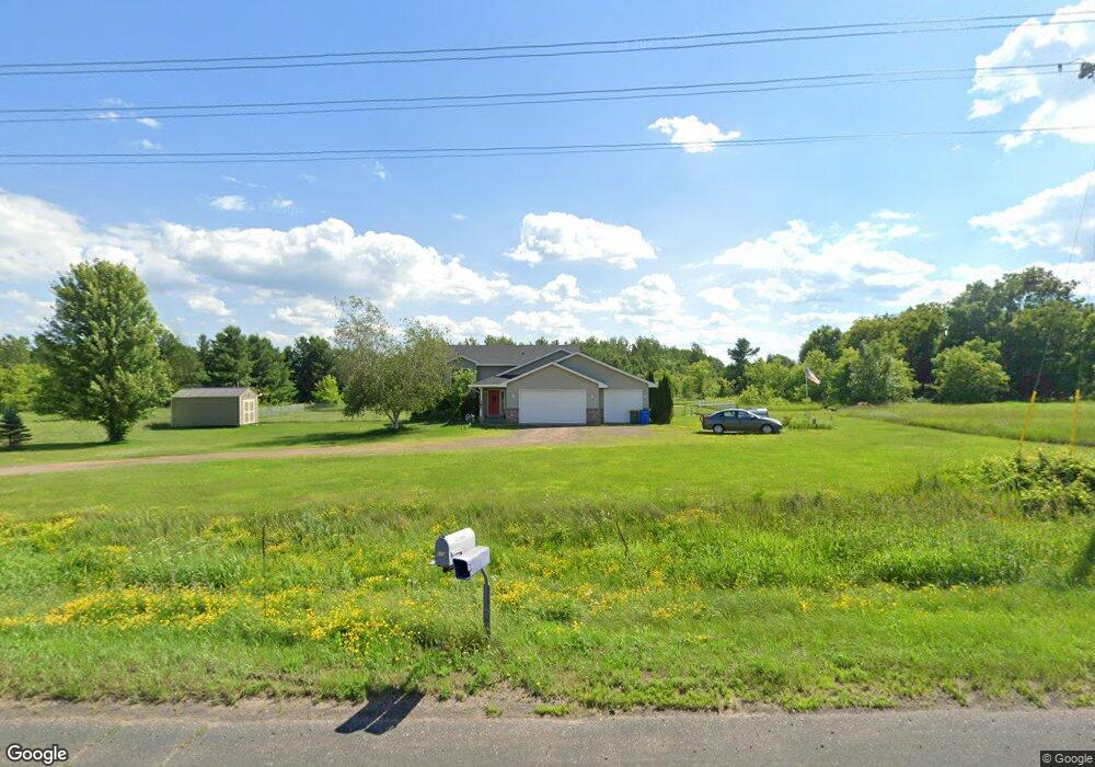
5169 Stark Rd Harris, MN 55032
Estimated Value: $422,933 - $454,000
4
Beds
2
Baths
1,368
Sq Ft
$318/Sq Ft
Est. Value
About This Home
This home is located at 5169 Stark Rd, Harris, MN 55032 and is currently estimated at $435,644, approximately $318 per square foot. 5169 Stark Rd is a home located in Chisago County with nearby schools including North Branch Middle School, Sunrise River Elementary School, and North Branch Senior High School.
Ownership History
Date
Name
Owned For
Owner Type
Purchase Details
Closed on
Jun 10, 2016
Sold by
Kvale Jeffrey A and Kvale Jenae L
Bought by
Sorenson Stephen M and Sorenson Marissa F
Current Estimated Value
Home Financials for this Owner
Home Financials are based on the most recent Mortgage that was taken out on this home.
Original Mortgage
$191,900
Outstanding Balance
$151,900
Interest Rate
3.57%
Mortgage Type
New Conventional
Estimated Equity
$283,744
Purchase Details
Closed on
Apr 14, 2000
Sold by
Levesseur Steven and Levesseur Kathleen L
Bought by
Kvale Jeffrey A and Kvale Jenae L
Create a Home Valuation Report for This Property
The Home Valuation Report is an in-depth analysis detailing your home's value as well as a comparison with similar homes in the area
Purchase History
| Date | Buyer | Sale Price | Title Company |
|---|---|---|---|
| Sorenson Stephen M | $239,900 | Home Title Inc | |
| Kvale Jeffrey A | $157,900 | -- |
Source: Public Records
Mortgage History
| Date | Status | Borrower | Loan Amount |
|---|---|---|---|
| Open | Sorenson Stephen M | $191,900 |
Source: Public Records
Tax History
| Year | Tax Paid | Tax Assessment Tax Assessment Total Assessment is a certain percentage of the fair market value that is determined by local assessors to be the total taxable value of land and additions on the property. | Land | Improvement |
|---|---|---|---|---|
| 2024 | $4,556 | $362,700 | $0 | $0 |
| 2023 | $4,556 | $373,000 | $0 | $0 |
| 2022 | $4,420 | $368,100 | $0 | $0 |
| 2021 | $4,098 | $288,100 | $0 | $0 |
| 2020 | $4,074 | $284,200 | $55,700 | $228,500 |
| 2019 | $3,572 | $0 | $0 | $0 |
| 2018 | $3,526 | $0 | $0 | $0 |
| 2017 | $2,942 | $0 | $0 | $0 |
| 2016 | $2,832 | $0 | $0 | $0 |
| 2015 | $2,826 | $0 | $0 | $0 |
| 2014 | -- | $179,100 | $0 | $0 |
Source: Public Records
Map
Nearby Homes
- 1xx Stark Rd
- 43xx2 Falcon Ave
- TBD Stark Road Ln
- XXX 424th St
- 43770 Garden Ave
- 43890 Ginger Ave
- 5048 450th St
- 67xx Old Sawmill Rd
- 41921 Goodview Ave
- TBD 412th St
- 44080 Maple Ln
- TBD Spring Lake Rd NE
- 5222 406th St
- 2320 Cedarcrest Ct
- 40867 Forest Blvd
- 5475 Fall Meadow Trail
- 5477 Fall Meadow Trail
- 5479 Fall Meadow Trail
- 5481 Fall Meadow Trail
- 5483 Fall Meadow Trail
- 5165 Stark Rd
- 5087 Stark Rd
- 5154 Stark Rd
- 5066 Stark Rd
- 5204 Stark Rd
- L2 B1 L2 B1 Falcon-Avenue-
- L2 B1 Falcon Ave
- 5002 Stark Rd
- 43774 Falcon Ave
- 43625 Falcon Ave
- 43273 Falcon Ave
- 43838 Falcon Ave
- 43191 Falcon Ave
- xxx Falcon Ave
- 43100 Falcon Ave
- Lot1 Blk1 454th Blvd
- Lot2 Blk1 454th Blvd
- XXXX Daisy Ave
- 4XX 457th St
- 0 Xxx Blackhawk Rd Unit 3627405
Your Personal Tour Guide
Ask me questions while you tour the home.