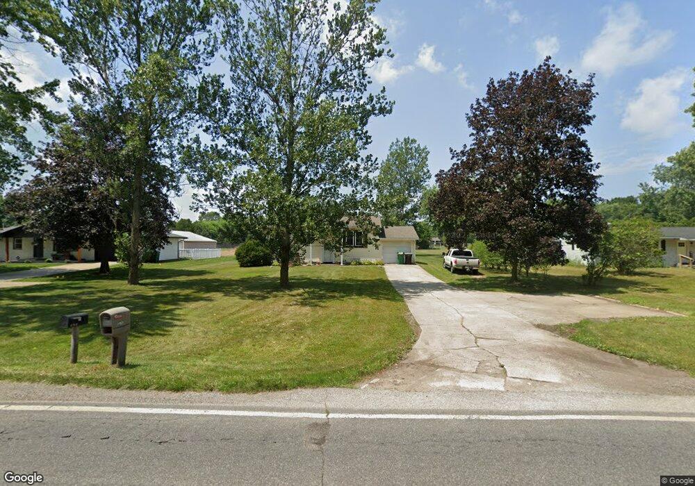
51821 Ash Rd Granger, IN 46530
Estimated Value: $300,000 - $326,000
4
Beds
3
Baths
3,000
Sq Ft
$104/Sq Ft
Est. Value
About This Home
This home is located at 51821 Ash Rd, Granger, IN 46530 and is currently estimated at $313,083, approximately $104 per square foot. 51821 Ash Rd is a home located in St. Joseph County with nearby schools including Horizon Elementary School, Discovery Middle School, and Penn High School.
Ownership History
Date
Name
Owned For
Owner Type
Purchase Details
Closed on
Nov 5, 2018
Sold by
Moore Kevin E and Moore Katharyn A
Bought by
Moore Kevin E and Moore Katharyn A
Current Estimated Value
Home Financials for this Owner
Home Financials are based on the most recent Mortgage that was taken out on this home.
Original Mortgage
$120,000
Outstanding Balance
$105,082
Interest Rate
4.6%
Mortgage Type
New Conventional
Estimated Equity
$208,001
Create a Home Valuation Report for This Property
The Home Valuation Report is an in-depth analysis detailing your home's value as well as a comparison with similar homes in the area
Home Values in the Area
Average Home Value in this Area
Purchase History
| Date | Buyer | Sale Price | Title Company |
|---|---|---|---|
| Moore Kevin E | $159,600 | None Listed On Document |
Source: Public Records
Mortgage History
| Date | Status | Borrower | Loan Amount |
|---|---|---|---|
| Open | Moore Kevin E | $120,000 |
Source: Public Records
Tax History Compared to Growth
Tax History
| Year | Tax Paid | Tax Assessment Tax Assessment Total Assessment is a certain percentage of the fair market value that is determined by local assessors to be the total taxable value of land and additions on the property. | Land | Improvement |
|---|---|---|---|---|
| 2024 | $1,621 | $195,100 | $63,300 | $131,800 |
| 2023 | $1,493 | $199,500 | $63,300 | $136,200 |
| 2022 | $1,493 | $178,600 | $63,300 | $115,300 |
| 2021 | $1,035 | $126,600 | $35,900 | $90,700 |
| 2020 | $987 | $124,000 | $35,200 | $88,800 |
| 2019 | $921 | $118,300 | $35,000 | $83,300 |
| 2018 | $945 | $121,000 | $35,800 | $85,200 |
| 2017 | $598 | $90,800 | $27,100 | $63,700 |
| 2016 | $685 | $95,800 | $27,100 | $68,700 |
| 2014 | $661 | $95,000 | $27,100 | $67,900 |
Source: Public Records
Map
Nearby Homes
- 52104 Ash Rd
- 51401 Hunters Crossing Ct
- 52290 Ash Rd
- 30465 Quail Pointe Dr
- 10360 Red Raspberry Ln
- 50920 Northbrook Shores Dr
- 30137 Fox Run Trail
- 50975 Cobus Ridge Ln
- 30356 Blackhawk Dr
- 10700 Adams Rd
- TBD County Road 2
- 10080 Pemburry Dr
- 50590 Deer Ridge Ct
- 50533 Cobus Ridge Ln
- 29749 County Road 4
- 50633 Weeping Willow Run W
- 71599 State Line Rd
- 50778 Brownstone Dr
- 11070 Birch Lake Dr
- 71353 State Line Rd
- 51843 Ash Rd
- 51799 Ash Rd
- 51865 Ash Rd
- 51783 Ash Rd
- 51810 Ash Rd
- 51887 Ash Rd
- 10070 Anderson Rd
- 51733 Trail Ridge Dr
- 51854 Ash Rd
- 10132 Glen Lee Trail
- 30954 Field Stone Dr
- 10096 Anderson Rd
- 10025 Patricia Church Dr
- 10021 Anderson Rd
- 10059 Patricia Church Dr
- 10128 Glen Lee Trail
- 30936 Field Stone Dr
- 51715 Trail Ridge Dr
- 10140 Glen Lee Trail
- 10083 Patricia Church Dr