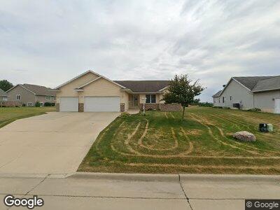
519 W Central St Raymond, IA 50667
Estimated Value: $281,000 - $354,000
3
Beds
3
Baths
1,602
Sq Ft
$198/Sq Ft
Est. Value
About This Home
This home is located at 519 W Central St, Raymond, IA 50667 and is currently estimated at $316,717, approximately $197 per square foot. 519 W Central St is a home located in Black Hawk County with nearby schools including Poyner Elementary School, Bunger Middle School, and East High School.
Ownership History
Date
Name
Owned For
Owner Type
Purchase Details
Closed on
Aug 16, 2022
Sold by
Declaration Of Revocable Living Trust
Bought by
Casey Alyssa R Blair and Moline Jessica B
Current Estimated Value
Purchase Details
Closed on
May 14, 2007
Sold by
Skyline Development Lc
Bought by
Vick Gary L and Vick Karen S
Home Financials for this Owner
Home Financials are based on the most recent Mortgage that was taken out on this home.
Original Mortgage
$15,701
Interest Rate
6.22%
Mortgage Type
Credit Line Revolving
Create a Home Valuation Report for This Property
The Home Valuation Report is an in-depth analysis detailing your home's value as well as a comparison with similar homes in the area
Home Values in the Area
Average Home Value in this Area
Purchase History
| Date | Buyer | Sale Price | Title Company |
|---|---|---|---|
| Casey Alyssa R Blair | $240,000 | None Listed On Document | |
| Vick Gary L | $198,500 | None Available |
Source: Public Records
Mortgage History
| Date | Status | Borrower | Loan Amount |
|---|---|---|---|
| Previous Owner | Vick Gary L | $12,500 | |
| Previous Owner | Vick Gary L | $208,800 | |
| Previous Owner | Vick Gary L | $31,000 | |
| Previous Owner | Vick Gary L | $43,173 | |
| Previous Owner | Vick Gary L | $192,000 | |
| Previous Owner | Vick Gary | $22,000 | |
| Previous Owner | Vick Gary L | $188,200 | |
| Previous Owner | Vick Gary L | $160,000 | |
| Previous Owner | Vick Gary L | $13,000 | |
| Previous Owner | Vick Gary L | $33,000 | |
| Previous Owner | Vick Gary L | $15,701 | |
| Previous Owner | Vick Gary L | $6,990 | |
| Previous Owner | Vick Gary L | $158,400 |
Source: Public Records
Tax History Compared to Growth
Tax History
| Year | Tax Paid | Tax Assessment Tax Assessment Total Assessment is a certain percentage of the fair market value that is determined by local assessors to be the total taxable value of land and additions on the property. | Land | Improvement |
|---|---|---|---|---|
| 2024 | $3,530 | $289,770 | $35,220 | $254,550 |
| 2023 | $3,438 | $289,770 | $35,220 | $254,550 |
| 2022 | $3,412 | $238,650 | $35,220 | $203,430 |
| 2021 | $3,736 | $238,650 | $35,220 | $203,430 |
| 2020 | $3,708 | $241,490 | $28,180 | $213,310 |
| 2019 | $3,708 | $241,490 | $28,180 | $213,310 |
| 2018 | $3,554 | $224,980 | $28,180 | $196,800 |
| 2017 | $3,554 | $224,980 | $28,180 | $196,800 |
| 2016 | $3,298 | $205,300 | $28,180 | $177,120 |
| 2015 | $3,298 | $205,300 | $28,180 | $177,120 |
| 2014 | $3,362 | $205,300 | $28,180 | $177,120 |
Source: Public Records
Map
Nearby Homes
- 6616 Lafayette Rd
- 306 N 4th St
- 0 Dubuque Rd Unit NBR20242713
- Lot 10 Eagles Landing 1st Addition
- Lot 15 Eagles Landing 1st Addition
- 3250 Gilbertville Rd
- Lot # 53 Hunter Dr
- Lot # 47 Hunter Dr
- Lot # 46 Hunter Dr
- Lot #45 Hunter Dr
- 266 Lainee Dr
- 660 Hunter Dr
- Lot 5 Lafayette Rd
- Lot 1 Lafayette Rd
- 701 Evansdale Dr
- 5047 Lafayette Rd
- 30.66 Acres Mccoy Rd
- 88 Eldene Ct
- 426 Dixie Cir
- Lot 33 Timberline Dr
- 519 W Central St
- 527 W Central St
- 125 Taylor Ln
- 145 Taylor Ln
- 165 Taylor Ln
- 535 W Central St
- 65 Taylor Ln
- 530 W Central St
- 520 W Central St
- 185 Taylor Ln
- 543 W Central St
- 540 W Central St
- 45 Taylor Ln
- 120 Taylor Ln
- 140 Taylor Ln
- 160 Taylor Ln
- 60 Taylor Ln
- 551 W Central St
- 550 W Central St
- 40 Taylor Ln