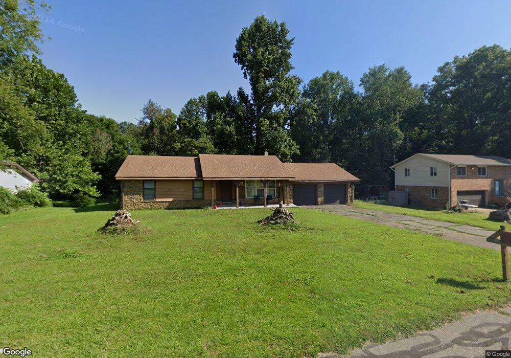
5192 W Quan Wae Dr Columbus, IN 47201
Estimated Value: $200,000 - $233,929
3
Beds
2
Baths
1,204
Sq Ft
$180/Sq Ft
Est. Value
About This Home
This home is located at 5192 W Quan Wae Dr, Columbus, IN 47201 and is currently estimated at $217,232, approximately $180 per square foot. 5192 W Quan Wae Dr is a home located in Bartholomew County with nearby schools including Taylorsville Elementary School, Northside Middle School, and Columbus North High School.
Ownership History
Date
Name
Owned For
Owner Type
Purchase Details
Closed on
Aug 13, 2014
Sold by
Rawlinson Thomas
Bought by
Bradley Crase
Current Estimated Value
Purchase Details
Closed on
Oct 11, 2013
Sold by
Robert Trust
Bought by
Rawlinson Thomas and Rawlinson Melissa R
Purchase Details
Closed on
Jan 31, 2003
Sold by
Thomas Robert S
Bought by
Thomas Robert S Tr
Purchase Details
Closed on
Jan 27, 2003
Sold by
Thomas Robert S Trustee Robert S
Bought by
Thomas Robert S
Purchase Details
Closed on
Jul 11, 2001
Sold by
Thomas Robert S
Bought by
Thomas Robert S Robert S
Create a Home Valuation Report for This Property
The Home Valuation Report is an in-depth analysis detailing your home's value as well as a comparison with similar homes in the area
Home Values in the Area
Average Home Value in this Area
Purchase History
| Date | Buyer | Sale Price | Title Company |
|---|---|---|---|
| Bradley Crase | $104,000 | Meridian Title Corporation | |
| Rawlinson Thomas | $90,000 | Meridian Title Corporation | |
| Thomas Robert S Tr | -- | -- | |
| Thomas Robert S | -- | -- | |
| Thomas Robert S Robert S | -- | -- |
Source: Public Records
Tax History Compared to Growth
Tax History
| Year | Tax Paid | Tax Assessment Tax Assessment Total Assessment is a certain percentage of the fair market value that is determined by local assessors to be the total taxable value of land and additions on the property. | Land | Improvement |
|---|---|---|---|---|
| 2024 | $1,184 | $172,700 | $21,800 | $150,900 |
| 2023 | $954 | $150,300 | $21,800 | $128,500 |
| 2022 | $999 | $148,900 | $21,800 | $127,100 |
| 2021 | $948 | $142,600 | $21,800 | $120,800 |
| 2020 | $974 | $142,600 | $21,800 | $120,800 |
| 2019 | $724 | $127,500 | $21,800 | $105,700 |
| 2018 | $679 | $122,500 | $21,800 | $100,700 |
| 2017 | $697 | $124,500 | $20,200 | $104,300 |
| 2016 | $725 | $127,600 | $20,200 | $107,400 |
| 2014 | $873 | $140,300 | $20,200 | $120,100 |
Source: Public Records
Map
Nearby Homes
- 7265 N 400 W
- 8437 N Sheffield Ct
- 2929 W 650 N
- 8312 Devonshire Rd
- 9117 Main St
- 8145 Sunset Ct
- 9744 Walnut St
- 6435 W Lowell Rd
- 2044 Buckthorn Dr
- 2034 Buckthorn Dr
- 5244 N Vance
- 4910 N 200 W
- 4986 Adkins St
- 5224 N Vance St
- 1756 Pinion Ct
- 4090 N 250 W
- 13131 N 200 W
- Palmetto Plan at Abbey - Place
- Spruce Plan at Abbey - Place
- Bradford Plan at Abbey - Commons
- 5162 W Quan Wae Dr
- 5232 W Quan Wae Dr
- 5193 W Quan Wae Dr
- 5163 W Quan Wae Dr
- 5233 W Quan Wae Dr
- 5263 W Quan Wae Dr
- 5302 W Quan Wae Dr
- 5303 W Quan Wae Dr
- 5322 W Quan Wae Dr
- 5392 W Quan Wae Dr
- 5403 W Quan Wae Dr
- 5312 W Quan Wae Dr
- 5315 W Quan Wae Dr
- 5355 W Quan Wae Dr
- 5501 W Ohio Ridge Rd
- 5411 W Ohio Ridge Rd
- 5221 W Ohio Ridge Rd
- 5685 W Ohio Ridge Rd
- 5511 W Ohio Ridge Rd
- 5571 W Ohio Ridge Rd