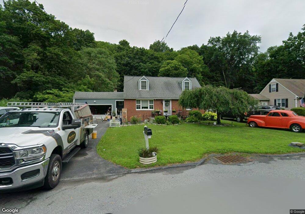
52 Henmond Blvd Poughkeepsie, NY 12603
Estimated Value: $341,000 - $465,725
4
Beds
2
Baths
1,806
Sq Ft
$221/Sq Ft
Est. Value
About This Home
This home is located at 52 Henmond Blvd, Poughkeepsie, NY 12603 and is currently estimated at $399,931, approximately $221 per square foot. 52 Henmond Blvd is a home located in Dutchess County with nearby schools including Arlington High School, Hawk Meadow Montessori School, and Holy Trinity School.
Ownership History
Date
Name
Owned For
Owner Type
Purchase Details
Closed on
Dec 11, 2019
Sold by
Ferris Jamie L and Ferris Alyson C
Bought by
Ferris Jamie L
Current Estimated Value
Home Financials for this Owner
Home Financials are based on the most recent Mortgage that was taken out on this home.
Original Mortgage
$41,153
Outstanding Balance
$36,353
Interest Rate
3.7%
Mortgage Type
Construction
Estimated Equity
$363,578
Purchase Details
Closed on
Oct 11, 2006
Sold by
Travis Sheila Joan
Bought by
Ferris Jamie
Home Financials for this Owner
Home Financials are based on the most recent Mortgage that was taken out on this home.
Original Mortgage
$160,000
Interest Rate
6.49%
Mortgage Type
Purchase Money Mortgage
Purchase Details
Closed on
Feb 8, 2000
Create a Home Valuation Report for This Property
The Home Valuation Report is an in-depth analysis detailing your home's value as well as a comparison with similar homes in the area
Home Values in the Area
Average Home Value in this Area
Purchase History
| Date | Buyer | Sale Price | Title Company |
|---|---|---|---|
| Ferris Jamie L | -- | None Available | |
| Ferris Jamie | $240,000 | -- | |
| -- | -- | -- |
Source: Public Records
Mortgage History
| Date | Status | Borrower | Loan Amount |
|---|---|---|---|
| Open | Ferris Jamie L | $41,153 | |
| Previous Owner | Ferris Jamie | $160,000 |
Source: Public Records
Tax History Compared to Growth
Tax History
| Year | Tax Paid | Tax Assessment Tax Assessment Total Assessment is a certain percentage of the fair market value that is determined by local assessors to be the total taxable value of land and additions on the property. | Land | Improvement |
|---|---|---|---|---|
| 2024 | $14,320 | $342,000 | $77,600 | $264,400 |
| 2023 | $14,320 | $342,000 | $77,600 | $264,400 |
| 2022 | $14,292 | $328,500 | $70,500 | $258,000 |
| 2021 | $13,795 | $273,500 | $70,500 | $203,000 |
| 2020 | $9,113 | $255,500 | $70,500 | $185,000 |
| 2019 | $9,053 | $255,500 | $70,500 | $185,000 |
| 2018 | $7,514 | $210,000 | $70,500 | $139,500 |
| 2017 | $7,448 | $210,000 | $70,500 | $139,500 |
| 2016 | $7,114 | $210,000 | $70,500 | $139,500 |
| 2015 | -- | $198,500 | $74,500 | $124,000 |
| 2014 | -- | $198,500 | $74,500 | $124,000 |
Source: Public Records
Map
Nearby Homes
- 17 Henmond Blvd
- 20 Mcintosh Dr
- 224 Manchester Rd
- 42 Shamrock Cir
- 34 Mountain View Rd
- 29 Peckham Rd
- 27 Peckham Rd
- 18 Peckham Rd
- 15 Orchard Rd
- 11 Mountain View Rd
- 21 Overlook Rd
- 0 Gentry Bend Unit ONEH6332533
- 67 Davis Ave
- 217 Overocker Rd
- 2833 Route 9d Unit 4
- 788 788 Dutchess Turnpike
- 41 Lagrange Ave
- 105 Cherry Hill Dr
- 61 Catskill Ave
- 122 King Dr
- 50 Henmond Blvd
- 54 Henmond Blvd
- 56 Henmond Blvd
- 51 Henmond Blvd
- 47 Henmond Blvd
- 58 Henmond Blvd
- 53 Henmond Blvd
- 46 Henmond Blvd
- 55 Henmond Blvd
- 60 Henmond Blvd
- 43 Henmond Blvd
- 57 Henmond Blvd
- 23 Henmond Blvd
- 21 Henmond Blvd
- 25 Henmond Blvd
- 19 Henmond Blvd
- 62 Henmond Blvd
- 59 Henmond Blvd
- 41 Henmond Blvd
- 25 Henmomd Blvd