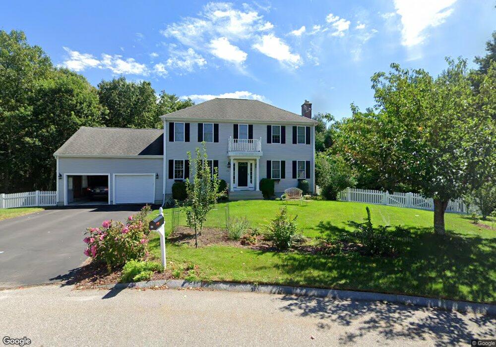
52 Jakes Way Mansfield, MA 02048
Estimated Value: $833,997 - $931,000
3
Beds
3
Baths
1,976
Sq Ft
$446/Sq Ft
Est. Value
About This Home
This home is located at 52 Jakes Way, Mansfield, MA 02048 and is currently estimated at $880,749, approximately $445 per square foot. 52 Jakes Way is a home located in Bristol County with nearby schools including Everett W. Robinson Elementary School, Jordan/Jackson Elementary School, and Harold L. Qualters Middle School.
Ownership History
Date
Name
Owned For
Owner Type
Purchase Details
Closed on
Oct 11, 2007
Sold by
Primacy Closing Corp
Bought by
Gay Richard W and Gay Sarah J
Current Estimated Value
Home Financials for this Owner
Home Financials are based on the most recent Mortgage that was taken out on this home.
Original Mortgage
$399,200
Outstanding Balance
$252,861
Interest Rate
6.49%
Mortgage Type
Purchase Money Mortgage
Estimated Equity
$627,888
Purchase Details
Closed on
Dec 8, 2005
Sold by
Bay Brook Village Llc
Bought by
Ballerstedt Bruce D and Franko Joann C
Home Financials for this Owner
Home Financials are based on the most recent Mortgage that was taken out on this home.
Original Mortgage
$395,920
Interest Rate
6.17%
Mortgage Type
Purchase Money Mortgage
Create a Home Valuation Report for This Property
The Home Valuation Report is an in-depth analysis detailing your home's value as well as a comparison with similar homes in the area
Home Values in the Area
Average Home Value in this Area
Purchase History
| Date | Buyer | Sale Price | Title Company |
|---|---|---|---|
| Gay Richard W | $499,000 | -- | |
| Primacy Closing Corp | $505,000 | -- | |
| Ballerstedt Bruce D | $496,650 | -- |
Source: Public Records
Mortgage History
| Date | Status | Borrower | Loan Amount |
|---|---|---|---|
| Open | Gay Richard W | $399,200 | |
| Previous Owner | Ballerstedt Bruce D | $395,920 |
Source: Public Records
Tax History Compared to Growth
Tax History
| Year | Tax Paid | Tax Assessment Tax Assessment Total Assessment is a certain percentage of the fair market value that is determined by local assessors to be the total taxable value of land and additions on the property. | Land | Improvement |
|---|---|---|---|---|
| 2025 | $9,702 | $736,700 | $302,800 | $433,900 |
| 2024 | $9,557 | $707,900 | $315,500 | $392,400 |
| 2023 | $9,273 | $658,100 | $315,500 | $342,600 |
| 2022 | $8,943 | $589,500 | $293,000 | $296,500 |
| 2021 | $8,677 | $564,900 | $244,000 | $320,900 |
| 2020 | $8,546 | $556,400 | $244,000 | $312,400 |
| 2019 | $8,071 | $530,300 | $204,800 | $325,500 |
| 2018 | $8,028 | $515,600 | $195,900 | $319,700 |
| 2017 | $7,534 | $501,600 | $190,700 | $310,900 |
| 2016 | $7,324 | $475,300 | $181,800 | $293,500 |
| 2015 | $7,094 | $457,700 | $181,800 | $275,900 |
Source: Public Records
Map
Nearby Homes
- 12 Wilson Place
- 21 East St Unit 1D
- 16 East St Unit 2
- 72 Court St Unit B
- 72 Court St Unit A
- 38 Court St
- 28 Court St
- 28 Court St Unit 4
- 76 Samoset Ave
- 99 Pleasant St
- 442 Ware St
- 460 Ware St
- 241-243 N Main St
- 82 Brook St
- 22 Pleasant St Unit B
- 22 Pleasant St Unit A
- 14 School St
- 150 Rumford Ave Unit 222
- 245 Willow St
- 631 East St Unit H102