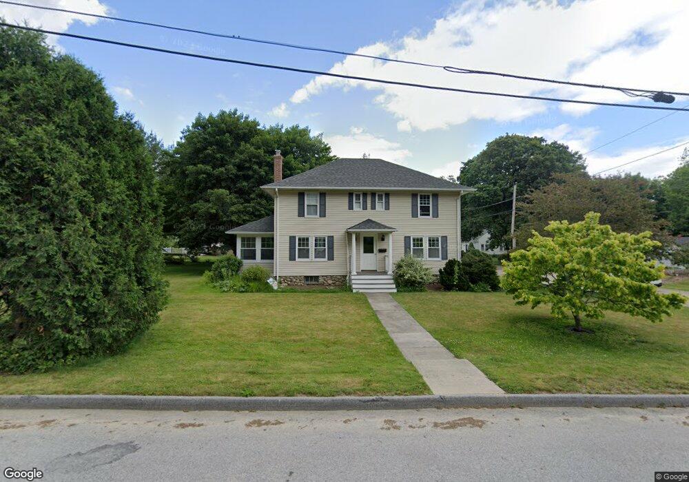
52 Stark Rd Worcester, MA 01602
West Tatnuck NeighborhoodEstimated Value: $481,538 - $517,000
4
Beds
2
Baths
1,768
Sq Ft
$280/Sq Ft
Est. Value
About This Home
This home is located at 52 Stark Rd, Worcester, MA 01602 and is currently estimated at $494,385, approximately $279 per square foot. 52 Stark Rd is a home located in Worcester County with nearby schools including West Tatnuck School, Chandler Magnet, and Jacob Hiatt Magnet School.
Create a Home Valuation Report for This Property
The Home Valuation Report is an in-depth analysis detailing your home's value as well as a comparison with similar homes in the area
Home Values in the Area
Average Home Value in this Area
Tax History
| Year | Tax Paid | Tax Assessment Tax Assessment Total Assessment is a certain percentage of the fair market value that is determined by local assessors to be the total taxable value of land and additions on the property. | Land | Improvement |
|---|---|---|---|---|
| 2025 | $5,943 | $450,600 | $118,900 | $331,700 |
| 2024 | $5,679 | $413,000 | $118,900 | $294,100 |
| 2023 | $5,478 | $382,000 | $103,300 | $278,700 |
| 2022 | $5,080 | $334,000 | $82,700 | $251,300 |
| 2021 | $4,923 | $302,400 | $66,200 | $236,200 |
| 2020 | $4,821 | $283,600 | $66,100 | $217,500 |
| 2019 | $4,682 | $260,100 | $59,600 | $200,500 |
| 2018 | $4,671 | $247,000 | $59,600 | $187,400 |
| 2017 | $4,467 | $232,400 | $59,600 | $172,800 |
| 2016 | $4,501 | $218,400 | $44,100 | $174,300 |
| 2015 | $4,383 | $218,400 | $44,100 | $174,300 |
| 2014 | $4,268 | $218,400 | $44,100 | $174,300 |
Source: Public Records
Map
Nearby Homes
- 9 Newburn Rd
- 148A Tory Fort Ln
- 53 Tiverton Pkwy
- 21 Baxter St
- 44 Drexel St
- 23 Tiverton Pkwy
- 10 Edwidge St
- 122 Copperfield Rd
- 21 Brewster Rd
- 70 Moreland Green Dr
- 118 Beaconsfield Rd
- 15 Chesterfield Rd
- 10 Wrentham Rd Unit 308
- 19 Assabet Ln
- 163 Moreland St
- 29 Scenic Dr
- 47R Yarnie Unit 1B
- 47R Yarnie Unit 4A
- 47R Yarnie Unit 1A
- 23 Orrison St
Your Personal Tour Guide
Ask me questions while you tour the home.