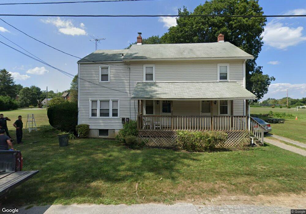
520 Murphys Ln Hockessin, DE 19707
Estimated Value: $262,276 - $362,000
3
Beds
1
Bath
1,212
Sq Ft
$265/Sq Ft
Est. Value
About This Home
This home is located at 520 Murphys Ln, Hockessin, DE 19707 and is currently estimated at $321,569, approximately $265 per square foot. 520 Murphys Ln is a home located in New Castle County with nearby schools including North Star Elementary School, Dupont (H.B.) Middle School, and Alexis I. du Pont High School.
Ownership History
Date
Name
Owned For
Owner Type
Purchase Details
Closed on
May 1, 2007
Sold by
Wynn Kenneth W
Bought by
Wynn Properties 2 Llc
Current Estimated Value
Purchase Details
Closed on
Nov 24, 2003
Sold by
Wynn Kenneth W and Wynn Lisa A
Bought by
Wynn Kenneth W
Home Financials for this Owner
Home Financials are based on the most recent Mortgage that was taken out on this home.
Original Mortgage
$128,250
Interest Rate
5.88%
Mortgage Type
New Conventional
Create a Home Valuation Report for This Property
The Home Valuation Report is an in-depth analysis detailing your home's value as well as a comparison with similar homes in the area
Home Values in the Area
Average Home Value in this Area
Purchase History
| Date | Buyer | Sale Price | Title Company |
|---|---|---|---|
| Wynn Properties 2 Llc | -- | None Available | |
| Wynn Kenneth W | -- | -- |
Source: Public Records
Mortgage History
| Date | Status | Borrower | Loan Amount |
|---|---|---|---|
| Previous Owner | Wynn Kenneth W | $128,250 |
Source: Public Records
Tax History Compared to Growth
Tax History
| Year | Tax Paid | Tax Assessment Tax Assessment Total Assessment is a certain percentage of the fair market value that is determined by local assessors to be the total taxable value of land and additions on the property. | Land | Improvement |
|---|---|---|---|---|
| 2024 | $1,467 | $39,700 | $6,200 | $33,500 |
| 2023 | $1,294 | $39,700 | $6,200 | $33,500 |
| 2022 | $1,309 | $39,700 | $6,200 | $33,500 |
| 2021 | $1,309 | $39,700 | $6,200 | $33,500 |
| 2020 | $0 | $39,700 | $6,200 | $33,500 |
| 2019 | $1,530 | $39,700 | $6,200 | $33,500 |
| 2018 | $1,285 | $39,700 | $6,200 | $33,500 |
| 2017 | $1,270 | $39,700 | $6,200 | $33,500 |
| 2016 | $1,213 | $39,700 | $6,200 | $33,500 |
| 2015 | $1,136 | $39,700 | $6,200 | $33,500 |
| 2014 | $1,052 | $39,700 | $6,200 | $33,500 |
Source: Public Records
Map
Nearby Homes
- 108 Evanson Rd
- 3 Ashleaf Ct
- 832 Evanson Rd
- 551 Southwood Rd
- 567 Southwood Rd
- 513 Pershing Rd
- 259 Grove View Dr
- 257 Grove View Dr
- 255 Grove View Dr
- 253 Grove View Dr
- 504 Hemingway Dr
- 6 Kings Grant Rd
- 308 Detjen Dr
- 22 Eynon Ct
- 683 Mc Govern Rd
- 408 Willowbend Ct
- 253 Peoples Way
- 107 Skyview Ln
- 606 Parkridge Dr
- 515 Massaferi Way