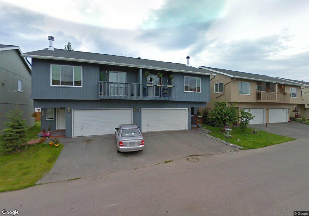
520 Ocean Point Dr Unit 27 Anchorage, AK 99515
Old Seward-Oceanview NeighborhoodEstimated Value: $323,000 - $344,037
3
Beds
2
Baths
1,376
Sq Ft
$242/Sq Ft
Est. Value
About This Home
This home is located at 520 Ocean Point Dr Unit 27, Anchorage, AK 99515 and is currently estimated at $333,519, approximately $242 per square foot. 520 Ocean Point Dr Unit 27 is a home located in Anchorage Municipality with nearby schools including Ocean View Elementary School, Hanshew Middle School, and Service High School.
Ownership History
Date
Name
Owned For
Owner Type
Purchase Details
Closed on
Dec 15, 2009
Sold by
Pulcifer Michael R and Pulcifier Michael R
Bought by
Pulcifer Michael R
Current Estimated Value
Home Financials for this Owner
Home Financials are based on the most recent Mortgage that was taken out on this home.
Original Mortgage
$132,000
Interest Rate
4.91%
Mortgage Type
New Conventional
Create a Home Valuation Report for This Property
The Home Valuation Report is an in-depth analysis detailing your home's value as well as a comparison with similar homes in the area
Home Values in the Area
Average Home Value in this Area
Purchase History
| Date | Buyer | Sale Price | Title Company |
|---|---|---|---|
| Pulcifer Michael R | -- | None Available |
Source: Public Records
Mortgage History
| Date | Status | Borrower | Loan Amount |
|---|---|---|---|
| Closed | Pulcifer Michael R | $132,000 |
Source: Public Records
Tax History Compared to Growth
Tax History
| Year | Tax Paid | Tax Assessment Tax Assessment Total Assessment is a certain percentage of the fair market value that is determined by local assessors to be the total taxable value of land and additions on the property. | Land | Improvement |
|---|---|---|---|---|
| 2025 | $3,461 | $304,100 | -- | $304,100 |
| 2024 | $3,461 | $289,400 | $0 | $289,400 |
| 2023 | $4,254 | $249,800 | $0 | $249,800 |
| 2022 | $3,280 | $243,500 | $0 | $243,500 |
| 2021 | $4,190 | $232,500 | $0 | $232,500 |
| 2020 | $3,080 | $226,800 | $0 | $226,800 |
| 2019 | $3,026 | $231,200 | $0 | $231,200 |
| 2018 | $3,073 | $234,200 | $0 | $234,200 |
| 2017 | $3,329 | $232,600 | $0 | $232,600 |
| 2016 | $2,709 | $224,700 | $0 | $224,700 |
| 2015 | $2,709 | $212,500 | $0 | $212,500 |
| 2014 | $2,709 | $200,500 | $0 | $200,500 |
Source: Public Records
Map
Nearby Homes
- 12106 Lucille Ln Unit 1
- 12023 Whitecap Place Unit 37
- 12301 Johns Rd Unit 6
- 12120 Johns Rd
- 411 Mariner Dr
- 200 W 123rd Ave
- 250 Botanical Cir
- 321 Ellen Cir
- 9031 Old Seward Hwy
- 11759 Birch Knoll Loop Unit 11759
- 1105 E Klatt Rd
- 12961 Nora Dr
- 12130 Timberlane Dr
- 1100 E 112th Ave Unit 2
- 11483 Moonrise Ridge Place Unit 10
- 840 Allison Cir
- 900 Botanical Heights Cir
- 1677 Circlewood Dr
- 13351 Venus Way
- 10600 Cordova St
- 522 Ocean Point Dr
- 530 Ocean Point Dr Unit 57
- 522 Ocean Point Dr Unit 28
- 502 Ocean Point Dr Unit 26
- 540 Ocean Point Dr Unit 29
- 500 Ocean Point Dr Unit 25
- 542 Ocean Point Dr Unit 30
- 503 Ocean Point Dr Unit 57
- 539 Ocean Point Dr Unit 48
- 541 Ocean Point Dr Unit 47
- 501 Ocean Point Dr Unit 58
- 473 Dailey Ave
- 473 Dailey Ave Unit 10
- 473 Dailey Ave Unit C-11
- 473 Dailey Ave Unit 12
- 473 Dailey Ave Unit C13
- 473 Dailey Ave Unit C14
- 482 Ocean Point Dr Unit 24
- 483 Ocean Point Dr Unit 59
- 562 Ocean Point Dr Unit 32