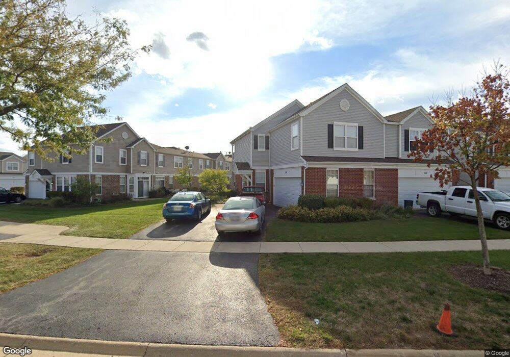
520 Springbrook Trail N Unit 1 Oswego, IL 60543
North Oswego NeighborhoodEstimated Value: $275,000 - $298,000
3
Beds
3
Baths
1,605
Sq Ft
$179/Sq Ft
Est. Value
About This Home
This home is located at 520 Springbrook Trail N Unit 1, Oswego, IL 60543 and is currently estimated at $286,541, approximately $178 per square foot. 520 Springbrook Trail N Unit 1 is a home located in Kendall County with nearby schools including Long Beach Elementary School, Plank Junior High School, and Oswego East High School.
Ownership History
Date
Name
Owned For
Owner Type
Purchase Details
Closed on
Jan 31, 2014
Sold by
Lindou Thomas
Bought by
American Homes 4 Rent Properties Ten Llc
Current Estimated Value
Purchase Details
Closed on
Jan 14, 2004
Sold by
Centex Homes
Bought by
Lindou Thomas R
Home Financials for this Owner
Home Financials are based on the most recent Mortgage that was taken out on this home.
Original Mortgage
$176,077
Interest Rate
5.96%
Mortgage Type
FHA
Create a Home Valuation Report for This Property
The Home Valuation Report is an in-depth analysis detailing your home's value as well as a comparison with similar homes in the area
Home Values in the Area
Average Home Value in this Area
Purchase History
| Date | Buyer | Sale Price | Title Company |
|---|---|---|---|
| American Homes 4 Rent Properties Ten Llc | $91,000 | None Available | |
| Lindou Thomas R | $179,000 | Chicago Title Insurance Co |
Source: Public Records
Mortgage History
| Date | Status | Borrower | Loan Amount |
|---|---|---|---|
| Previous Owner | Lindou Thomas R | $176,077 |
Source: Public Records
Tax History Compared to Growth
Tax History
| Year | Tax Paid | Tax Assessment Tax Assessment Total Assessment is a certain percentage of the fair market value that is determined by local assessors to be the total taxable value of land and additions on the property. | Land | Improvement |
|---|---|---|---|---|
| 2024 | $6,409 | $79,645 | $16,237 | $63,408 |
| 2023 | $5,845 | $69,256 | $14,119 | $55,137 |
| 2022 | $5,845 | $64,725 | $13,195 | $51,530 |
| 2021 | $5,660 | $60,491 | $12,332 | $48,159 |
| 2020 | $5,549 | $58,729 | $11,973 | $46,756 |
| 2019 | $5,637 | $58,729 | $11,973 | $46,756 |
| 2018 | $4,866 | $50,051 | $10,204 | $39,847 |
| 2017 | $4,729 | $46,130 | $9,405 | $36,725 |
| 2016 | $4,362 | $41,936 | $8,550 | $33,386 |
| 2015 | $4,085 | $37,443 | $7,634 | $29,809 |
| 2014 | -- | $35,324 | $7,202 | $28,122 |
| 2013 | -- | $38,395 | $7,828 | $30,567 |
Source: Public Records
Map
Nearby Homes
- 235 Springbrook Trail S Unit 1
- 295 Springbrook Trail S
- 121 Springbrook Trail S
- 0000 Fifth St
- 610 Salem Cir
- 2071 Wiesbrook Dr
- 712 Bohannon Cir
- 215 Long Beach Rd
- 404 Kent Ct
- 623 Queen Dr
- 457 Newport Cir
- 786 Bohannon Cir
- 790 Bohannon Cir
- 222 Mondovi Dr
- 122 Longbeach Rd
- 136 Heathgate Rd
- 22 Alex Ct Unit 1
- 124 Heathgate Rd
- 36 Fallcreek Cir Unit 35
- 37 Fallcreek Cir
- 522 Springbrook Trail N Unit 1
- 498 Brookside Dr Unit 1
- 496 Brookside Dr Unit 1
- 526 Springbrook Trail N Unit 1
- 494 Brookside Dr Unit 1
- 492 Brookside Dr
- 521 Springbrook Trail N
- 519 Springbrook Trail N Unit 1
- 490 Brookside Dr Unit 1
- 523 Springbrook Trail N
- 517 Springbrook Trail N Unit 1
- 525 Springbrook Trail N
- 525 Springbrook Trail N Unit 525
- 527 Springbrook Trail N
- 540 Springbrook Trail N Unit 1
- 529 Springbrook Trail N Unit 1
- 488 Brookside Dr
- 542 Springbrook Trail N
- 533 Springbrook Trail N