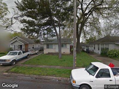
5200 2nd Ave Sacramento, CA 95817
Elmhurst NeighborhoodEstimated Value: $374,000 - $484,000
2
Beds
1
Bath
672
Sq Ft
$631/Sq Ft
Est. Value
About This Home
This home is located at 5200 2nd Ave, Sacramento, CA 95817 and is currently estimated at $423,723, approximately $630 per square foot. 5200 2nd Ave is a home located in Sacramento County with nearby schools including Tahoe Elementary School, Umoja International Academy, and Hiram W. Johnson High School.
Ownership History
Date
Name
Owned For
Owner Type
Purchase Details
Closed on
Jun 3, 2002
Sold by
Larson Mildred Irene
Bought by
Stephenson Robert W
Current Estimated Value
Create a Home Valuation Report for This Property
The Home Valuation Report is an in-depth analysis detailing your home's value as well as a comparison with similar homes in the area
Home Values in the Area
Average Home Value in this Area
Purchase History
| Date | Buyer | Sale Price | Title Company |
|---|---|---|---|
| Stephenson Robert W | $130,000 | First American Title Ins Co |
Source: Public Records
Mortgage History
| Date | Status | Borrower | Loan Amount |
|---|---|---|---|
| Open | Stephenson Robert W | $59,778 | |
| Closed | Stephenson Robert W | $46,290 | |
| Open | Stephenson Robert W | $215,000 | |
| Closed | Stephenson Robert W | $76,000 | |
| Closed | Stephenson Robert W | $156,750 | |
| Closed | Stephenson Robert W | $100,000 | |
| Closed | Stephenson Robert W | $65,000 |
Source: Public Records
Tax History Compared to Growth
Tax History
| Year | Tax Paid | Tax Assessment Tax Assessment Total Assessment is a certain percentage of the fair market value that is determined by local assessors to be the total taxable value of land and additions on the property. | Land | Improvement |
|---|---|---|---|---|
| 2024 | $2,238 | $188,257 | $130,337 | $57,920 |
| 2023 | $2,183 | $184,567 | $127,782 | $56,785 |
| 2022 | $2,144 | $180,949 | $125,277 | $55,672 |
| 2021 | $2,042 | $177,402 | $122,821 | $54,581 |
| 2020 | $2,057 | $175,584 | $121,562 | $54,022 |
| 2019 | $2,012 | $172,142 | $119,179 | $52,963 |
| 2018 | $1,958 | $168,768 | $116,843 | $51,925 |
| 2017 | $1,929 | $165,459 | $114,552 | $50,907 |
| 2016 | $1,876 | $162,215 | $112,306 | $49,909 |
| 2015 | $1,847 | $159,780 | $110,620 | $49,160 |
| 2014 | $1,797 | $156,652 | $108,454 | $48,198 |
Source: Public Records
Map
Nearby Homes