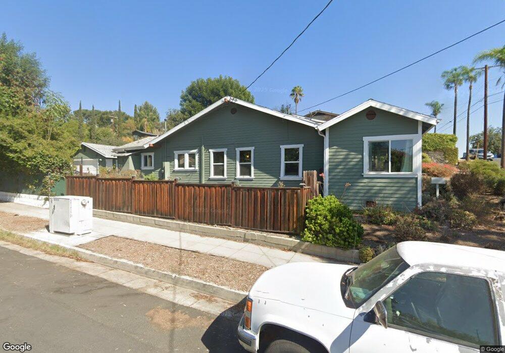
5201 Coringa Dr Los Angeles, CA 90042
Eagle Rock NeighborhoodEstimated Value: $1,214,000 - $1,528,000
3
Beds
2
Baths
1,452
Sq Ft
$934/Sq Ft
Est. Value
About This Home
This home is located at 5201 Coringa Dr, Los Angeles, CA 90042 and is currently estimated at $1,356,267, approximately $934 per square foot. 5201 Coringa Dr is a home located in Los Angeles County with nearby schools including Buchanan Street Elementary and Franklin Middle School & High School.
Ownership History
Date
Name
Owned For
Owner Type
Purchase Details
Closed on
Oct 31, 2008
Sold by
Mcllravy Margaret S
Bought by
Estrella Steven and Estrella Michelle
Current Estimated Value
Home Financials for this Owner
Home Financials are based on the most recent Mortgage that was taken out on this home.
Original Mortgage
$427,360
Outstanding Balance
$278,022
Interest Rate
5.9%
Mortgage Type
FHA
Estimated Equity
$1,078,245
Purchase Details
Closed on
Apr 4, 2000
Sold by
Eder George L
Bought by
Eder George L and Eder Florence M
Create a Home Valuation Report for This Property
The Home Valuation Report is an in-depth analysis detailing your home's value as well as a comparison with similar homes in the area
Home Values in the Area
Average Home Value in this Area
Purchase History
| Date | Buyer | Sale Price | Title Company |
|---|---|---|---|
| Estrella Steven | $433,000 | Orange Coast Title Company | |
| Eder George L | -- | -- |
Source: Public Records
Mortgage History
| Date | Status | Borrower | Loan Amount |
|---|---|---|---|
| Open | Estrella Steven | $427,360 |
Source: Public Records
Tax History
| Year | Tax Paid | Tax Assessment Tax Assessment Total Assessment is a certain percentage of the fair market value that is determined by local assessors to be the total taxable value of land and additions on the property. | Land | Improvement |
|---|---|---|---|---|
| 2025 | $6,767 | $557,587 | $376,795 | $180,792 |
| 2024 | $6,767 | $546,655 | $369,407 | $177,248 |
| 2023 | $6,636 | $535,937 | $362,164 | $173,773 |
| 2022 | $6,329 | $525,429 | $355,063 | $170,366 |
| 2021 | $6,247 | $515,127 | $348,101 | $167,026 |
| 2019 | $6,060 | $499,850 | $337,777 | $162,073 |
| 2018 | $5,950 | $490,050 | $331,154 | $158,896 |
| 2016 | $5,678 | $471,023 | $318,296 | $152,727 |
| 2015 | $5,594 | $463,948 | $313,515 | $150,433 |
| 2014 | $5,617 | $454,861 | $307,374 | $147,487 |
Source: Public Records
Map
Nearby Homes
- 5240 Barker Dr
- 5218 Barker Dr
- 1932 Phillips Way
- 5007 Almaden Dr
- 1942 Phillips Way
- 1938 Phillips Way
- 1813 N Avenue 55
- 1817 N Avenue 55
- 1835 N Avenue 55
- 4920 Stratford Rd
- 5618 Tehama St
- 1393 N Avenue 57
- 1333 Wildwood Dr
- 5144 Buchanan St
- 5001 Buchanan St
- 5681 Fallston St
- 4631 4637 Loleta Place
- 5606 E Alloway Ct
- 1018 N Avenue 54
- 5349 Baltimore St
- 5207 Coringa Dr
- 5211 Coringa Dr
- 5127 Coringa Dr
- 1812 North Avenue 52
- 5132 Coringa Dr
- 1816 North Avenue 52
- 5217 Coringa Dr
- 5123 Coringa Dr
- 1815 North Avenue 52
- 1820 North Avenue 52
- 5202 Coringa Dr
- 5134 Coringa Dr
- 5206 Coringa Dr
- 5130 Coringa Dr
- 1817 North Avenue 52
- 5210 Coringa Dr
- 5223 Coringa Dr
- 5126 Coringa Dr
- 5126 Coringa Dr
- 5117 Coringa Dr
Your Personal Tour Guide
Ask me questions while you tour the home.