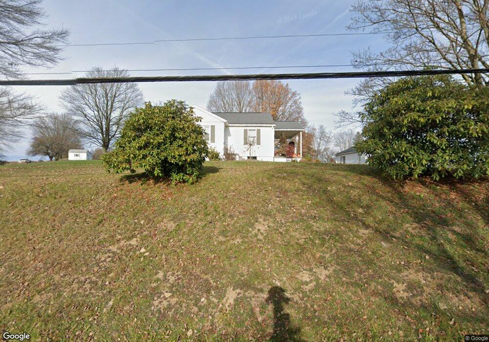
521 Iron Bridge Rd Kittanning, PA 16201
Rayburn Township NeighborhoodEstimated Value: $150,000 - $251,000
3
Beds
1
Bath
1,089
Sq Ft
$180/Sq Ft
Est. Value
About This Home
This home is located at 521 Iron Bridge Rd, Kittanning, PA 16201 and is currently estimated at $196,404, approximately $180 per square foot. 521 Iron Bridge Rd is a home with nearby schools including West Hills Intermediate School, West Hills Primary School, and Faith Christian Academy.
Ownership History
Date
Name
Owned For
Owner Type
Purchase Details
Closed on
Dec 13, 2016
Sold by
Mechling Catherine J and Reed Vivian M
Bought by
Toy Toby and Bowser Alyssa D
Current Estimated Value
Home Financials for this Owner
Home Financials are based on the most recent Mortgage that was taken out on this home.
Original Mortgage
$122,220
Outstanding Balance
$100,358
Interest Rate
4.08%
Mortgage Type
New Conventional
Estimated Equity
$96,046
Create a Home Valuation Report for This Property
The Home Valuation Report is an in-depth analysis detailing your home's value as well as a comparison with similar homes in the area
Home Values in the Area
Average Home Value in this Area
Purchase History
| Date | Buyer | Sale Price | Title Company |
|---|---|---|---|
| Toy Toby | $126,000 | None Available |
Source: Public Records
Mortgage History
| Date | Status | Borrower | Loan Amount |
|---|---|---|---|
| Open | Toy Toby | $122,220 |
Source: Public Records
Tax History Compared to Growth
Tax History
| Year | Tax Paid | Tax Assessment Tax Assessment Total Assessment is a certain percentage of the fair market value that is determined by local assessors to be the total taxable value of land and additions on the property. | Land | Improvement |
|---|---|---|---|---|
| 2025 | $2,753 | $31,500 | $20,420 | $11,080 |
| 2024 | $2,596 | $31,500 | $20,420 | $11,080 |
| 2023 | $2,404 | $31,500 | $20,420 | $11,080 |
| 2022 | $2,404 | $31,500 | $20,420 | $11,080 |
| 2021 | $2,404 | $31,500 | $20,420 | $11,080 |
| 2020 | $2,404 | $31,500 | $20,420 | $11,080 |
| 2019 | $2,404 | $31,500 | $20,420 | $11,080 |
| 2018 | $2,372 | $29,170 | $13,345 | $15,825 |
| 2017 | $2,354 | $31,500 | $20,420 | $11,080 |
| 2016 | $2,354 | $31,500 | $20,420 | $11,080 |
| 2015 | $1,803 | $31,500 | $20,420 | $11,080 |
| 2014 | $1,803 | $31,500 | $20,420 | $11,080 |
Source: Public Records
Map
Nearby Homes
- 174 Mcmillen Rd
- 142.19 Acs Along Elkin & Beck Roads
- 119 6th St
- 421 Red Mill Rd
- 139 Oak Ave
- 435 1/2 Reesman Dr Unit 2
- 136 Queen St
- 1017 Johnston Ave
- 1594 Johnston Ave
- 614 Woodward Ave
- 143 N Grant Ave
- 414 North Ave
- 114 S Mckean St
- 1408 Orr Ave
- 176 Wray Plan Rd
- 203-205 Maple St
- 509 N Jefferson St
- 238 Allegheny Ave
- 349 Franklin Ave
- 226 Ridge Ave
- 518 Iron Bridge Rd
- 513 Iron Bridge Rd
- 512 Iron Bridge Rd
- 703 State Route 28 and 66
- 710 State Route 28 and 66
- 496 Iron Bridge Rd
- 499 Iron Bridge Rd
- 725 State Route 28 and 66
- 1242 Anderson Creek Rd
- 679 State Route 28&66
- 724 State Route 28 and 66
- 1237 Anderson Creek Rd
- 484 Iron Bridge Rd
- 1222 Anderson Creek Rd
- 678 State Route 28 and 66
- 677 State Route 2007
- 677 State Route 28/66
- 744 State Route 28 and 66
- 662 State Route 28 and 66
- 473 Iron Bridge Rd