521 Tolson Ln Sheridan, MT 59749
Estimated Value: $434,550 - $464,000
2
Beds
2
Baths
1,768
Sq Ft
$252/Sq Ft
Est. Value
About This Home
This home is located at 521 Tolson Ln, Sheridan, MT 59749 and is currently estimated at $445,517, approximately $251 per square foot. 521 Tolson Ln is a home with nearby schools including Sheridan Elementary School, Sheridan Middle School, and Sheridan High School.
Ownership History
Date
Name
Owned For
Owner Type
Purchase Details
Closed on
Jul 12, 2024
Sold by
Lawyer Robert L
Bought by
Lawyer Gaynelle R
Current Estimated Value
Purchase Details
Closed on
Jan 20, 2007
Sold by
Lewis Richard A
Bought by
Lawyer Robert L and Lawyer Gaynelle R
Purchase Details
Closed on
Apr 6, 2006
Sold by
Tolson Mary C
Bought by
Lewis Richard A
Home Financials for this Owner
Home Financials are based on the most recent Mortgage that was taken out on this home.
Original Mortgage
$100,545
Interest Rate
6.29%
Mortgage Type
Construction
Create a Home Valuation Report for This Property
The Home Valuation Report is an in-depth analysis detailing your home's value as well as a comparison with similar homes in the area
Home Values in the Area
Average Home Value in this Area
Purchase History
| Date | Buyer | Sale Price | Title Company |
|---|---|---|---|
| Lawyer Robert L | -- | American Land Title Co | |
| Lewis Richard A | -- | American Land Title Co |
Source: Public Records
Mortgage History
| Date | Status | Borrower | Loan Amount |
|---|---|---|---|
| Previous Owner | Lewis Richard A | $100,545 |
Source: Public Records
Tax History Compared to Growth
Tax History
| Year | Tax Paid | Tax Assessment Tax Assessment Total Assessment is a certain percentage of the fair market value that is determined by local assessors to be the total taxable value of land and additions on the property. | Land | Improvement |
|---|---|---|---|---|
| 2024 | $837 | $389,300 | $0 | $0 |
| 2023 | $1,957 | $389,300 | $0 | $0 |
| 2022 | $1,156 | $239,400 | $0 | $0 |
| 2021 | $983 | $239,400 | $0 | $0 |
| 2020 | $1,030 | $220,000 | $0 | $0 |
| 2019 | $1,023 | $220,000 | $0 | $0 |
| 2018 | $1,089 | $219,000 | $0 | $0 |
| 2017 | $1,179 | $219,000 | $0 | $0 |
| 2016 | $1,001 | $193,500 | $0 | $0 |
| 2015 | $999 | $193,500 | $0 | $0 |
| 2014 | $647 | $117,236 | $0 | $0 |
Source: Public Records
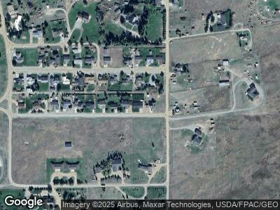
Map
Nearby Homes
- 502 Mill St
- TBD Mill St
- 113 Washington St
- 516 Mill St
- 401 Mill St
- 306 Jefferson St
- 106 E Hamilton St
- 6 Flagstone Ct
- Tract 8 61 13 Acres
- 210 W Hamilton St
- 109 Flick Ln
- 9 Hawks Ct
- 204 Boundary St
- 33 Sky Ln
- 30 Wilson Ln
- 4 Elk Hills Rd
- 234 Mill Creek Rd
- Lot 6 3.499Ac Mt Hwy 287 Hwy
- 21 Fools Gold Ln
- 4 Sapphire Way