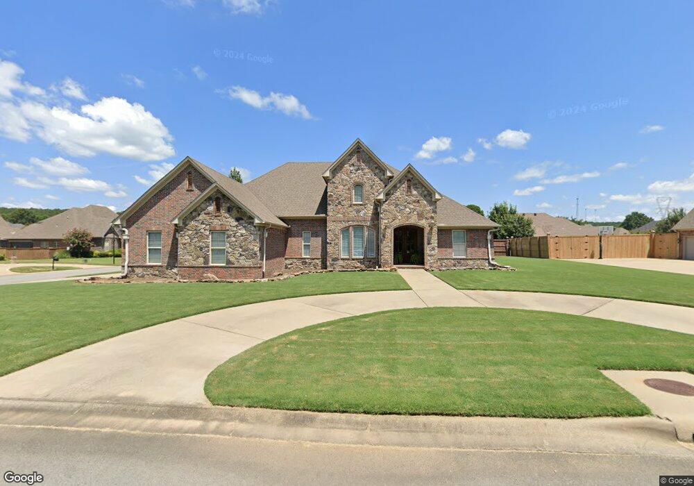
5210 Burnt Pine Conway, AR 72034
Estimated Value: $590,000 - $623,000
--
Bed
4
Baths
3,214
Sq Ft
$188/Sq Ft
Est. Value
About This Home
This home is located at 5210 Burnt Pine, Conway, AR 72034 and is currently estimated at $603,249, approximately $187 per square foot. 5210 Burnt Pine is a home located in Faulkner County with nearby schools including Woodrow Cummins Elementary School, Ruth Doyle Intermediate School, and Conway Junior High School.
Ownership History
Date
Name
Owned For
Owner Type
Purchase Details
Closed on
Feb 24, 2005
Bought by
Tate
Current Estimated Value
Home Financials for this Owner
Home Financials are based on the most recent Mortgage that was taken out on this home.
Original Mortgage
$45,000
Outstanding Balance
$22,903
Interest Rate
5.77%
Mortgage Type
Purchase Money Mortgage
Estimated Equity
$580,346
Purchase Details
Closed on
Feb 17, 2005
Sold by
Rushhal Development Llc
Bought by
Tate John C and Tate Mary E
Home Financials for this Owner
Home Financials are based on the most recent Mortgage that was taken out on this home.
Original Mortgage
$45,000
Outstanding Balance
$22,903
Interest Rate
5.77%
Mortgage Type
Purchase Money Mortgage
Estimated Equity
$580,346
Create a Home Valuation Report for This Property
The Home Valuation Report is an in-depth analysis detailing your home's value as well as a comparison with similar homes in the area
Home Values in the Area
Average Home Value in this Area
Purchase History
| Date | Buyer | Sale Price | Title Company |
|---|---|---|---|
| Tate | $55,000 | -- | |
| Tate John C | $55,000 | None Available |
Source: Public Records
Mortgage History
| Date | Status | Borrower | Loan Amount |
|---|---|---|---|
| Open | Tate John C | $45,000 |
Source: Public Records
Tax History Compared to Growth
Tax History
| Year | Tax Paid | Tax Assessment Tax Assessment Total Assessment is a certain percentage of the fair market value that is determined by local assessors to be the total taxable value of land and additions on the property. | Land | Improvement |
|---|---|---|---|---|
| 2024 | $4,580 | $111,820 | $9,800 | $102,020 |
| 2023 | $4,362 | $86,210 | $9,800 | $76,410 |
| 2022 | $3,904 | $86,210 | $9,800 | $76,410 |
| 2021 | $3,710 | $86,210 | $9,800 | $76,410 |
| 2020 | $3,516 | $76,890 | $9,800 | $67,090 |
| 2019 | $3,516 | $76,890 | $9,800 | $67,090 |
| 2018 | $3,541 | $76,890 | $9,800 | $67,090 |
| 2017 | $3,482 | $76,890 | $9,800 | $67,090 |
| 2016 | $3,282 | $71,770 | $9,800 | $61,970 |
| 2015 | $3,459 | $68,350 | $8,400 | $59,950 |
| 2014 | $3,109 | $68,350 | $8,400 | $59,950 |
Source: Public Records
Map
Nearby Homes
- 5090 Oakhurst Way
- 1615 Nantucket Dr
- 1645 Nantucket Dr
- 5645 Tivoli Dr
- 1650 Dolphin Dr
- 1360 Champions Dr
- 1645 Dolphin Dr
- 1655 Dolphin Dr
- 1520 Southwinds Dr
- 1105 Georgetown Dr
- 1060 Georgetown Dr
- 1635 Southwinds Dr
- 1040 Calloway Dr
- 1035 Calloway Dr
- 6 Eve Ln
- 21 Eve Ln
- 930 Brownstone Dr
- 970 Timber Knoll Dr
- 980 Timber Knoll Dr
- 960 Timber Knoll Dr
- 5240 Burnt Pine
- 5230 Burnt Pine
- 5240 Burnt Pine
- 5260 Burnt Pine
- 5265 Burnt Pine
- 5250 Burnt Pine
- 5250 Burnt Pine Dr
- 5300 Burnt Pine
- 5255 Burnt Pine
- 5265 Bay Town
- 5255 Bay Town
- 5305 Bay Town
- 5245 Burnt Pine
- 5320 Burnt Pine
- 5360 Burnt Pine
- 5245 Bay Town
- 5360 Burnt Pine Dr
- 5305 Burnt Pine
- 5315 Burnt Pine
- 5305 Burnt Pine