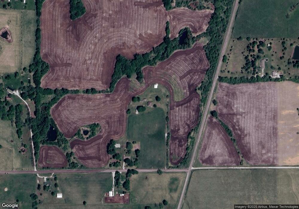
5210 Mount Zion Rd Edgerton, MO 64444
Estimated Value: $399,000 - $574,162
3
Beds
2
Baths
3,052
Sq Ft
$153/Sq Ft
Est. Value
About This Home
This home is located at 5210 Mount Zion Rd, Edgerton, MO 64444 and is currently estimated at $465,721, approximately $152 per square foot. 5210 Mount Zion Rd is a home located in Platte County with nearby schools including North Platte Elementary School, North Platte Intermediate School, and North Platte Junior High School.
Ownership History
Date
Name
Owned For
Owner Type
Purchase Details
Closed on
Jan 19, 2024
Sold by
Masoner Steven G
Bought by
Steven And Melissa Masoner Living Trust and Masoner
Current Estimated Value
Purchase Details
Closed on
Sep 19, 2023
Sold by
Carolyn S Masoner Living Trust
Bought by
Masoner Steven G
Purchase Details
Closed on
Mar 24, 2023
Sold by
Masoner Carolyn S
Bought by
Carolyn S Masoner Living Trust and Masoner
Create a Home Valuation Report for This Property
The Home Valuation Report is an in-depth analysis detailing your home's value as well as a comparison with similar homes in the area
Home Values in the Area
Average Home Value in this Area
Purchase History
| Date | Buyer | Sale Price | Title Company |
|---|---|---|---|
| Steven And Melissa Masoner Living Trust | -- | None Listed On Document | |
| Masoner Steven G | -- | None Listed On Document | |
| Carolyn S Masoner Living Trust | -- | None Listed On Document |
Source: Public Records
Tax History Compared to Growth
Tax History
| Year | Tax Paid | Tax Assessment Tax Assessment Total Assessment is a certain percentage of the fair market value that is determined by local assessors to be the total taxable value of land and additions on the property. | Land | Improvement |
|---|---|---|---|---|
| 2024 | $1,665 | $25,173 | $5,059 | $20,114 |
| 2023 | $1,665 | $25,173 | $5,059 | $20,114 |
| 2022 | $1,679 | $25,173 | $5,059 | $20,114 |
| 2021 | $1,684 | $25,173 | $5,059 | $20,114 |
| 2020 | $1,891 | $27,851 | $7,737 | $20,114 |
| 2019 | $1,891 | $27,851 | $7,737 | $20,114 |
| 2018 | $1,902 | $27,851 | $7,737 | $20,114 |
| 2017 | $1,902 | $27,851 | $7,737 | $20,114 |
| 2016 | $1,883 | $27,850 | $7,737 | $20,113 |
| 2015 | $1,883 | $27,850 | $7,737 | $20,113 |
| 2013 | $1,812 | $27,575 | $0 | $0 |
Source: Public Records
Map
Nearby Homes
- 200 W Perry St
- 306 Lewis St
- 705-707 Belt Ave
- 3815 Highway Z
- 5990 Z Hwy
- 19925 S Ridgely Rd
- 19845 S Ridgely Rd
- 6009 SW Walnut Cove
- 6193 SW Maple Ridge
- Lot 1 Unit 2 Z Highway
- 8894 Ssr-Z Hwy
- Lot 1, 2 Z Hwy
- 8894 SW Highway Z
- 9750 SW 200th St
- Lot 5 Z Hwy
- Lot 2 Z Hwy
- 5595 County Road Sw 313
- Lot 3 Z Hwy
- 9170 E Hwy
- 7127 SW Karen Rd
- 5715 Buena Vista Rd
- 5630 Mount Zion Rd
- 5630 Mount Zion Rd
- 5340 Mount Zion Rd
- 21910 Highway B
- 5345 Mount Zion Rd
- 6040 Buena Vista Rd
- 5585 Mount Zion Rd
- 5805 Buena Vista Rd
- 21745 Highway B
- 5000 Buena Vista Rd
- 5855 Buena Vista Rd
- 5765 Mount Zion Rd
- 19020 SE B Rural Route
- 2C Tract Castile Estate Dr
- 1A Tract Castile Estate Dr
- 1B Tract Castile Estate Dr
- 2 Tract Castile Estate Dr
- 2B Tract Castile Estate Dr
- 1 Tract Castile Estate Dr
