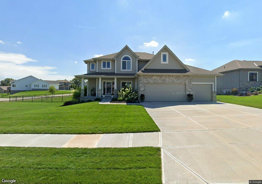
525 Locust St Gretna, NE 68028
Estimated Value: $512,918 - $571,000
4
Beds
3
Baths
2,429
Sq Ft
$223/Sq Ft
Est. Value
About This Home
This home is located at 525 Locust St, Gretna, NE 68028 and is currently estimated at $542,730, approximately $223 per square foot. 525 Locust St is a home with nearby schools including Squire John Thomas Elementary School, Gretna Middle School, and Gretna High School.
Ownership History
Date
Name
Owned For
Owner Type
Purchase Details
Closed on
Jun 5, 2018
Sold by
Proline Custom Homes Inc
Bought by
Gering Jessica A and Gering Macs G
Current Estimated Value
Home Financials for this Owner
Home Financials are based on the most recent Mortgage that was taken out on this home.
Original Mortgage
$295,388
Outstanding Balance
$255,461
Interest Rate
4.5%
Mortgage Type
New Conventional
Estimated Equity
$287,269
Purchase Details
Closed on
Oct 28, 2017
Sold by
Mccune Development L L C
Bought by
Proline Custom Homes Inc
Create a Home Valuation Report for This Property
The Home Valuation Report is an in-depth analysis detailing your home's value as well as a comparison with similar homes in the area
Home Values in the Area
Average Home Value in this Area
Purchase History
| Date | Buyer | Sale Price | Title Company |
|---|---|---|---|
| Gering Jessica A | $348,000 | Nebraska Land Title & Abst | |
| Proline Custom Homes Inc | $50,000 | Ambassdor Title Services |
Source: Public Records
Mortgage History
| Date | Status | Borrower | Loan Amount |
|---|---|---|---|
| Open | Gering Jessica A | $295,388 |
Source: Public Records
Tax History Compared to Growth
Tax History
| Year | Tax Paid | Tax Assessment Tax Assessment Total Assessment is a certain percentage of the fair market value that is determined by local assessors to be the total taxable value of land and additions on the property. | Land | Improvement |
|---|---|---|---|---|
| 2025 | $10,011 | $472,056 | $86,000 | $386,056 |
| 2024 | $10,193 | $466,960 | $80,000 | $386,960 |
| 2023 | $10,193 | $398,050 | $60,000 | $338,050 |
| 2022 | $9,616 | $360,153 | $55,000 | $305,153 |
| 2021 | $8,918 | $338,834 | $50,000 | $288,834 |
| 2020 | $9,047 | $332,487 | $50,000 | $282,487 |
| 2019 | $8,890 | $327,362 | $48,000 | $279,362 |
| 2018 | $2,157 | $79,790 | $48,000 | $31,790 |
| 2017 | $780 | $28,800 | $28,800 | $0 |
| 2016 | $324 | $12,004 | $12,004 | $0 |
| 2015 | $54 | $1,997 | $1,997 | $0 |
Source: Public Records
Map
Nearby Homes
- 19819 Sherwood Cir
- 19905 Maple St
- 434 Devonshire Dr
- 19910 Oak St
- 11719 S 203rd St
- 22111 Hackberry Dr
- 206 E Westplains Rd
- 20717 Frances St
- 11280 S 200th Ave
- 11647 Willow Park Dr
- 21716 Glenmore Dr
- 21711 Glenmore Dr
- 21707 Glenmore Dr
- 11512 S 191st Ave
- 11606 S 191st Ave
- 109 Meadow Ln
- 19120 Murray Trail
- 19122 Fir St
- 20919 Birch St
- 19016 Hazelnut Dr
- 521 Locust St
- 524 Sherwood Dr
- 517 Locust St
- 522 Locust St
- 530 Locust St
- 11555 S 200th St
- 11551 S 200th St
- 520 Sherwood Dr
- 518 Locust St
- 513 Locust St
- 11521 S 199th St
- 516 Sherwood Dr
- 514 Locust St
- Lot 21 Sherwood Dr
- 11517 S 199th St
- 19908 Sherwood Cir
- 509 Locust St
- 525 Devonshire Dr
- 521 Devonshire Dr
- 19915 Sherwood Cir