Estimated Value: $297,047 - $322,000
4
Beds
2
Baths
912
Sq Ft
$336/Sq Ft
Est. Value
About This Home
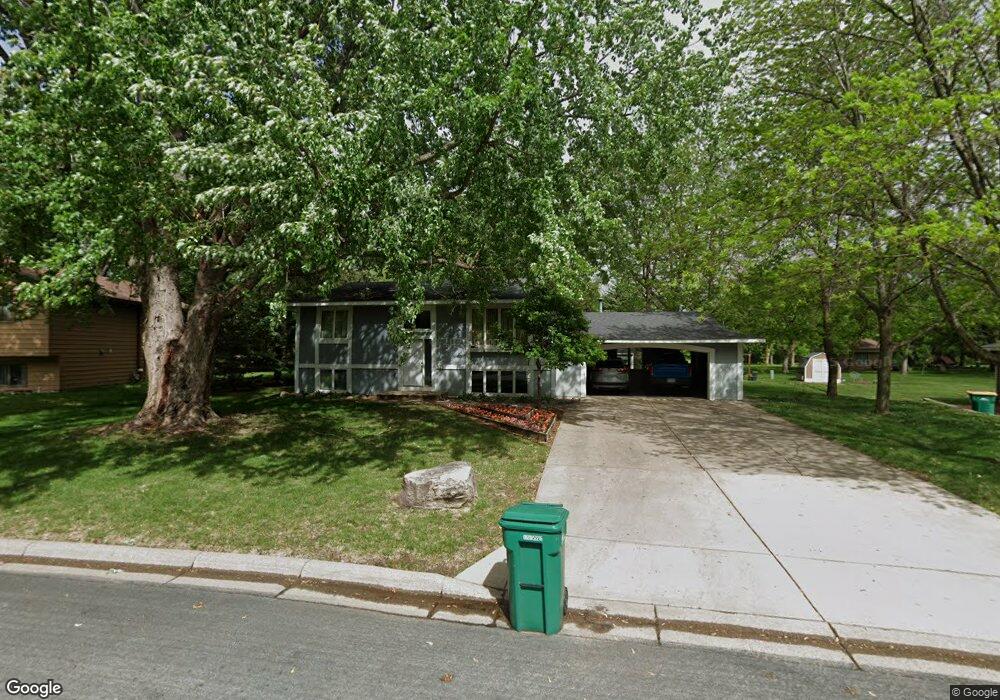
This home is located at 525 Ridge Rd, Mayer, MN 55360 and is currently estimated at $306,012, approximately $335 per square foot. 525 Ridge Rd is a home located in Carver County with nearby schools including Watertown-Mayer Elementary School, Watertown-Mayer Middle School, and Watertown Mayer High School.
Ownership History
Date
Name
Owned For
Owner Type
Purchase Details
Closed on
Jul 23, 2002
Sold by
Lee Daniel A and Lee Allison L
Bought by
Scott Earl A and Scott Deirdre Lynne
Current Estimated Value
Purchase Details
Closed on
Jul 31, 2000
Sold by
Flemal Richard J
Bought by
Lee Daniel A and Lee Allison L
Purchase Details
Closed on
Oct 1, 1998
Sold by
Lueck Larry W and Lueck Kathy E
Bought by
Flemal Richard James
Create a Home Valuation Report for This Property
The Home Valuation Report is an in-depth analysis detailing your home's value as well as a comparison with similar homes in the area
Home Values in the Area
Average Home Value in this Area
Purchase History
| Date | Buyer | Sale Price | Title Company |
|---|---|---|---|
| Scott Earl A | $153,000 | -- | |
| Lee Daniel A | $139,900 | -- | |
| Flemal Richard James | $120,000 | -- |
Source: Public Records
Tax History Compared to Growth
Tax History
| Year | Tax Paid | Tax Assessment Tax Assessment Total Assessment is a certain percentage of the fair market value that is determined by local assessors to be the total taxable value of land and additions on the property. | Land | Improvement |
|---|---|---|---|---|
| 2025 | $2,528 | $246,500 | $55,000 | $191,500 |
| 2024 | $2,546 | $248,600 | $55,000 | $193,600 |
| 2023 | $2,594 | $241,100 | $52,000 | $189,100 |
| 2022 | $2,408 | $234,000 | $52,000 | $182,000 |
| 2021 | $2,410 | $188,200 | $43,400 | $144,800 |
| 2020 | $2,458 | $188,200 | $43,400 | $144,800 |
| 2019 | $2,302 | $181,000 | $41,300 | $139,700 |
| 2018 | $2,368 | $181,000 | $41,300 | $139,700 |
| 2017 | $3,596 | $177,000 | $41,300 | $135,700 |
| 2016 | $3,652 | $137,700 | $0 | $0 |
| 2015 | $3,438 | $135,700 | $0 | $0 |
| 2014 | $3,438 | $113,000 | $0 | $0 |
Source: Public Records
Map
Nearby Homes
- 337 2nd St NW
- 344 2nd St NW
- 190 Morning Dr
- XXX 62nd St
- 5190 Prairie Point
- 2208 Coldwater Crossing
- 2083 River Bend Trail
- 2091 River Bend Trail
- 2095 River Bend Trail
- 2102 River Bend Trail
- 2103 River Bend Trail
- 2107 River Bend Trail
- 1518 Hidden Trail
- 5875 Highway 25
- 2119 River Bend Trail
- The Calhoun Plan at Coldwater Crossing
- The Rockwell Plan at Coldwater Crossing
- The Hemlock Plan at Coldwater Crossing
- The Mulberry Plan at Coldwater Crossing
- The Wentworth Plan at Coldwater Crossing