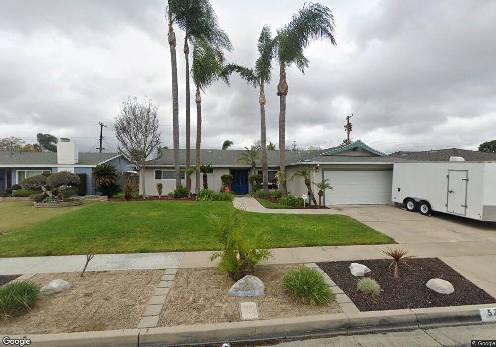
525 S Westgate Dr Anaheim, CA 92806
Southeast Anaheim NeighborhoodEstimated Value: $975,000 - $1,047,000
3
Beds
2
Baths
1,539
Sq Ft
$650/Sq Ft
Est. Value
About This Home
This home is located at 525 S Westgate Dr, Anaheim, CA 92806 and is currently estimated at $1,000,908, approximately $650 per square foot. 525 S Westgate Dr is a home located in Orange County with nearby schools including Benito Juarez Elementary School, South Junior High School, and Katella High School.
Ownership History
Date
Name
Owned For
Owner Type
Purchase Details
Closed on
Oct 19, 2010
Sold by
Weigand Michael B
Bought by
Bartley Dale J and Bartley Cheryl
Current Estimated Value
Home Financials for this Owner
Home Financials are based on the most recent Mortgage that was taken out on this home.
Original Mortgage
$414,226
Outstanding Balance
$273,623
Interest Rate
4.37%
Mortgage Type
FHA
Estimated Equity
$727,285
Purchase Details
Closed on
Aug 17, 2009
Sold by
Weigand Michael B
Bought by
Weigand Michael B and Michael B Weigand Living Trust
Home Financials for this Owner
Home Financials are based on the most recent Mortgage that was taken out on this home.
Original Mortgage
$246,500
Interest Rate
5.17%
Mortgage Type
New Conventional
Purchase Details
Closed on
Sep 25, 2007
Sold by
Weigand Michael B
Bought by
Weigand Michael B and Michael B Weigand Living Trust
Create a Home Valuation Report for This Property
The Home Valuation Report is an in-depth analysis detailing your home's value as well as a comparison with similar homes in the area
Home Values in the Area
Average Home Value in this Area
Purchase History
| Date | Buyer | Sale Price | Title Company |
|---|---|---|---|
| Bartley Dale J | $425,000 | Orange Coast Title | |
| Weigand Michael B | -- | Accommodation | |
| Weigand Michael B | -- | Fidelity National Title | |
| Weigand Michael B | -- | None Available |
Source: Public Records
Mortgage History
| Date | Status | Borrower | Loan Amount |
|---|---|---|---|
| Open | Bartley Dale J | $414,226 | |
| Previous Owner | Weigand Michael B | $246,500 |
Source: Public Records
Tax History Compared to Growth
Tax History
| Year | Tax Paid | Tax Assessment Tax Assessment Total Assessment is a certain percentage of the fair market value that is determined by local assessors to be the total taxable value of land and additions on the property. | Land | Improvement |
|---|---|---|---|---|
| 2025 | $6,470 | $564,181 | $422,998 | $141,183 |
| 2024 | $6,470 | $553,119 | $414,704 | $138,415 |
| 2023 | $6,335 | $542,274 | $406,573 | $135,701 |
| 2022 | $6,257 | $531,642 | $398,601 | $133,041 |
| 2021 | $6,269 | $521,218 | $390,785 | $130,433 |
| 2020 | $6,162 | $508,674 | $386,778 | $121,896 |
| 2019 | $5,857 | $488,112 | $379,194 | $108,918 |
| 2018 | $5,736 | $478,542 | $371,759 | $106,783 |
| 2017 | $5,508 | $469,159 | $364,469 | $104,690 |
| 2016 | $5,494 | $459,960 | $357,322 | $102,638 |
| 2015 | $5,446 | $453,051 | $351,954 | $101,097 |
| 2014 | $5,108 | $444,177 | $345,060 | $99,117 |
Source: Public Records
Map
Nearby Homes
- 2842 E Virginia Ave
- 238 S Trevor St
- 165 S Connie Cir
- 824 S Dune St
- 115 S Connie Cir
- 2810 E Burntwood Ave
- 320 N Park Vista St Unit 105
- 320 N Park Vista St Unit 64
- 320 N Park Vista St
- 320 N Park Vista St Unit 109
- 320 N Park Vista St Unit 179
- 320 N Park Vista St Unit 180
- 320 N Park Vista St Unit 139
- 320 N Park Vista St Unit 115
- 320 N Park Vista St Unit 28
- 320 N Park Vista St Unit 58
- 3052 N Spicewood St
- 369 N Via Remo
- 2430 E Agave St Unit 4
- 2410 E Agave St Unit 10
- 529 S Westgate Dr
- 519 S Westgate Dr
- 513 S Westgate Dr Unit 1
- 513 S Westgate Dr
- 535 S Westgate Dr
- 2875 E Virginia Ave
- 522 S Jeanine St
- 528 S Jeanine St
- 526 S Westgate Dr
- 2872 E Gerald Cir
- 522 S Westgate Dr
- 2876 E Gerald Cir
- 532 S Westgate Dr
- 2869 E Virginia Ave
- 516 S Westgate Dr
- 507 S Westgate Dr
- 536 S Westgate Dr
- 2866 E Gerald Cir
- 506 S Westgate Dr
- 2863 E Virginia Ave