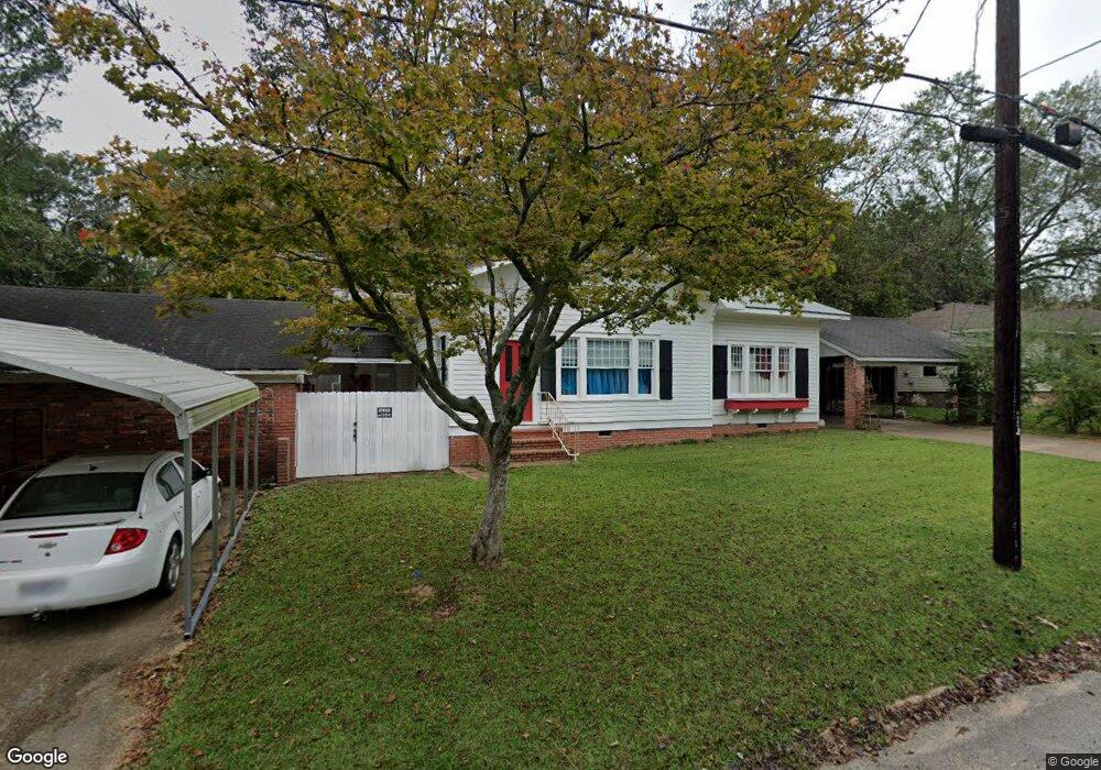
525 State Ave Philadelphia, MS 39350
Estimated Value: $116,000 - $193,000
--
Bed
2
Baths
2,815
Sq Ft
$50/Sq Ft
Est. Value
About This Home
This home is located at 525 State Ave, Philadelphia, MS 39350 and is currently estimated at $141,802, approximately $50 per square foot. 525 State Ave is a home located in Neshoba County with nearby schools including Philadelphia Elementary School, Philadelphia Middle School, and Philadelphia High School.
Ownership History
Date
Name
Owned For
Owner Type
Purchase Details
Closed on
May 30, 2018
Sold by
Reynolds Jimmy
Bought by
Rutledge Hilda and Dayton Hedy
Current Estimated Value
Home Financials for this Owner
Home Financials are based on the most recent Mortgage that was taken out on this home.
Original Mortgage
$74,400
Outstanding Balance
$64,208
Interest Rate
4.5%
Mortgage Type
New Conventional
Estimated Equity
$77,594
Purchase Details
Closed on
Sep 21, 2009
Sold by
Sanders Emily and Ingram Ames B
Bought by
Reynolds Ledale
Create a Home Valuation Report for This Property
The Home Valuation Report is an in-depth analysis detailing your home's value as well as a comparison with similar homes in the area
Home Values in the Area
Average Home Value in this Area
Purchase History
| Date | Buyer | Sale Price | Title Company |
|---|---|---|---|
| Rutledge Hilda | -- | -- | |
| Reynolds Ledale | -- | -- |
Source: Public Records
Mortgage History
| Date | Status | Borrower | Loan Amount |
|---|---|---|---|
| Open | Rutledge Hilda | $74,400 |
Source: Public Records
Tax History Compared to Growth
Tax History
| Year | Tax Paid | Tax Assessment Tax Assessment Total Assessment is a certain percentage of the fair market value that is determined by local assessors to be the total taxable value of land and additions on the property. | Land | Improvement |
|---|---|---|---|---|
| 2025 | $41 | $8,932 | $0 | $0 |
| 2024 | $41 | $8,932 | $0 | $0 |
| 2023 | $41 | $8,156 | $0 | $0 |
| 2022 | $41 | $8,156 | $0 | $0 |
| 2021 | $41 | $8,116 | $0 | $0 |
| 2020 | $41 | $8,116 | $0 | $0 |
| 2019 | $41 | $7,800 | $0 | $0 |
| 2018 | $1,577 | $11,700 | $0 | $0 |
| 2017 | $1,652 | $11,777 | $0 | $0 |
| 2016 | $1,652 | $11,777 | $0 | $0 |
| 2015 | -- | $11,681 | $0 | $0 |
| 2014 | -- | $7,787 | $0 | $0 |
Source: Public Records
Map
Nearby Homes
- 531 State Ave
- 519 Welch St
- 521 Holland Ave
- 517 Holland Ave
- 0 State Ave
- 507 Poplar Ave
- 507 Dorothy St
- 321 Range Ave
- 319 Range Ave
- 1133 Weyerhaeuser St
- 0 E Myrtle St
- 423 Pecan Ave
- 414 Columbus Ave Unit A
- 437C Pecan Ave
- 271A Byrd Ave
- 0 Columbus Ave
- 408 Hospital St
- 457 Pecan Ave
- 100 Highway 19
- 0 Mississippi 19